TopoQuest Logo
Do you find TopoQuest useful?
Help keep TopoQuest running and adding new maps/features by donating!
Bitcoin:  19c7KJd3qBynnjoSw5npx9KScwjBe4ifkT
Litecoin:  LXs6TkuXGGXo1vDsWCkWVdjQX94eUKd6ui
Home View Maps Find Maps Find Places Resources & Links


Goodlow Park, Texas Topographic Map

USGS Map Title: Goodlow Park, TX
USGS Map MRC: 32096A2
DRG (GeoTIFF) Download: o32096a2.tif


Neighboring USGS Topographic Map Quads:


  Bazette, TX  
32096B3
 

  Kerens, TX  
32096B2
 

  Malakoff, TX  
32096B1
 

  Powell, TX  
32096A3
 

  Goodlow Park, TX  
32096A2
 

  Creslenn Ranch, TX  
32096A1
 

  Streetman, TX  
31096H3
 

  Winkler, TX  
31096H2
 

  Roustabout Camp, TX  
31096H1


Map MRC Location:

N33°
W97°
N33°
W96°
H8 H7 H6 H5 H4 H3 H2 H1
G8 G7 G6 G5 G4 G3 G2 G1
F8 F7 F6 F5 F4 F3 F2 F1
E8 E7 E6 E5 E4 E3 E2 E1
D8 D7 D6 D5 D4 D3 D2 D1
C8 C7 C6 C5 C4 C3 C2 C1
B8 B7 B6 B5 B4 B3 B2 B1
A8 A7 A6 A5 A4 A3 A2 A1
N32°
W97°
N32°
W96°

Goodlow Park, TX USGS 1:24K Topographic Map Preview:
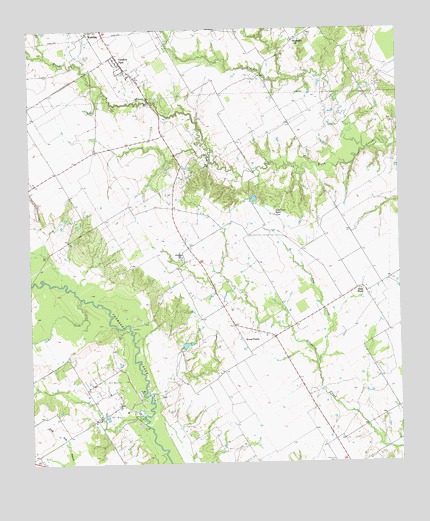
Goodlow Park, TX USGS Topographic Map
Click on map above to begin viewing in our Map Viewer.

This topographic map contains these locations and features:
Feature Name Type Latitude Longitude GNIS ID View Map
Alligator ChurchChurchN32.0596°W96.1983°1329414View Map
Cedar CreekStreamN32.0477°W96.2330°1332410View Map
Cemetery CreekStreamN32.1177°W96.2444°1332510View Map
City of GoodlowCivilN32.1091°W96.2151°2410620View Map
Cow CreekStreamN32.1113°W96.1616°1333548View Map
Gas CreekStreamN32.0282°W96.1530°1336428View Map
Goodlow ParkPopulated PlaceN32.1154°W96.2183°1388186View Map
GoodnightPopulated PlaceN32.1218°W96.1597°1378368View Map
Hoffer LakeReservoirN32.1168°W96.1491°1859293View Map
Hoffer Lake DamDamN32.1168°W96.1469°1859292View Map
Indian CreekStreamN32.0904°W96.1361°1338414View Map
Kerens DivisionCivilN32.1032°W96.2060°1938882View Map
Owens CemeteryCemeteryN32.1024°W96.2222°1343377View Map
Petersburg CemeteryCemeteryN32.0004°W96.1483°1343905View Map
Roscoe McConnico Airport (historical)AirportN32.1207°W96.1791°1387007View Map
Round House (historical)Populated PlaceN32.0193°W96.1558°2034797View Map
Round PrairiePopulated PlaceN32.0354°W96.1783°1378990View Map
Rural ShadePopulated PlaceN32.0502°W96.1394°1378998View Map
Rush Creek RanchLocaleN32.0715°W96.1666°1345759View Map

Note: Coordinates in the location and feature list above are referenced to NAD83 datum.


Copyright (C) 2008-2025 Ryan Niemi / Sunset Dynamics ... All Rights Reserved