TopoQuest Logo
Do you find TopoQuest useful?
Help keep TopoQuest running and adding new maps/features by donating!
Bitcoin:  19c7KJd3qBynnjoSw5npx9KScwjBe4ifkT
Litecoin:  LXs6TkuXGGXo1vDsWCkWVdjQX94eUKd6ui
Home View Maps Find Maps Find Places Resources & Links


Winkler, Texas Topographic Map

USGS Map Title: Winkler, TX
USGS Map MRC: 31096H2
DRG (GeoTIFF) Download: o31096h2.tif


Neighboring USGS Topographic Map Quads:


  Powell, TX  
32096A3
 

  Goodlow Park, TX  
32096A2
 

  Creslenn Ranch, TX  
32096A1
 

  Streetman, TX  
31096H3
 

  Winkler, TX  
31096H2
 

  Roustabout Camp, TX  
31096H1
 

  Kirvin, TX  
31096G3
 

  Stewards Mill, TX  
31096G2
 

  Young, TX  
31096G1


Map MRC Location:

N32°
W97°
N32°
W96°
H8 H7 H6 H5 H4 H3 H2 H1
G8 G7 G6 G5 G4 G3 G2 G1
F8 F7 F6 F5 F4 F3 F2 F1
E8 E7 E6 E5 E4 E3 E2 E1
D8 D7 D6 D5 D4 D3 D2 D1
C8 C7 C6 C5 C4 C3 C2 C1
B8 B7 B6 B5 B4 B3 B2 B1
A8 A7 A6 A5 A4 A3 A2 A1
N31°
W97°
N31°
W96°

Winkler, TX USGS 1:24K Topographic Map Preview:
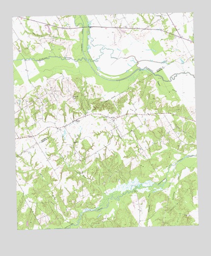
Winkler, TX USGS Topographic Map
Click on map above to begin viewing in our Map Viewer.

This topographic map contains these locations and features:
Feature Name Type Latitude Longitude GNIS ID View Map
Camphouse DugoutStreamN31.8982°W96.1494°1332044View Map
Chambers CreekStreamN31.9743°W96.1986°1332631View Map
Greenbriar CemeteryCemeteryN31.9077°W96.2047°1336955View Map
Greenbriar ChurchChurchN31.9254°W96.2097°1336956View Map
Greenbriar CreekStreamN31.8935°W96.1839°1336957View Map
Hogpen SloughGutN31.9504°W96.1325°1337921View Map
Lee CemeteryCemeteryN31.9190°W96.2078°1339776View Map
Long Arm BranchStreamN31.9860°W96.2011°1340413View Map
New Hope ChurchChurchN31.9396°W96.1858°1342465View Map
Petersburg ChurchChurchN31.9982°W96.1466°1343906View Map
Pleasant Hill ChurchChurchN31.9513°W96.2086°1344216View Map
Reka Oil FieldOilfieldN31.9468°W96.2336°1345030View Map
Richland Chambers 287 Fire and RescueBuildingN31.9979°W96.2265°2552361View Map
Saint ElmoPopulated PlaceN31.9379°W96.1819°1379002View Map
Sandy CreekStreamN31.9157°W96.1325°1346587View Map
Southern Oaks Volunteer Fire DepartmentBuildingN31.9421°W96.1704°2552581View Map
Spring BranchStreamN31.8774°W96.2125°1347691View Map
Stewards Mill Oil FieldOilfieldN31.8891°W96.1336°1347913View Map
Sweatman - Blackmon CemeteryCemeteryN31.9551°W96.2231°1348125View Map
Texas Industries LakeReservoirN31.9593°W96.2461°1859479View Map
WinklerPopulated PlaceN31.9382°W96.2089°1379285View Map

Note: Coordinates in the location and feature list above are referenced to NAD83 datum.


Copyright (C) 2008-2025 Ryan Niemi / Sunset Dynamics ... All Rights Reserved