TopoQuest Logo
Do you find TopoQuest useful?
Help keep TopoQuest running and adding new maps/features by donating!
Bitcoin:  19c7KJd3qBynnjoSw5npx9KScwjBe4ifkT
Litecoin:  LXs6TkuXGGXo1vDsWCkWVdjQX94eUKd6ui
Home View Maps Find Maps Find Places Resources & Links


Hemlock, Michigan Topographic Map

USGS Map Title: Hemlock, MI
USGS Map MRC: 43084D2
DRG (GeoTIFF) Download: o43084d2.tif


Neighboring USGS Topographic Map Quads:


  Gordonville, MI  
43084E3
 

  Midland South, MI  
43084E2
 

  Auburn, MI  
43084E1
 

  Merrill, MI  
43084D3
 

  Hemlock, MI  
43084D2
 

  Shields, MI  
43084D1
 

  Lakefield, MI  
43084C3
 

  Saint Charles, MI  
43084C2
 

  Alicia, MI  
43084C1


Map MRC Location:

N44°
W85°
N44°
W84°
H8 H7 H6 H5 H4 H3 H2 H1
G8 G7 G6 G5 G4 G3 G2 G1
F8 F7 F6 F5 F4 F3 F2 F1
E8 E7 E6 E5 E4 E3 E2 E1
D8 D7 D6 D5 D4 D3 D2 D1
C8 C7 C6 C5 C4 C3 C2 C1
B8 B7 B6 B5 B4 B3 B2 B1
A8 A7 A6 A5 A4 A3 A2 A1
N43°
W85°
N43°
W84°

Hemlock, MI USGS 1:24K Topographic Map Preview:
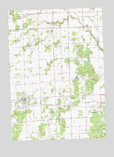
Hemlock, MI USGS Topographic Map
Click on map above to begin viewing in our Map Viewer.

This topographic map contains these locations and features:
Feature Name Type Latitude Longitude GNIS ID View Map
Abbey DrainCanalN43.4206°W84.1616°619783View Map
Badger DrainCanalN43.4070°W84.1605°620428View Map
Bebee DrainCanalN43.3953°W84.1536°620963View Map
Calvary Baptist ChurchChurchN43.4189°W84.1903°2558794View Map
Chapman DrainCanalN43.4984°W84.1500°623097View Map
Edgewood Village Mobile Home ParkPopulated PlaceN43.4014°W84.1333°2558618View Map
Ernie's FieldAirportN43.4190°W84.1929°2717261View Map
HemlockPopulated PlaceN43.4147°W84.2305°628079View Map
Hemlock Census Designated PlaceCensusN43.4180°W84.2326°2393046View Map
Hemlock Elementary SchoolSchoolN43.4167°W84.2314°2558796View Map
Hemlock High SchoolSchoolN43.4189°W84.2306°2558798View Map
Hemlock Middle SchoolSchoolN43.4189°W84.2347°2558797View Map
Hemlock Post OfficePost OfficeN43.4131°W84.2294°2558799View Map
Hemlock StationLocaleN43.4111°W84.2317°2558789View Map
Hemlock United Methodist ChurchChurchN43.4150°W84.2247°2558803View Map
Hubbell DrainCanalN43.4681°W84.1711°628747View Map
Kenneth C Ling Elementary SchoolSchoolN43.4208°W84.2333°2558795View Map
Kris Kay Mobile Home ParkPopulated PlaceN43.4006°W84.1333°2558619View Map
La Porte United Methodist ChurchChurchN43.4967°W84.1911°2543009View Map
LaportePopulated PlaceN43.4964°W84.1889°630158View Map
Laporte CemeteryCemeteryN43.4872°W84.1922°630159View Map
Laporte Post Office (historical)Post OfficeN43.4964°W84.1889°2544207View Map
Maple Hill Golf CourseLocaleN43.4142°W84.1758°1623499View Map
Middle SchoolSchoolN43.4189°W84.2347°632276View Map
Nelson RunStreamN43.4739°W84.2328°633291View Map
OrrPopulated PlaceN43.3803°W84.1703°1617763View Map
Pleasant Valley Estates Mobile Home ParkPopulated PlaceN43.4069°W84.2361°2558792View Map
Rauchholz Memorial LibraryBuildingN43.4258°W84.2297°2558800View Map
Richland Lutheran CemeteryCemeteryN43.4658°W84.2247°2558986View Map
Richland Township CemeteryCemeteryN43.4139°W84.2239°2558985View Map
Richland Township Fire DepartmentBuildingN43.4231°W84.2303°2558791View Map
Richland Township ParkParkN43.4175°W84.2219°2558790View Map
Richland Township Police DepartmentBuildingN43.4231°W84.2303°2737441View Map
Saint John's Lutheran CemeteryCemeteryN43.3897°W84.2000°2558997View Map
Saint Johns ChurchChurchN43.3903°W84.2003°636737View Map
Saint Mary ChurchChurchN43.4147°W84.2400°2558801View Map
Saint Marys CemeteryCemeteryN43.4150°W84.2011°636890View Map
Saint Marys SchoolSchoolN43.4161°W84.2397°636924View Map
Saint Peter Lutheran ChurchChurchN43.4444°W84.2100°2558802View Map
Saint Peter SchoolSchoolN43.4442°W84.2092°637012View Map
Smith DrainCanalN43.3847°W84.2183°638145View Map
Township of RichlandCivilN43.4372°W84.2311°1626974View Map
Tri - Township Fire Department Station 3BuildingN43.3794°W84.1299°2636228View Map

Note: Coordinates in the location and feature list above are referenced to NAD83 datum.


Copyright (C) 2008-2025 Ryan Niemi / Sunset Dynamics ... All Rights Reserved