TopoQuest Logo
Do you find TopoQuest useful?
Help keep TopoQuest running and adding new maps/features by donating!
Bitcoin:  19c7KJd3qBynnjoSw5npx9KScwjBe4ifkT
Litecoin:  LXs6TkuXGGXo1vDsWCkWVdjQX94eUKd6ui
Home View Maps Find Maps Find Places Resources & Links


Grady, Arkansas Topographic Map

USGS Map Title: Grady, AR
USGS Map MRC: 34091A6
DRG (GeoTIFF) Download: o34091a6.tif


Neighboring USGS Topographic Map Quads:


  Moscow, AR  
34091B7
 

  Cornerstone, AR  
34091B6
 

  Reydell, AR  
34091B5
 

  Tarry, AR  
34091A7
 

  Grady, AR  
34091A6
 

  Cades, AR  
34091A5
 

  Star City, AR  
33091H7
 

  Avery, AR  
33091H6
 

  Gould, AR  
33091H5


Map MRC Location:

N35°
W92°
N35°
W91°
H8 H7 H6 H5 H4 H3 H2 H1
G8 G7 G6 G5 G4 G3 G2 G1
F8 F7 F6 F5 F4 F3 F2 F1
E8 E7 E6 E5 E4 E3 E2 E1
D8 D7 D6 D5 D4 D3 D2 D1
C8 C7 C6 C5 C4 C3 C2 C1
B8 B7 B6 B5 B4 B3 B2 B1
A8 A7 A6 A5 A4 A3 A2 A1
N34°
W92°
N34°
W91°

Grady, AR USGS 1:24K Topographic Map Preview:
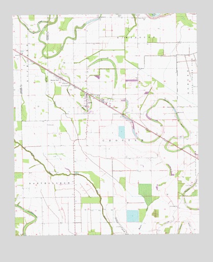
Grady, AR USGS Topographic Map
Click on map above to begin viewing in our Map Viewer.

This topographic map contains these locations and features:
Feature Name Type Latitude Longitude GNIS ID View Map
Bethel Church (historical)ChurchN34.0243°W91.6354°64043View Map
Church of GodChurchN34.0718°W91.6412°64045View Map
Church of GodChurchN34.0723°W91.6835°64046View Map
City of GradyCivilN34.0790°W91.6981°2403720View Map
Crawford CemeteryCemeteryN34.0270°W91.6296°48149View Map
Damascus ChurchChurchN34.0687°W91.6785°48342View Map
Dolton (historical)Populated PlaceN34.1034°W91.7457°63917View Map
Dorabell ChurchChurchN34.0215°W91.6362°76810View Map
First Baptist ChurchChurchN34.0157°W91.6401°49057View Map
First Baptist Church (historical)ChurchN34.0523°W91.7243°64054View Map
Four Groves (historical)Populated PlaceN34.0070°W91.6862°64056View Map
Gocio CemeteryCemeteryN34.0912°W91.7185°49465View Map
GradyPopulated PlaceN34.0801°W91.7007°77049View Map
Grady CemeteryCemeteryN34.0693°W91.7001°49535View Map
Grady Elementary SchoolSchoolN34.0759°W91.6891°60285View Map
Grady Fire DepartmentBuildingN34.0794°W91.7006°2116492View Map
Grady High SchoolSchoolN34.0728°W91.7010°60284View Map
Grady Police DepartmentBuildingN34.0791°W91.7006°2118655View Map
Grady Post OfficePost OfficeN34.0801°W91.6987°83921View Map
Grady Public LibraryBuildingN34.0801°W91.7010°60282View Map
Hawley CemeteryCemeteryN34.0765°W91.6871°49955View Map
Kennedy High School (historical)SchoolN34.0729°W91.7010°60281View Map
Lee School (historical)SchoolN34.0076°W91.7371°64066View Map
Long LakeLakeN34.1119°W91.7134°51432View Map
Lowe CemeteryCemeteryN34.0673°W91.6748°51495View Map
Macedonia ChurchChurchN34.0687°W91.6393°51573View Map
Marzell ChurchChurchN34.1029°W91.7457°51724View Map
Matthews Field (historical)AirportN34.0487°W91.6626°60280View Map
McBride CemeteryCemeteryN34.0629°W91.7276°51778View Map
Mount Calvary CemeteryCemeteryN34.1243°W91.6273°64072View Map
Mount Calvary Church (historical)ChurchN34.1243°W91.6273°64087View Map
Mount Pisgah Church (historical)ChurchN34.0798°W91.6915°64074View Map
Mount Zion ChurchChurchN34.0865°W91.7135°52464View Map
New Saint James Zion ChurchChurchN34.0854°W91.7115°52734View Map
Palestine Church (historical)ChurchN34.0501°W91.6746°64080View Map
Paradise ChurchChurchN34.1232°W91.6910°53175View Map
Pleasant Grove CemeteryCemeteryN34.1229°W91.6662°64084View Map
Pleasant Grove ChurchChurchN34.1229°W91.6662°53537View Map
Randolph CemeteryCemeteryN34.0684°W91.6748°53891View Map
Saint Pauls Church (historical)ChurchN34.0068°W91.7093°64093View Map
SarassaPopulated PlaceN34.1232°W91.6651°60287View Map
Sarassa LakeLakeN34.1243°W91.6552°75118View Map
Shannon TankPopulated PlaceN34.0893°W91.7187°58602View Map
Silt (historical)Populated PlaceN34.0676°W91.6743°60286View Map
Township of ChoctawCivilN34.0424°W91.6650°66822View Map
WoodvillePopulated PlaceN34.1232°W91.6907°60283View Map

Note: Coordinates in the location and feature list above are referenced to NAD83 datum.


Copyright (C) 2008-2025 Ryan Niemi / Sunset Dynamics ... All Rights Reserved