TopoQuest Logo
Do you find TopoQuest useful?
Help keep TopoQuest running and adding new maps/features by donating!
Bitcoin:  19c7KJd3qBynnjoSw5npx9KScwjBe4ifkT
Litecoin:  LXs6TkuXGGXo1vDsWCkWVdjQX94eUKd6ui
Home View Maps Find Maps Find Places Resources & Links


Star City, Arkansas Topographic Map

USGS Map Title: Star City, AR
USGS Map MRC: 33091H7
DRG (GeoTIFF) Download: o33091h7.tif


Neighboring USGS Topographic Map Quads:


  Pinebergen, AR  
34091A8
 

  Tarry, AR  
34091A7
 

  Grady, AR  
34091A6
 

  Glendale, AR  
33091H8
 

  Star City, AR  
33091H7
 

  Avery, AR  
33091H6
 

  Cornerville, AR  
33091G8
 

  Relfs Bluff, AR  
33091G7
 

  Tyro, AR  
33091G6


Map MRC Location:

N34°
W92°
N34°
W91°
H8 H7 H6 H5 H4 H3 H2 H1
G8 G7 G6 G5 G4 G3 G2 G1
F8 F7 F6 F5 F4 F3 F2 F1
E8 E7 E6 E5 E4 E3 E2 E1
D8 D7 D6 D5 D4 D3 D2 D1
C8 C7 C6 C5 C4 C3 C2 C1
B8 B7 B6 B5 B4 B3 B2 B1
A8 A7 A6 A5 A4 A3 A2 A1
N33°
W92°
N33°
W91°

Star City, AR USGS 1:24K Topographic Map Preview:
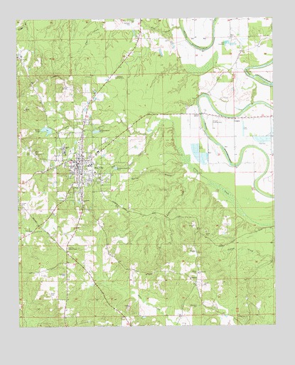
Star City, AR USGS Topographic Map
Click on map above to begin viewing in our Map Viewer.

This topographic map contains these locations and features:
Feature Name Type Latitude Longitude GNIS ID View Map
Best CemeteryCemeteryN33.9454°W91.8665°46417View Map
Brockman CemeteryCemeteryN33.8832°W91.7882°46975View Map
Bulter CemeteryCemeteryN33.8970°W91.7879°47180View Map
Bush CemeteryCemeteryN33.8884°W91.8590°47229View Map
Butler School (historical)SchoolN33.8973°W91.7874°60306View Map
CalhounPopulated PlaceN33.8929°W91.7887°76496View Map
Cane Creek LakeLakeN33.9306°W91.7711°60303View Map
Chatham Landing Strip (historical)AirportN33.9768°W91.8268°66361View Map
City of Star CityCivilN33.9406°W91.8402°2405522View Map
CriglerPopulated PlaceN33.9590°W91.7693°76706View Map
Crigler CemeteryCemeteryN33.9604°W91.7640°60300View Map
Crigler Missionary Baptist ChurchChurchN33.9601°W91.7754°60301View Map
Dry Fork CreekStreamN33.9526°W91.8099°76825View Map
Emergency Ambulance Service Star CityBuildingN33.9481°W91.8439°2119051View Map
First Baptist Church of Star CityChurchN33.9401°W91.8457°60310View Map
Frizzell Landing Strip (historical)AirportN33.9582°W91.7796°66362View Map
Heflin CemeteryCemeteryN33.9465°W91.8668°49990View Map
Jimmy Brown Elementary SchoolSchoolN33.9458°W91.8377°2039325View Map
Leek CemeteryCemeteryN33.9457°W91.8682°51056View Map
Lick CreekStreamN33.9368°W91.7871°51136View Map
Lincoln County CourthouseBuildingN33.9395°W91.8446°60311View Map
Lincoln County Sheriff's OfficeBuildingN33.9398°W91.8446°2118650View Map
Middle SchoolSchoolN33.9476°W91.8526°51938View Map
Mount Nebo CemeteryCemeteryN33.9990°W91.8190°52325View Map
O'Neel CemeteryCemeteryN33.8787°W91.7646°52867View Map
Patocca Lower Lake DamDamN33.9134°W91.8735°81264View Map
Pine Hill ChurchChurchN33.9848°W91.8743°53438View Map
Pine Hill School (historical)SchoolN33.9845°W91.8743°60315View Map
Pleasant Hill Baptist ChurchChurchN33.8968°W91.7874°78043View Map
Pleasant Hill High School (historical)SchoolN33.8995°W91.7890°60305View Map
Providence Primitive Baptist ChurchChurchN33.9262°W91.8432°78105View Map
Spring BranchStreamN33.9412°W91.7915°55080View Map
Star CityPopulated PlaceN33.9429°W91.8435°78447View Map
Star City Elementary SchoolSchoolN33.9407°W91.8401°60312View Map
Star City Fire StationBuildingN33.9441°W91.8443°2117171View Map
Star City High SchoolSchoolN33.9419°W91.8400°60313View Map
Star City Lookout TowerTowerN33.9070°W91.8507°82561View Map
Star City Middle SchoolSchoolN33.9411°W91.8409°60314View Map
Star City Municipal AirportAirportN33.9281°W91.8610°83838View Map
Star City Police DepartmentBuildingN33.9416°W91.8464°2118651View Map
Steed Lake DamDamN33.9537°W91.8582°80429View Map
Steeds LakeReservoirN33.9549°W91.8606°75856View Map
Todd (historical)Populated PlaceN33.9145°W91.7515°60304View Map
Township of Cane CreekCivilN33.9372°W91.8102°66821View Map
Trinity Methodist ChurchChurchN33.9598°W91.7635°60299View Map

Note: Coordinates in the location and feature list above are referenced to NAD83 datum.


Copyright (C) 2008-2024 Ryan Niemi / Sunset Dynamics ... All Rights Reserved