TopoQuest Logo
Do you find TopoQuest useful?
Help keep TopoQuest running and adding new maps/features by donating!
Bitcoin:  19c7KJd3qBynnjoSw5npx9KScwjBe4ifkT
Litecoin:  LXs6TkuXGGXo1vDsWCkWVdjQX94eUKd6ui
Home View Maps Find Maps Find Places Resources & Links


Moscow, Arkansas Topographic Map

USGS Map Title: Moscow, AR
USGS Map MRC: 34091B7
DRG (GeoTIFF) Download: o34091b7.tif


Neighboring USGS Topographic Map Quads:


  Rob Roy, AR  
34091C8
 

  Altheimer, AR  
34091C7
 

  Humphrey SW, AR  
34091C6
 

  Ladd, AR  
34091B8
 

  Moscow, AR  
34091B7
 

  Cornerstone, AR  
34091B6
 

  Pinebergen, AR  
34091A8
 

  Tarry, AR  
34091A7
 

  Grady, AR  
34091A6


Map MRC Location:

N35°
W92°
N35°
W91°
H8 H7 H6 H5 H4 H3 H2 H1
G8 G7 G6 G5 G4 G3 G2 G1
F8 F7 F6 F5 F4 F3 F2 F1
E8 E7 E6 E5 E4 E3 E2 E1
D8 D7 D6 D5 D4 D3 D2 D1
C8 C7 C6 C5 C4 C3 C2 C1
B8 B7 B6 B5 B4 B3 B2 B1
A8 A7 A6 A5 A4 A3 A2 A1
N34°
W92°
N34°
W91°

Moscow, AR USGS 1:24K Topographic Map Preview:
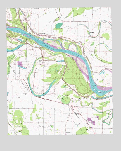
Moscow, AR USGS Topographic Map
Click on map above to begin viewing in our Map Viewer.

This topographic map contains these locations and features:
Feature Name Type Latitude Longitude GNIS ID View Map
Bass Chapel (historical)ChurchN34.2215°W91.7871°63897View Map
Bass Chapel School (historical)SchoolN34.2215°W91.7874°63899View Map
Blackman CemeteryCemeteryN34.1529°W91.7871°46691View Map
Brunson CrossingCrossingN34.1984°W91.7940°81334View Map
Cherry Hill CemeteryCemeteryN34.1579°W91.7976°47727View Map
Cherry Hill Church (historical)ChurchN34.1518°W91.7971°63909View Map
CottondalePopulated PlaceN34.1804°W91.8604°57588View Map
Cottondale CemeteryCemeteryN34.1879°W91.8599°63911View Map
Cottondale School (historical)SchoolN34.1798°W91.8601°63912View Map
Elm Grove Church (historical)ChurchN34.1801°W91.8640°63922View Map
Hunters CemeteryCemeteryN34.1506°W91.8326°50418View Map
Lakeside Church (historical)ChurchN34.2070°W91.8676°63940View Map
Lakeside School (historical)SchoolN34.2068°W91.8676°63941View Map
LinwoodPopulated PlaceN34.1537°W91.7974°58072View Map
Linwood Baptist ChurchChurchN34.1512°W91.7971°60697View Map
Linwood Moscow Volunteer Fire DepartmentBuildingN34.1528°W91.7981°2116716View Map
Linwood School (historical)SchoolN34.1526°W91.7982°63953View Map
Little Cypress BayouStreamN34.1268°W91.8512°51252View Map
Macedonia CemeteryCemeteryN34.1270°W91.8062°51544View Map
Macedonia ChurchChurchN34.2209°W91.7646°51575View Map
MaddingPopulated PlaceN34.2248°W91.8337°57103View Map
Maddings Ferry (historical)CrossingN34.2201°W91.8429°63955View Map
MoscowPopulated PlaceN34.1465°W91.7951°52230View Map
Moscow Post OfficePost OfficeN34.1511°W91.7934°2781933View Map
Mulberry Grove CemeteryCemeteryN34.1979°W91.8365°63961View Map
Mulberry Grove ChurchChurchN34.1979°W91.8324°52539View Map
New GasconyPopulated PlaceN34.2265°W91.7765°77813View Map
New Gascony CemeteryCemeteryN34.2304°W91.7798°52639View Map
New Hope CemeteryCemeteryN34.1445°W91.7543°52661View Map
New Hope Church (historical)ChurchN34.1457°W91.7535°63967View Map
New Hope School (historical)SchoolN34.1415°W91.7535°63968View Map
Nickelson CemeteryCemeteryN34.1490°W91.7501°77852View Map
Noble LakePopulated PlaceN34.1732°W91.8543°77853View Map
Noble LakeLakeN34.1646°W91.8326°75805View Map
Oak Ridge School (historical)SchoolN34.1518°W91.7804°63972View Map
Old Channel Plum BayouStreamN34.2276°W91.8532°77902View Map
Olive Branch Church (historical)ChurchN34.1662°W91.7546°63973View Map
Pilgrims Rest ChurchChurchN34.1654°W91.8518°53388View Map
Pilgrims Rest Church (historical)ChurchN34.1434°W91.8501°64019View Map
Ray Station (historical)Populated PlaceN34.2237°W91.8196°60690View Map
Richland BendBendN34.1682°W91.7690°63982View Map
Saint James CemeteryCemeteryN34.2012°W91.7832°54336View Map
Saint James Church (historical)ChurchN34.2009°W91.7801°63987View Map
Saint Peters CemeteryCemeteryN34.2212°W91.7785°54467View Map
Saint Peters Church (historical)ChurchN34.2212°W91.7776°63995View Map
Saint Ruth CemeteryCemeteryN34.2093°W91.8448°54473View Map
Saint Ruth Church (historical)ChurchN34.2093°W91.8443°63996View Map
Township of BogyCivilN34.2451°W91.7618°66732View Map
Township of RichlandCivilN34.1433°W91.7931°66742View Map
Trulock BendBendN34.2154°W91.8335°64007View Map
Trulock Public Use AreaParkN34.2123°W91.8360°78589View Map
Vaster SchoolSchoolN34.1384°W91.7815°55890View Map
Walstein Cemetery (historical)CemeteryN34.1673°W91.7612°64013View Map
Watt CemeteryCemeteryN34.2084°W91.8323°56113View Map
Wattensaw ChurchChurchN34.1343°W91.8746°56114View Map
Whites CemeteryCemeteryN34.1348°W91.7932°56323View Map

Note: Coordinates in the location and feature list above are referenced to NAD83 datum.


Copyright (C) 2008-2024 Ryan Niemi / Sunset Dynamics ... All Rights Reserved