TopoQuest Logo
Do you find TopoQuest useful?
Help keep TopoQuest running and adding new maps/features by donating!
Bitcoin:  19c7KJd3qBynnjoSw5npx9KScwjBe4ifkT
Litecoin:  LXs6TkuXGGXo1vDsWCkWVdjQX94eUKd6ui
Home View Maps Find Maps Find Places Resources & Links


Bad Luck Creek, Montana Topographic Map

USGS Map Title: Bad Luck Creek, MT
USGS Map MRC: 44111H5
DRG (GeoTIFF) Download: o44111h5.tif


Neighboring USGS Topographic Map Quads:


  Bucks Nest, MT  
45111A6
 

  No Man Peak, MT  
45111A5
 

  Koch Peak, MT  
45111A4
 

  Granite Mountain, MT  
44111H6
 

  Bad Luck Creek, MT  
44111H5
 

  Hilgard Peak, MT  
44111H4
 

  Freezeout Mountain, MT  
44111G6
 

  Cliff Lake, MT  
44111G5
 

  Earthquake Lake, MT  
44111G4


Map MRC Location:

N45°
W112°
N45°
W111°
H8 H7 H6 H5 H4 H3 H2 H1
G8 G7 G6 G5 G4 G3 G2 G1
F8 F7 F6 F5 F4 F3 F2 F1
E8 E7 E6 E5 E4 E3 E2 E1
D8 D7 D6 D5 D4 D3 D2 D1
C8 C7 C6 C5 C4 C3 C2 C1
B8 B7 B6 B5 B4 B3 B2 B1
A8 A7 A6 A5 A4 A3 A2 A1
N44°
W112°
N44°
W111°

Bad Luck Creek, MT USGS 1:24K Topographic Map Preview:
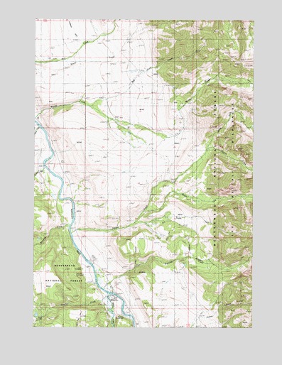
Bad Luck Creek, MT USGS Topographic Map
Click on map above to begin viewing in our Map Viewer.

This topographic map contains these locations and features:
Feature Name Type Latitude Longitude GNIS ID View Map
10S01E04CCCC01 SpringSpringN44.9855°W111.6136°807253View Map
10S01E09BBB_01 SpringSpringN44.9838°W111.6139°807251View Map
10S01E09BBBB01 SpringSpringN44.9841°W111.6166°807252View Map
10S01E09BBC_01 SpringSpringN44.9824°W111.6152°807249View Map
10S01E15DDAD01 WellWellN44.9574°W111.5772°807242View Map
10S01E17DAB_01 WellWellN44.9605°W111.6191°807243View Map
10S01E17DAB_02 WellWellN44.9605°W111.6191°807244View Map
10S01E21CCDD01 WellWellN44.9416°W111.6122°807240View Map
10S01E28DDD_01 SpringSpringN44.9271°W111.5986°807236View Map
10S01E33DDB_01 WellWellN44.9133°W111.5986°807235View Map
11S01E03CACB01 WellWellN44.9019°W111.5930°807234View Map
11S01E03CCCB01 WellWellN44.8983°W111.5975°807233View Map
11S01E10DACD01 WellWellN44.8871°W111.5819°807231View Map
11S01E13DBB_01 SpringSpringN44.8752°W111.5472°807229View Map
11S01E14BABD01 WellWellN44.8816°W111.5714°807230View Map
Alex Diekmann PeakSummitN44.9956°W111.5333°2791307View Map
Bad Luck CreekStreamN44.9655°W111.5958°779233View Map
Gazelle CreekStreamN44.8888°W111.5830°783872View Map
Horse CreekStreamN44.9566°W111.6241°785030View Map
Hutchins BridgeBridgeN44.8888°W111.5808°1797441View Map
Hutchins Ranch (historical)LocaleN44.8899°W111.5808°1797515View Map
Kirby RanchLocaleN44.8896°W111.5805°785769View Map
Lyon Forest Service StationLocaleN44.8985°W111.5977°794549View Map
Lyon Post Office (historical)Post OfficeN44.8985°W111.5939°1797493View Map
Lyon School (historical)SchoolN44.8985°W111.5939°1797494View Map
Lyons Bridge Fishing Access SiteLocaleN44.8994°W111.5905°1744558View Map
Madison CampgroundLocaleN44.8869°W111.5822°801817View Map
Middle Fork Sun CreekStreamN44.9221°W111.5625°778845View Map
North Fork Sun CreekStreamN44.9480°W111.5266°788254View Map
Papoose CreekStreamN44.8905°W111.5855°788614View Map
Papoose DitchCanalN44.8988°W111.5750°788616View Map
Quaking Aspen CreekStreamN44.9402°W111.6208°789260View Map
Raynolds Pass Historical MarkerParkN44.9019°W111.5933°1797803View Map
Secret LakesSwampN44.8799°W111.6241°790184View Map
Snowhall InnLocaleN44.9252°W111.6025°790791View Map
South Fork Sun CreekStreamN44.9177°W111.5675°791057View Map
Squaw Creek RanchLocaleN44.9133°W111.6016°791380View Map
Standard CreekStreamN44.9166°W111.6052°791420View Map
Sun CreekStreamN44.9133°W111.6047°791368View Map
Sun RanchLocaleN44.9580°W111.5786°791678View Map
United States Forest Service Lyon Work CampLocaleN44.8985°W111.5980°793671View Map
United States Forest Service West Fork CampLocaleN44.8874°W111.5839°792578View Map
West Fork Cabins and RV ParkLocaleN44.8819°W111.5730°1797661View Map
West Fork CampgroundLocaleN44.8869°W111.5822°806860View Map
West Fork Cow CampLocaleN44.8969°W111.5980°793006View Map
West Fork Madison RiverStreamN44.8888°W111.5830°793046View Map
West Fork Rest AreaLocaleN44.9019°W111.5933°801824View Map
Wolf Creek Hot SpringSpringN44.9841°W111.6169°793455View Map

Note: Coordinates in the location and feature list above are referenced to NAD83 datum.


Copyright (C) 2008-2024 Ryan Niemi / Sunset Dynamics ... All Rights Reserved