TopoQuest Logo
Do you find TopoQuest useful?
Help keep TopoQuest running and adding new maps/features by donating!
Bitcoin:  19c7KJd3qBynnjoSw5npx9KScwjBe4ifkT
Litecoin:  LXs6TkuXGGXo1vDsWCkWVdjQX94eUKd6ui
Home View Maps Find Maps Find Places Resources & Links


Pitkin, Louisiana Topographic Map

USGS Map Title: Pitkin, LA
USGS Map MRC: 30092H8
DRG (GeoTIFF) Download: o30092h8.tif


Neighboring USGS Topographic Map Quads:


  Birds Creek, LA  
31093A1
 

  Fullerton Lake, LA  
31092A8
 

  Afeman, LA  
31092A7
 

  Sugrue, LA  
30093H1
 

  Pitkin, LA  
30092H8
 

  Steep Gully, LA  
30092H7
 

  Sugartown, LA  
30093G1
 

  Grant, LA  
30092G8
 

  Elizabeth, LA  
30092G7


Map MRC Location:

N31°
W93°
N31°
W92°
H8 H7 H6 H5 H4 H3 H2 H1
G8 G7 G6 G5 G4 G3 G2 G1
F8 F7 F6 F5 F4 F3 F2 F1
E8 E7 E6 E5 E4 E3 E2 E1
D8 D7 D6 D5 D4 D3 D2 D1
C8 C7 C6 C5 C4 C3 C2 C1
B8 B7 B6 B5 B4 B3 B2 B1
A8 A7 A6 A5 A4 A3 A2 A1
N30°
W93°
N30°
W92°

Pitkin, LA USGS 1:24K Topographic Map Preview:
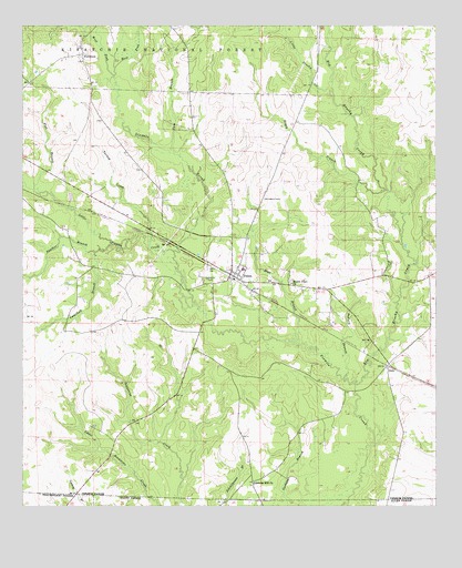
Pitkin, LA USGS Topographic Map
Click on map above to begin viewing in our Map Viewer.

This topographic map contains these locations and features:
Feature Name Type Latitude Longitude GNIS ID View Map
Big Brushy CreekStreamN30.9066°W92.8985°553633View Map
Blue BranchStreamN30.9174°W92.9165°547105View Map
Boggy BranchStreamN30.9571°W92.8902°547114View Map
Campbell BranchStreamN30.9413°W92.9779°547177View Map
Denard BranchStreamN30.9457°W92.9885°547296View Map
DidoPopulated PlaceN30.9116°W92.8899°554241View Map
East Fork Sixmile CreekStreamN30.9877°W92.9715°547334View Map
First Baptist ChurchChurchN30.9377°W92.9350°2601755View Map
Flat BranchStreamN30.9577°W92.9946°547364View Map
FullertonPopulated PlaceN30.9932°W92.9821°554494View Map
Gum BranchStreamN30.9677°W92.9540°547426View Map
Little Brushy CreekStreamN30.9816°W92.9057°547593View Map
Little Sixmile CreekStreamN30.9416°W92.9540°555098View Map
Mathis CemeteryCemeteryN30.9349°W92.9438°555251View Map
Mount Olive ChurchChurchN30.9332°W92.9188°547752View Map
Nitram (historical)Populated PlaceN30.9544°W92.9927°550046View Map
Oakey BranchStreamN30.9419°W92.9918°547788View Map
Panther BranchStreamN30.9432°W92.9729°547813View Map
PitkinPopulated PlaceN30.9363°W92.9363°555670View Map
Pitkin Census Designated PlaceCensusN30.9344°W92.9267°2586699View Map
Pitkin High SchoolSchoolN30.9369°W92.9336°550056View Map
Pitkin Lookout TowerLocaleN30.9635°W92.9663°550057View Map
Pitkin Pentecostal ChurchChurchN30.9383°W92.9416°2602589View Map
Pitkin Post OfficePost OfficeN30.9339°W92.9331°1631388View Map
Pitkin Volunteer Fire DepartmentBuildingN30.9354°W92.9380°2672825View Map
Pollard BranchStreamN30.9091°W92.9021°547862View Map
Simmons Mill ChurchChurchN30.8810°W92.9299°547997View Map
Turkey CreekStreamN30.9457°W92.9607°548095View Map
Ward FiveCivilN30.9482°W92.9321°545251View Map
West Fork Sixmile CreekStreamN30.9869°W92.9721°556390View Map

Note: Coordinates in the location and feature list above are referenced to NAD83 datum.


Copyright (C) 2008-2025 Ryan Niemi / Sunset Dynamics ... All Rights Reserved