TopoQuest Logo
Do you find TopoQuest useful?
Help keep TopoQuest running and adding new maps/features by donating!
Bitcoin:  19c7KJd3qBynnjoSw5npx9KScwjBe4ifkT
Litecoin:  LXs6TkuXGGXo1vDsWCkWVdjQX94eUKd6ui
Home View Maps Find Maps Find Places Resources & Links


Granville, New York Topographic Map

USGS Map Title: Granville, NY
USGS Map MRC: 43073D3
DRG (GeoTIFF) Download: o43073d3.tif


Neighboring USGS Topographic Map Quads:


  Whitehall, NY  
43073E4
 

  Thorn Hill, NY  
43073E3
 

  Poultney, VT  
43073E2
 

  Fort Ann, NY  
43073D4
 

  Granville, NY  
43073D3
 

  Wells, VT  
43073D2
 

  Hartford, NY  
43073C4
 

  West Pawlet, VT  
43073C3
 

  Pawlet, VT  
43073C2


Map MRC Location:

N44°
W74°
N44°
W73°
H8 H7 H6 H5 H4 H3 H2 H1
G8 G7 G6 G5 G4 G3 G2 G1
F8 F7 F6 F5 F4 F3 F2 F1
E8 E7 E6 E5 E4 E3 E2 E1
D8 D7 D6 D5 D4 D3 D2 D1
C8 C7 C6 C5 C4 C3 C2 C1
B8 B7 B6 B5 B4 B3 B2 B1
A8 A7 A6 A5 A4 A3 A2 A1
N43°
W74°
N43°
W73°

Granville, NY USGS 1:24K Topographic Map Preview:
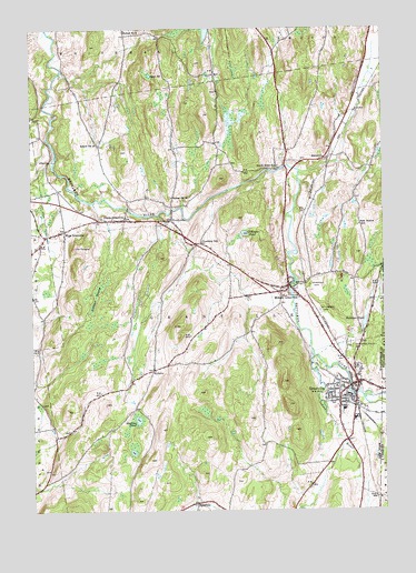
Granville, NY USGS Topographic Map
Click on map above to begin viewing in our Map Viewer.

This topographic map contains these locations and features:
Feature Name Type Latitude Longitude GNIS ID View Map
All Saints Hall (historical)BuildingN43.4047°W73.2639°2462718View Map
All Saints Roman Catholic Church (historical)ChurchN43.4047°W73.2644°2462717View Map
Calvary Baptist ChurchChurchN43.4553°W73.3650°2598347View Map
Elmwood CemeteryCemeteryN43.4331°W73.2759°949597View Map
Elvell QuarryMineN43.4406°W73.2867°2633256View Map
Emma Lang Stevens Hospital (historical)HospitalN43.4139°W73.2625°2462725View Map
Gillespie PondLakeN43.4469°W73.2986°951118View Map
GranvillePopulated PlaceN43.4078°W73.2596°951525View Map
Granville AirportAirportN43.4239°W73.2693°978046View Map
Granville Baptist ChurchChurchN43.4050°W73.2661°2462727View Map
Granville Elementary SchoolSchoolN43.4011°W73.2681°2462728View Map
Granville Fire Station Number 1 (historical)BuildingN43.4075°W73.2589°2462711View Map
Granville High SchoolSchoolN43.4011°W73.2633°2462721View Map
Granville Hook and Ladder CompanyBuildingN43.4033°W73.2654°2718759View Map
Granville Municipal BuildingBuildingN43.4083°W73.2589°2462712View Map
Granville Post OfficePost OfficeN43.4075°W73.2602°2598339View Map
Granville Rescue SquadBuildingN43.4007°W73.2576°2720156View Map
Henry Hose Company 1BuildingN43.4058°W73.2654°2462720View Map
Hicks OrchardLocaleN43.4133°W73.3306°2516841View Map
HillsdalePopulated PlaceN43.3767°W73.3168°972618View Map
Holbrook's Adult HomeBuildingN43.4139°W73.2650°2599508View Map
Hollister SwampSwampN43.4306°W73.3518°953003View Map
Indian RiverStreamN43.4148°W73.2748°953694View Map
Indian River Rehabilitation and Health Care CenterBuildingN43.4047°W73.2719°2499804View Map
Jerusalem Welsh Congregational ChurchChurchN43.4036°W73.2636°2462723View Map
Kingdom Hall of Jehovahs WitnessesChurchN43.4033°W73.2713°2598354View Map
Martins PondLakeN43.3982°W73.3384°956599View Map
Mary J Tanner Elementary SchoolSchoolN43.4294°W73.2883°2462729View Map
Mettawee Valley FarmLocaleN43.4175°W73.2689°2462726View Map
Mettowee Valley CemeteryCemeteryN43.4184°W73.2620°957045View Map
Middle GranvillePopulated PlaceN43.4334°W73.2834°957100View Map
New Boston SchoolSchoolN43.4487°W73.2579°958393View Map
New England FarmsLocaleN43.3875°W73.2825°2559419View Map
North Bend SchoolSchoolN43.4640°W73.2868°958686View Map
North GranvillePopulated PlaceN43.4503°W73.3415°958792View Map
North Granville CemeteryCemeteryN43.4519°W73.3528°2500695View Map
North Granville Fire CompanyBuildingN43.4497°W73.3369°2718535View Map
North Granville Post OfficePost OfficeN43.4501°W73.3383°2598343View Map
Old Quaker CemeteryCemeteryN43.4064°W73.2654°2462715View Map
Our Lady of Mount Carmel CemeteryCemeteryN43.4267°W73.2723°957816View Map
Pastime TheatreBuildingN43.4075°W73.2611°2462710View Map
Pember Library And MuseumBuildingN43.4061°W73.2631°2462719View Map
Peniel Presbyterian ChurchChurchN43.4069°W73.2653°2462714View Map
Penrhyn Hill Vein Slate QuarryMineN43.4386°W73.2881°2633255View Map
Phillips QuarryMineN43.4619°W73.2847°2633254View Map
Poultney SchoolSchoolN43.4445°W73.3143°961062View Map
Quaker Street School (historical)SchoolN43.4047°W73.2653°2462716View Map
RacevillePopulated PlaceN43.4662°W73.2707°962121View Map
Rathbun PondLakeN43.4238°W73.2564°962207View Map
Richards Memorial ParkParkN43.4100°W73.2642°2499805View Map
Ryan PondLakeN43.4880°W73.3318°963136View Map
Saint Mary's ChurchChurchN43.4035°W73.2635°2667493View Map
Saint Mary's Roman Catholic ChurchChurchN43.4039°W73.2625°2462722View Map
Saint Peter And Saint Paul Greek Catholic ChurchChurchN43.4031°W73.2597°2462724View Map
School Number 13 (historical)SchoolN43.4701°W73.3507°975071View Map
School Number 14 (historical)SchoolN43.4565°W73.3246°975095View Map
School Number 2 (historical)SchoolN43.4992°W73.3409°975213View Map
Sheldon Slate QuarryMineN43.4397°W73.2650°2633253View Map
SlyboroPopulated PlaceN43.4120°W73.3318°973076View Map
The OrchardBuildingN43.4513°W73.3648°2599507View Map
The PinnacleSummitN43.4434°W73.3590°967314View Map
Town of GranvilleCivilN43.4188°W73.3086°979014View Map
Trinity Episcopal ChurchChurchN43.4078°W73.2556°2462713View Map
TruthvillePopulated PlaceN43.4503°W73.3248°967915View Map
Truthville Baptist ChurchChurchN43.4503°W73.3256°2499921View Map
Truthville Christian AcademySchoolN43.4503°W73.3258°2499803View Map
Village of GranvilleCivilN43.4082°W73.2616°2390865View Map
West GranvillePopulated PlaceN43.4478°W73.3626°969239View Map
Western Slate QuarryMineN43.4228°W73.2831°2633252View Map

Note: Coordinates in the location and feature list above are referenced to NAD83 datum.


Copyright (C) 2008-2024 Ryan Niemi / Sunset Dynamics ... All Rights Reserved