TopoQuest Logo
Do you find TopoQuest useful?
Help keep TopoQuest running and adding new maps/features by donating!
Bitcoin:  19c7KJd3qBynnjoSw5npx9KScwjBe4ifkT
Litecoin:  LXs6TkuXGGXo1vDsWCkWVdjQX94eUKd6ui
Home View Maps Find Maps Find Places Resources & Links


Grapevine, Arkansas Topographic Map

USGS Map Title: Grapevine, AR
USGS Map MRC: 34092B3
DRG (GeoTIFF) Download: o34092b3.tif


Neighboring USGS Topographic Map Quads:


  Sheridan, AR  
34092C4
 

  Prague, AR  
34092C3
 

  Hardin, AR  
34092C2
 

  Millerville, AR  
34092B4
 

  Grapevine, AR  
34092B3
 

  Pine Bluff NW, AR  
34092B2
 

  Bunn, AR  
34092A4
 

  Staves, AR  
34092A3
 

  Kedron, AR  
34092A2


Map MRC Location:

N35°
W93°
N35°
W92°
H8 H7 H6 H5 H4 H3 H2 H1
G8 G7 G6 G5 G4 G3 G2 G1
F8 F7 F6 F5 F4 F3 F2 F1
E8 E7 E6 E5 E4 E3 E2 E1
D8 D7 D6 D5 D4 D3 D2 D1
C8 C7 C6 C5 C4 C3 C2 C1
B8 B7 B6 B5 B4 B3 B2 B1
A8 A7 A6 A5 A4 A3 A2 A1
N34°
W93°
N34°
W92°

Grapevine, AR USGS 1:24K Topographic Map Preview:
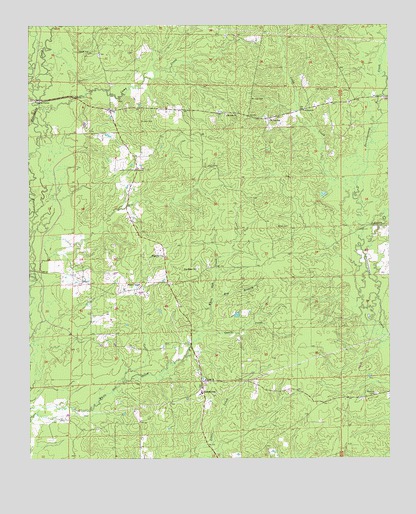
Grapevine, AR USGS Topographic Map
Click on map above to begin viewing in our Map Viewer.

This topographic map contains these locations and features:
Feature Name Type Latitude Longitude GNIS ID View Map
AinPopulated PlaceN34.2084°W92.3377°60618View Map
Ain ChurchChurchN34.2087°W92.3374°45797View Map
Big BranchStreamN34.1701°W92.3115°46511View Map
Camp CreekStreamN34.2268°W92.3713°47317View Map
Caney CreekStreamN34.1607°W92.3165°47407View Map
Clegg CreekStreamN34.2015°W92.2618°47845View Map
Deer CreekStreamN34.2318°W92.3732°48455View Map
GrapevinePopulated PlaceN34.1457°W92.3154°57036View Map
Grapevine ChurchChurchN34.1837°W92.3290°49562View Map
Grapevine Elementary SchoolSchoolN34.1440°W92.3154°60628View Map
Grapevine Volunteer Fire DepartmentBuildingN34.1471°W92.3131°2116496View Map
Heddon ChapelChurchN34.1743°W92.3368°49988View Map
Johnson CreekStreamN34.1920°W92.2588°50694View Map
Mount Zion CemeteryCemeteryN34.2287°W92.2980°52442View Map
Mount Zion ChurchChurchN34.2240°W92.3065°52467View Map
Pine Ridge ChurchChurchN34.1798°W92.3174°53467View Map
Pumpkinvine CreekStreamN34.1570°W92.2501°53845View Map
Raymick CemeteryCemeteryN34.1437°W92.2551°53924View Map
Saint John CemeteryCemeteryN34.2225°W92.3366°54344View Map
Saint Paul CemeteryCemeteryN34.2312°W92.2751°54435View Map
Saint Paul ChurchChurchN34.2257°W92.2796°54444View Map
Saint Paul SchoolSchoolN34.2229°W92.2910°54450View Map
Sardis ChurchChurchN34.1476°W92.3143°54593View Map
Studemeir (historical)Populated PlaceN34.1765°W92.3015°60645View Map
Township of DarysawCivilN34.2338°W92.2947°66604View Map
White CemeteryCemeteryN34.1918°W92.2854°56245View Map

Note: Coordinates in the location and feature list above are referenced to NAD83 datum.


Copyright (C) 2008-2024 Ryan Niemi / Sunset Dynamics ... All Rights Reserved