TopoQuest Logo
Do you find TopoQuest useful?
Help keep TopoQuest running and adding new maps/features by donating!
Bitcoin:  19c7KJd3qBynnjoSw5npx9KScwjBe4ifkT
Litecoin:  LXs6TkuXGGXo1vDsWCkWVdjQX94eUKd6ui
Home View Maps Find Maps Find Places Resources & Links


Hardin, Arkansas Topographic Map

USGS Map Title: Hardin, AR
USGS Map MRC: 34092C2
DRG (GeoTIFF) Download: o34092c2.tif


Neighboring USGS Topographic Map Quads:


  Cane Creek, AR  
34092D3
 

  Redfield, AR  
34092D2
 

  Wright, AR  
34092D1
 

  Prague, AR  
34092C3
 

  Hardin, AR  
34092C2
 

  White Hall, AR  
34092C1
 

  Grapevine, AR  
34092B3
 

  Pine Bluff NW, AR  
34092B2
 

  Pine Bluff, AR  
34092B1


Map MRC Location:

N35°
W93°
N35°
W92°
H8 H7 H6 H5 H4 H3 H2 H1
G8 G7 G6 G5 G4 G3 G2 G1
F8 F7 F6 F5 F4 F3 F2 F1
E8 E7 E6 E5 E4 E3 E2 E1
D8 D7 D6 D5 D4 D3 D2 D1
C8 C7 C6 C5 C4 C3 C2 C1
B8 B7 B6 B5 B4 B3 B2 B1
A8 A7 A6 A5 A4 A3 A2 A1
N34°
W93°
N34°
W92°

Hardin, AR USGS 1:24K Topographic Map Preview:
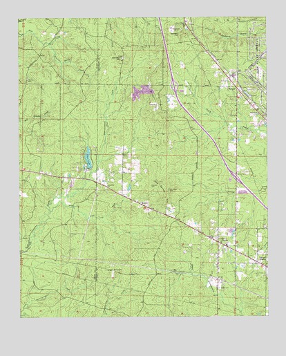
Hardin, AR USGS Topographic Map
Click on map above to begin viewing in our Map Viewer.

This topographic map contains these locations and features:
Feature Name Type Latitude Longitude GNIS ID View Map
Boyd School (historical)SchoolN34.3379°W92.1788°60853View Map
Bruce (historical)Populated PlaceN34.2679°W92.1815°60851View Map
Chandler CemeteryCemeteryN34.3049°W92.1838°47684View Map
Clear LakeReservoirN34.3118°W92.2135°74748View Map
Clear LakePopulated PlaceN34.3140°W92.2190°60622View Map
Clear Lake DamDamN34.3118°W92.2135°80243View Map
DonaldsonvillePopulated PlaceN34.2765°W92.1390°60857View Map
DoylestownPopulated PlaceN34.2701°W92.2038°56997View Map
East Fork Derrieusseaux CreekStreamN34.2945°W92.2349°48762View Map
EastwoodPopulated PlaceN34.3495°W92.1443°60858View Map
Ellis School (historical)SchoolN34.3084°W92.2204°60626View Map
Gum Springs HillSummitN34.3004°W92.1757°57860View Map
HardinPopulated PlaceN34.2812°W92.1501°57880View Map
Hardin Baptist ChurchChurchN34.2798°W92.1460°60856View Map
Hardin CemeteryCemeteryN34.2620°W92.1496°49848View Map
Hardin Fire DepartmentBuildingN34.2800°W92.1455°2116527View Map
Jefferson School (historical)SchoolN34.3676°W92.1621°60859View Map
Jennings HillSummitN34.3579°W92.1976°50623View Map
KIPR-FM (Pine Bluff)TowerN34.3701°W92.1688°85419View Map
Little Derrieusseaux CreekStreamN34.2526°W92.2499°51263View Map
MidwayPopulated PlaceN34.2970°W92.1890°58172View Map
Miller HillSummitN34.3362°W92.1804°58185View Map
Morris CemeteryCemeteryN34.3497°W92.2456°52216View Map
New Shiloh ChurchChurchN34.3048°W92.2060°77841View Map
Oak Grove Baptist ChurchChurchN34.3345°W92.1288°77878View Map
Oakland HeightsPopulated PlaceN34.2720°W92.1293°58293View Map
Old Shiloh CemeteryCemeteryN34.3031°W92.1762°53025View Map
Pentecostal ChurchChurchN34.2798°W92.1479°60855View Map
Pine Bluff Disposal LandfillLocaleN34.3433°W92.1906°2726749View Map
Piper CemeteryCemeteryN34.3337°W92.1439°53504View Map
Preacher Berry CreekStreamN34.3643°W92.2346°53781View Map
Redfield Volunteer Fire Department Station 3BuildingN34.3728°W92.1664°2117022View Map
Ruth School (historical)SchoolN34.2679°W92.1507°60854View Map
SamplesPopulated PlaceN34.3462°W92.1407°58578View Map
Sanders HillSummitN34.3693°W92.1685°58583View Map
Shiloh School (historical)SchoolN34.3120°W92.1829°60852View Map
Stark GateLocaleN34.3520°W92.1396°55166View Map
Township of JeffersonCivilN34.3636°W92.1383°66736View Map
Township of WashingtonCivilN34.2725°W92.1387°66749View Map
Tracy Spur (historical)LocaleN34.3709°W92.1624°60860View Map

Note: Coordinates in the location and feature list above are referenced to NAD83 datum.


Copyright (C) 2008-2024 Ryan Niemi / Sunset Dynamics ... All Rights Reserved