TopoQuest Logo
Do you find TopoQuest useful?
Help keep TopoQuest running and adding new maps/features by donating!
Bitcoin:  19c7KJd3qBynnjoSw5npx9KScwjBe4ifkT
Litecoin:  LXs6TkuXGGXo1vDsWCkWVdjQX94eUKd6ui
Home View Maps Find Maps Find Places Resources & Links


Kedron, Arkansas Topographic Map

USGS Map Title: Kedron, AR
USGS Map MRC: 34092A2
DRG (GeoTIFF) Download: o34092a2.tif


Neighboring USGS Topographic Map Quads:


  Grapevine, AR  
34092B3
 

  Pine Bluff NW, AR  
34092B2
 

  Pine Bluff, AR  
34092B1
 

  Staves, AR  
34092A3
 

  Kedron, AR  
34092A2
 

  Faith, AR  
34092A1
 

  Fordyce NE, AR  
33092H3
 

  Rison, AR  
33092H2
 

  Calmer, AR  
33092H1


Map MRC Location:

N35°
W93°
N35°
W92°
H8 H7 H6 H5 H4 H3 H2 H1
G8 G7 G6 G5 G4 G3 G2 G1
F8 F7 F6 F5 F4 F3 F2 F1
E8 E7 E6 E5 E4 E3 E2 E1
D8 D7 D6 D5 D4 D3 D2 D1
C8 C7 C6 C5 C4 C3 C2 C1
B8 B7 B6 B5 B4 B3 B2 B1
A8 A7 A6 A5 A4 A3 A2 A1
N34°
W93°
N34°
W92°

Kedron, AR USGS 1:24K Topographic Map Preview:
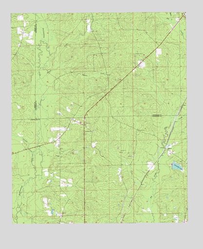
Kedron, AR USGS Topographic Map
Click on map above to begin viewing in our Map Viewer.

This topographic map contains these locations and features:
Feature Name Type Latitude Longitude GNIS ID View Map
Allgood CreekStreamN34.0868°W92.2299°76162View Map
Cabool (historical)Populated PlaceN34.0334°W92.1501°60981View Map
Dunkeffie LakeReservoirN34.0335°W92.1327°76831View Map
Dyson CreekStreamN34.1198°W92.1354°48727View Map
Howard School (historical)SchoolN34.0787°W92.1793°60695View Map
Hudson CreekStreamN34.0929°W92.2160°50389View Map
KedronPopulated PlaceN34.0445°W92.1404°50774View Map
Lake Dunkeffie DamDamN34.0362°W92.1343°80288View Map
Macedonia CemeteryCemeteryN34.0548°W92.1601°51543View Map
Mount Carnel ChurchChurchN34.0545°W92.1932°52283View Map
Panther CreekStreamN34.0404°W92.2357°53156View Map
Peace (historical)Populated PlaceN34.0145°W92.1640°60998View Map
Piney Grove CemeteryCemeteryN34.1004°W92.1560°53487View Map
Randolph CemeteryCemeteryN34.0402°W92.2160°53890View Map
RonePopulated PlaceN34.0698°W92.1279°58518View Map
Township of Jackson (historical)CivilN34.0293°W92.1585°63737View Map
Township of NivenCivilN34.0182°W92.1939°63741View Map
Township of TalladegaCivilN34.0986°W92.1415°66745View Map
Y Fire Department SubstationBuildingN34.0621°W92.2075°2117340View Map

Note: Coordinates in the location and feature list above are referenced to NAD83 datum.


Copyright (C) 2008-2024 Ryan Niemi / Sunset Dynamics ... All Rights Reserved