TopoQuest Logo
Do you find TopoQuest useful?
Help keep TopoQuest running and adding new maps/features by donating!
Bitcoin:  19c7KJd3qBynnjoSw5npx9KScwjBe4ifkT
Litecoin:  LXs6TkuXGGXo1vDsWCkWVdjQX94eUKd6ui
Home View Maps Find Maps Find Places Resources & Links


Pine Bluff NW, Arkansas Topographic Map

USGS Map Title: Pine Bluff NW, AR
USGS Map MRC: 34092B2
DRG (GeoTIFF) Download: o34092b2.tif


Neighboring USGS Topographic Map Quads:


  Prague, AR  
34092C3
 

  Hardin, AR  
34092C2
 

  White Hall, AR  
34092C1
 

  Grapevine, AR  
34092B3
 

  Pine Bluff NW, AR  
34092B2
 

  Pine Bluff, AR  
34092B1
 

  Staves, AR  
34092A3
 

  Kedron, AR  
34092A2
 

  Faith, AR  
34092A1


Map MRC Location:

N35°
W93°
N35°
W92°
H8 H7 H6 H5 H4 H3 H2 H1
G8 G7 G6 G5 G4 G3 G2 G1
F8 F7 F6 F5 F4 F3 F2 F1
E8 E7 E6 E5 E4 E3 E2 E1
D8 D7 D6 D5 D4 D3 D2 D1
C8 C7 C6 C5 C4 C3 C2 C1
B8 B7 B6 B5 B4 B3 B2 B1
A8 A7 A6 A5 A4 A3 A2 A1
N34°
W93°
N34°
W92°

Pine Bluff NW, AR USGS 1:24K Topographic Map Preview:
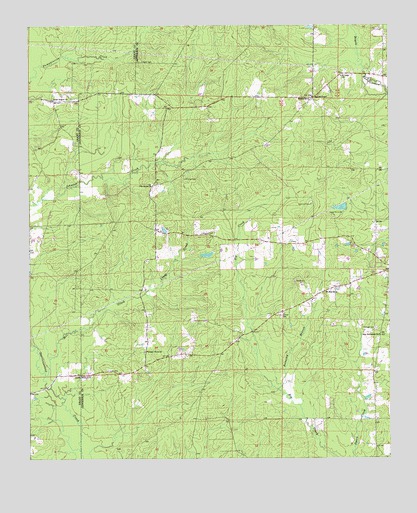
Pine Bluff NW, AR USGS Topographic Map
Click on map above to begin viewing in our Map Viewer.

This topographic map contains these locations and features:
Feature Name Type Latitude Longitude GNIS ID View Map
Barnes ChapelChurchN34.2295°W92.1515°46105View Map
Barnes SchoolSchoolN34.2284°W92.1529°46108View Map
Branch CemeteryCemeteryN34.1898°W92.1904°46911View Map
Camp Ta-Lo-HaLocaleN34.1951°W92.1449°47337View Map
Camp Ta-Lo-Ha Lake DamDamN34.1984°W92.1401°80490View Map
Cedar Branch ChurchChurchN34.2287°W92.2415°47577View Map
Craig CreekStreamN34.1729°W92.2101°48135View Map
Darysaw (historical)Populated PlaceN34.2376°W92.2401°60623View Map
Double WellsPopulated PlaceN34.1551°W92.1960°60912View Map
Double Wells ChurchChurchN34.1487°W92.2293°48579View Map
Fitzhugh CemeteryCemeteryN34.1626°W92.1299°49075View Map
Heutt CemeteryCemeteryN34.2398°W92.2110°50038View Map
Lee CemeteryCemeteryN34.1506°W92.2229°51043View Map
Mill CreekStreamN34.1493°W92.2446°51991View Map
Mount Zion ChurchChurchN34.1729°W92.1438°52466View Map
New Bethlehem ChurchChurchN34.1607°W92.1285°52631View Map
Phillips CemeteryCemeteryN34.2059°W92.1963°53334View Map
Pleasant Home ChurchChurchN34.1559°W92.2104°53579View Map
Providence ChurchChurchN34.2040°W92.2079°53827View Map
Robinson LakeReservoirN34.1839°W92.1884°80493View Map
Robinson Lake DamDamN34.1834°W92.1901°80492View Map
Running BranchStreamN34.1445°W92.1629°54267View Map
Saint Luke ChurchChurchN34.2357°W92.1418°54384View Map
Sulphur Springs Census Designated PlaceCensusN34.1708°W92.1299°2612132View Map
Ta-Lo-Ha-LakeReservoirN34.1975°W92.1418°80491View Map
Township of SpringCivilN34.1713°W92.1747°66744View Map

Note: Coordinates in the location and feature list above are referenced to NAD83 datum.


Copyright (C) 2008-2024 Ryan Niemi / Sunset Dynamics ... All Rights Reserved