TopoQuest Logo
Do you find TopoQuest useful?
Help keep TopoQuest running and adding new maps/features by donating!
Bitcoin:  19c7KJd3qBynnjoSw5npx9KScwjBe4ifkT
Litecoin:  LXs6TkuXGGXo1vDsWCkWVdjQX94eUKd6ui
Home View Maps Find Maps Find Places Resources & Links


Grapevine Draw, New Mexico Topographic Map

USGS Map Title: Grapevine Draw, NM
USGS Map MRC: 32104A5
DRG (GeoTIFF) Download: o32104a5.tif


Neighboring USGS Topographic Map Quads:


  Queen, NM  
32104B6
 

  Serpentine Bends, NM  
32104B5
 

  Carlsbad Caverns, NM  
32104B4
 

  Gunsight Canyon, NM  
32104A6
 

  Grapevine Draw, NM  
32104A5
 

  Rattlesnake Springs, NM  
32104A4
 

  Independence Spring, TX  
31104H6
 

  South Rector Canyon, TX  
31104H5
 

  Alligator Draw, TX  
31104H4


Map MRC Location:

N33°
W105°
N33°
W104°
H8 H7 H6 H5 H4 H3 H2 H1
G8 G7 G6 G5 G4 G3 G2 G1
F8 F7 F6 F5 F4 F3 F2 F1
E8 E7 E6 E5 E4 E3 E2 E1
D8 D7 D6 D5 D4 D3 D2 D1
C8 C7 C6 C5 C4 C3 C2 C1
B8 B7 B6 B5 B4 B3 B2 B1
A8 A7 A6 A5 A4 A3 A2 A1
N32°
W105°
N32°
W104°

Grapevine Draw, NM USGS 1:24K Topographic Map Preview:
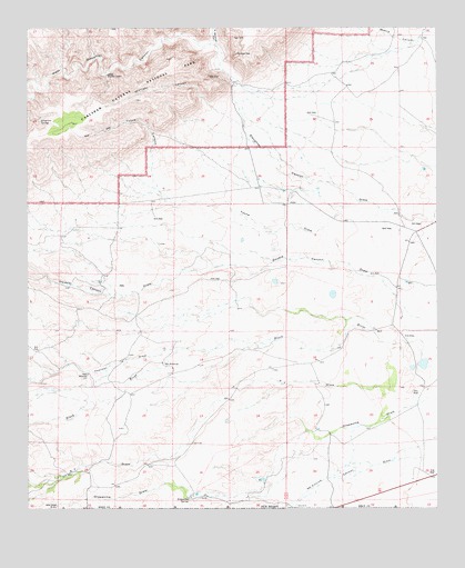
Grapevine Draw, NM USGS Topographic Map
Click on map above to begin viewing in our Map Viewer.

This topographic map contains these locations and features:
Feature Name Type Latitude Longitude GNIS ID View Map
Colwell RanchLocaleN32.0818°W104.5419°900872View Map
Double CanyonValleyN32.0594°W104.6014°905829View Map
Double Canyon DrawValleyN32.0489°W104.5039°898301View Map
Farrell RanchLocaleN32.0035°W104.5749°901164View Map
Geyser SpringsSpringN32.0027°W104.5766°914278View Map
Grapevine DrawValleyN32.0303°W104.5019°898327View Map
Grapevine SpringSpringN32.0029°W104.5763°898328View Map
Leeman RanchLocaleN32.0190°W104.5361°901181View Map
Longview SpringSpringN32.1009°W104.6213°891319View Map
McKittrick Canyon DrawValleyN32.0197°W104.5009°898385View Map
Midnight CanyonValleyN32.0997°W104.5595°892020View Map
North Slaughter CanyonValleyN32.1211°W104.5675°909189View Map
Rock WindmillLocaleN32.0351°W104.6069°894098View Map
School Section Water HoleSpringN32.0754°W104.5077°901135View Map
Spring Number ElevenSpringN32.1009°W104.6222°920846View Map
Thurman DrawValleyN32.0420°W104.5765°911693View Map
Thurman RanchLocaleN32.0496°W104.5113°900751View Map
Tucker Ranch (historical)LocaleN32.0348°W104.5816°900925View Map
Twin WindmillsLocaleN32.0379°W104.5841°895972View Map
West Slaughter CanyonValleyN32.1216°W104.5689°912260View Map
X T RanchLocaleN32.0087°W104.6141°900750View Map
XT DrawValleyN32.0273°W104.5088°912510View Map
Yucca CanyonValleyN32.0826°W104.5848°898490View Map
Yucca DrawValleyN32.0800°W104.5239°898491View Map

Note: Coordinates in the location and feature list above are referenced to NAD83 datum.


Copyright (C) 2008-2025 Ryan Niemi / Sunset Dynamics ... All Rights Reserved