TopoQuest Logo
Do you find TopoQuest useful?
Help keep TopoQuest running and adding new maps/features by donating!
Bitcoin:  19c7KJd3qBynnjoSw5npx9KScwjBe4ifkT
Litecoin:  LXs6TkuXGGXo1vDsWCkWVdjQX94eUKd6ui
Home View Maps Find Maps Find Places Resources & Links


Serpentine Bends, New Mexico Topographic Map

USGS Map Title: Serpentine Bends, NM
USGS Map MRC: 32104B5
DRG (GeoTIFF) Download: o32104b5.tif


Neighboring USGS Topographic Map Quads:


  Red Bluff Draw, NM  
32104C6
 

  Bandanna Point, NM  
32104C5
 

  Carnero Peak, NM  
32104C4
 

  Queen, NM  
32104B6
 

  Serpentine Bends, NM  
32104B5
 

  Carlsbad Caverns, NM  
32104B4
 

  Gunsight Canyon, NM  
32104A6
 

  Grapevine Draw, NM  
32104A5
 

  Rattlesnake Springs, NM  
32104A4


Map MRC Location:

N33°
W105°
N33°
W104°
H8 H7 H6 H5 H4 H3 H2 H1
G8 G7 G6 G5 G4 G3 G2 G1
F8 F7 F6 F5 F4 F3 F2 F1
E8 E7 E6 E5 E4 E3 E2 E1
D8 D7 D6 D5 D4 D3 D2 D1
C8 C7 C6 C5 C4 C3 C2 C1
B8 B7 B6 B5 B4 B3 B2 B1
A8 A7 A6 A5 A4 A3 A2 A1
N32°
W105°
N32°
W104°

Serpentine Bends, NM USGS 1:24K Topographic Map Preview:
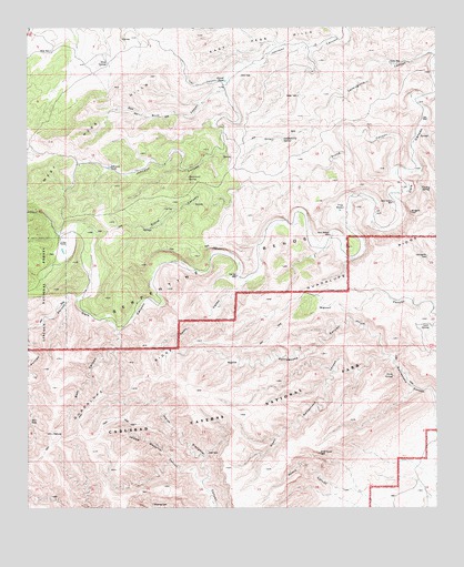
Serpentine Bends, NM USGS Topographic Map
Click on map above to begin viewing in our Map Viewer.

This topographic map contains these locations and features:
Feature Name Type Latitude Longitude GNIS ID View Map
Able SeepSpringN32.1479°W104.6247°902936View Map
Bear CanyonValleyN32.1720°W104.5981°903619View Map
Carlsbad Caverns National ParkParkN32.1409°W104.5530°904780View Map
Carlsbad Caverns WildernessReserveN32.1318°W104.5738°2035539View Map
Dark Canyon WellWellN32.2046°W104.5133°905606View Map
Fawn ValleyValleyN32.1830°W104.5612°906241View Map
Gravel TankReservoirN32.2363°W104.5650°906715View Map
Hammond SpringSpringN32.2111°W104.5762°906820View Map
Hat Bar WellWellN32.1854°W104.5608°906866View Map
Hess SpringSpringN32.2410°W104.6012°906941View Map
Hess WellWellN32.2440°W104.6177°906942View Map
Johnson TankReservoirN32.2139°W104.6004°907415View Map
Lechuguilla SpringSpringN32.2211°W104.5471°907918View Map
Lowe SpringSpringN32.1726°W104.5025°908263View Map
Middle Slaughter CanyonValleyN32.1320°W104.5729°908713View Map
Mudgetts Wilderness Study AreaParkN32.2021°W104.5083°935850View Map
North Rattlesnake CanyonValleyN32.1650°W104.5142°909179View Map
Putman CanyonValleyN32.1803°W104.6098°909907View Map
Putman Water WellWellN32.1726°W104.6241°1983836View Map
Red Bluff CanyonValleyN32.2339°W104.5653°910038View Map
Rock Bottom WellWellN32.1962°W104.5325°910360View Map
Serpentine BendsAreaN32.1915°W104.5683°910949View Map
South Rattlesnake CanyonValleyN32.1648°W104.5156°911268View Map
Stone CanyonValleyN32.2133°W104.5132°911430View Map
Stone SpringSpringN32.1594°W104.5139°911436View Map
The BowlBasinN32.2023°W104.5294°911626View Map
Trail CanyonValleyN32.2363°W104.5657°911780View Map
Turkey SpringSpringN32.2080°W104.5048°911891View Map
West Hess HillsRangeN32.2173°W104.5954°912246View Map
X Bar RanchLocaleN32.1946°W104.6155°912506View Map
Youse WellWellN32.2409°W104.5144°912536View Map

Note: Coordinates in the location and feature list above are referenced to NAD83 datum.


Copyright (C) 2008-2024 Ryan Niemi / Sunset Dynamics ... All Rights Reserved