TopoQuest Logo
Do you find TopoQuest useful?
Help keep TopoQuest running and adding new maps/features by donating!
Bitcoin:  19c7KJd3qBynnjoSw5npx9KScwjBe4ifkT
Litecoin:  LXs6TkuXGGXo1vDsWCkWVdjQX94eUKd6ui
Home View Maps Find Maps Find Places Resources & Links


Graves Spring, Tennessee Topographic Map

USGS Map Title: Graves Spring, TN
USGS Map MRC: 35087E6
DRG (GeoTIFF) Download: o35087e6.tif


Neighboring USGS Topographic Map Quads:


  Chestnut Grove, TN  
35087F7
 

  Pleasantville, TN  
35087F6
 

  Beaverdam Springs, TN  
35087F5
 

  Linden, TN  
35087E7
 

  Graves Spring, TN  
35087E6
 

  Hohenwald, TN  
35087E5
 

  Leatherwood, TN  
35087D7
 

  Topsy, TN  
35087D6
 

  Riverside, TN  
35087D5


Map MRC Location:

N36°
W88°
N36°
W87°
H8 H7 H6 H5 H4 H3 H2 H1
G8 G7 G6 G5 G4 G3 G2 G1
F8 F7 F6 F5 F4 F3 F2 F1
E8 E7 E6 E5 E4 E3 E2 E1
D8 D7 D6 D5 D4 D3 D2 D1
C8 C7 C6 C5 C4 C3 C2 C1
B8 B7 B6 B5 B4 B3 B2 B1
A8 A7 A6 A5 A4 A3 A2 A1
N35°
W88°
N35°
W87°

Graves Spring, TN USGS 1:24K Topographic Map Preview:
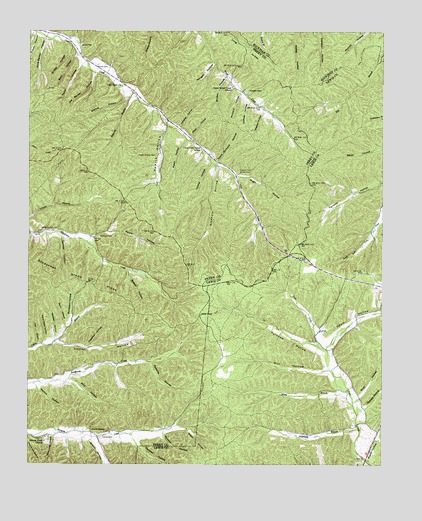
Graves Spring, TN USGS Topographic Map
Click on map above to begin viewing in our Map Viewer.

This topographic map contains these locations and features:
Feature Name Type Latitude Longitude GNIS ID View Map
Alberson CemeteryCemeteryN35.5656°W87.7250°1275523View Map
Apple Orchard HollowValleyN35.5873°W87.6832°1275824View Map
Arkansas BranchStreamN35.5104°W87.6334°1275849View Map
Barber CemeteryCemeteryN35.6148°W87.7222°1276279View Map
Barn HollowValleyN35.5396°W87.7364°1276327View Map
Barn HollowValleyN35.6184°W87.7332°1276328View Map
Bishop HollowValleyN35.6064°W87.7164°1277524View Map
Bob Barber HollowValleyN35.5698°W87.6687°1308554View Map
Boneyard HollowValleyN35.5410°W87.7344°1277947View Map
Bowen HollowValleyN35.5557°W87.7146°1278046View Map
Bryson HollowValleyN35.6118°W87.6805°1278766View Map
Camper HollowValleyN35.5658°W87.7380°1279473View Map
Cane Patch HollowValleyN35.5357°W87.7438°1279539View Map
Carter BranchStreamN35.5356°W87.7403°1647062View Map
Carter HollowValleyN35.5354°W87.7402°1279813View Map
Chestnut HollowValleyN35.5341°W87.7284°1280395View Map
Chop HollowValleyN35.5945°W87.6924°1280508View Map
Comer HollowValleyN35.5870°W87.6855°1281038View Map
Coon Creek ChurchChurchN35.6090°W87.7175°1281169View Map
Dill HollowValleyN35.5271°W87.6449°1306347View Map
Double Oak Stand (historical)LocaleN35.5628°W87.6739°1308579View Map
Duncan HollowValleyN35.5088°W87.7022°1283165View Map
Edwards BranchStreamN35.6076°W87.7136°1283542View Map
Enoch HollowValleyN35.6236°W87.7477°1283808View Map
Fain CemeteryCemeteryN35.5606°W87.6286°1309399View Map
Fall BranchStreamN35.5348°W87.7464°1284054View Map
Graves CemeteryCemeteryN35.5078°W87.7239°1285955View Map
Graves HollowValleyN35.5074°W87.7261°1285964View Map
Graves SpringSpringN35.5100°W87.7275°1285967View Map
Hamm HollowValleyN35.5225°W87.7465°1286672View Map
Hensley CemeteryCemeteryN35.5578°W87.6517°1309414View Map
Hensley HollowValleyN35.5973°W87.6967°1287467View Map
Hickerson CemeteryCemeteryN35.5676°W87.7459°1287537View Map
Hickory FlatFlatN35.5737°W87.6970°1308585View Map
Hogpen HollowValleyN35.6016°W87.6672°1288012View Map
Horse PondLakeN35.5433°W87.6891°1288413View Map
Hugh HollowValleyN35.5833°W87.6769°1288657View Map
Hugh Hollow BranchStreamN35.5828°W87.6775°1647070View Map
Joe Barber HollowValleyN35.6130°W87.7268°1289453View Map
Knot HollowValleyN35.5185°W87.6340°1307352View Map
Moon BranchStreamN35.5170°W87.6350°1294221View Map
Morgan HollowValleyN35.6159°W87.6846°1294370View Map
Mulberry HollowValleyN35.6075°W87.6755°1295063View Map
Odam CemeteryCemeteryN35.5395°W87.6447°1309459View Map
Odom HollowValleyN35.5347°W87.6435°1307361View Map
Oldfield HollowValleyN35.6048°W87.6719°1296399View Map
Parsonage HollowValleyN35.5083°W87.7408°1296892View Map
Patch HollowValleyN35.5939°W87.6942°1296910View Map
Penny HollowValleyN35.5655°W87.7276°1297157View Map
Poplin HollowValleyN35.5013°W87.6291°1307366View Map
Poplin HollowValleyN35.5974°W87.7008°1298240View Map
Poplin Hollow CemeteryCemeteryN35.5890°W87.7053°1298241View Map
Qualls CemeteryCemeteryN35.6209°W87.7322°1298737View Map
Qualls HollowValleyN35.6217°W87.7375°1298740View Map
Reeves HollowValleyN35.5159°W87.6327°1307368View Map
Roberts HollowValleyN35.5296°W87.7064°1299641View Map
Sand Trace HollowValleyN35.5364°W87.6468°1309475View Map
Sheep HollowValleyN35.6163°W87.6855°1308628View Map
Sinkhole HollowValleyN35.5862°W87.6838°1270371View Map
Sinking Creek ChurchChurchN35.5067°W87.7439°1270389View Map
Sinking Creek School (historical)SchoolN35.5065°W87.7442°1308615View Map
Slipoff HollowValleyN35.5104°W87.6925°1270527View Map
Stephens CemeteryCemeteryN35.6078°W87.6728°1303823View Map
Taylor HollowValleyN35.6155°W87.7316°1272236View Map
Thomas HollowValleyN35.5069°W87.7117°1272492View Map
Turnbow CemeteryCemeteryN35.5278°W87.6381°1309494View Map
Turnbow HollowValleyN35.5339°W87.6469°1304202View Map
Upper Brush Creek SchoolSchoolN35.6092°W87.6784°1273290View Map
Upper Coon Creek CemeteryCemeteryN35.5851°W87.6758°1273294View Map
Upper Coon Creek SchoolSchoolN35.5909°W87.6895°1304277View Map
Upper Hurrican Creek School (historical)SchoolN35.5667°W87.7264°1308622View Map
Waxtree HollowValleyN35.5362°W87.7407°1273952View Map
Whit HollowValleyN35.5246°W87.7355°1304513View Map
Willis Barber HollowValleyN35.6228°W87.7442°1274735View Map
Wilson CemeteryCemeteryN35.5020°W87.6320°1309502View Map

Note: Coordinates in the location and feature list above are referenced to NAD83 datum.


Copyright (C) 2008-2025 Ryan Niemi / Sunset Dynamics ... All Rights Reserved