TopoQuest Logo
Do you find TopoQuest useful?
Help keep TopoQuest running and adding new maps/features by donating!
Bitcoin:  19c7KJd3qBynnjoSw5npx9KScwjBe4ifkT
Litecoin:  LXs6TkuXGGXo1vDsWCkWVdjQX94eUKd6ui
Home View Maps Find Maps Find Places Resources & Links


Leatherwood, Tennessee Topographic Map

USGS Map Title: Leatherwood, TN
USGS Map MRC: 35087D7
DRG (GeoTIFF) Download: o35087d7.tif


Neighboring USGS Topographic Map Quads:


  Pope, TN  
35087E8
 

  Linden, TN  
35087E7
 

  Graves Spring, TN  
35087E6
 

  Clifton, TN  
35087D8
 

  Leatherwood, TN  
35087D7
 

  Topsy, TN  
35087D6
 

  Eagle Creek, TN  
35087C8
 

  Waynesboro, TN  
35087C7
 

  Waynesboro East, TN  
35087C6


Map MRC Location:

N36°
W88°
N36°
W87°
H8 H7 H6 H5 H4 H3 H2 H1
G8 G7 G6 G5 G4 G3 G2 G1
F8 F7 F6 F5 F4 F3 F2 F1
E8 E7 E6 E5 E4 E3 E2 E1
D8 D7 D6 D5 D4 D3 D2 D1
C8 C7 C6 C5 C4 C3 C2 C1
B8 B7 B6 B5 B4 B3 B2 B1
A8 A7 A6 A5 A4 A3 A2 A1
N35°
W88°
N35°
W87°

Leatherwood, TN USGS 1:24K Topographic Map Preview:
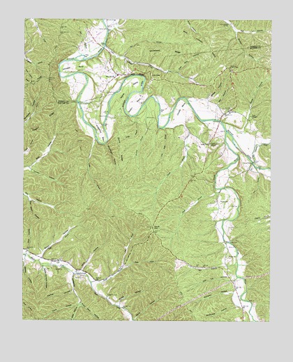
Leatherwood, TN USGS Topographic Map
Click on map above to begin viewing in our Map Viewer.

This topographic map contains these locations and features:
Feature Name Type Latitude Longitude GNIS ID View Map
Ann HomerRidgeN35.4929°W87.7889°1275761View Map
Apple Orchard HollowValleyN35.3975°W87.8647°1275823View Map
Barnes GravesCemeteryN35.3931°W87.8422°1641748View Map
Bartley BridgeBridgeN35.4406°W87.7592°1276406View Map
Bastin BendBendN35.4651°W87.8186°1276442View Map
Battles HollowValleyN35.4005°W87.8738°1276485View Map
Bawcom CemeteryCemeteryN35.3967°W87.8578°1304998View Map
Beech Creek Volunteer Fire DepartmentBuildingN35.3948°W87.8433°2653894View Map
Bell BridgeBridgeN35.4579°W87.7759°1276909View Map
Bell CemeteryCemeteryN35.4626°W87.7734°1276913View Map
Bell HollowValleyN35.4647°W87.7769°1276929View Map
Bells FordCrossingN35.4579°W87.7759°1302703View Map
Big Opossum CreekStreamN35.4406°W87.7586°1305223View Map
Big Rock FordCrossingN35.4695°W87.8289°1314680View Map
Boldin HollowValleyN35.4011°W87.8660°1277897View Map
Bridge BranchStreamN35.4598°W87.8189°1278341View Map
Bromley BranchStreamN35.4648°W87.8142°1305432View Map
Bromley CemeteryCemeteryN35.4590°W87.8086°1278457View Map
Bromley FordCrossingN35.4573°W87.8070°1302707View Map
Brushy HollowValleyN35.4951°W87.7678°1278706View Map
Buck BranchStreamN35.4301°W87.7753°1278790View Map
Bunch FordCrossingN35.4598°W87.8331°1314769View Map
Burns CemeteryCemeteryN35.4576°W87.7553°1641766View Map
Burns HollowValleyN35.4545°W87.7640°1305553View Map
Canoe BranchStreamN35.4504°W87.8384°1279617View Map
Chalk HollowValleyN35.3824°W87.8460°1280199View Map
Chappell CemeteryCemeteryN35.4751°W87.8272°1642898View Map
Chappell Methodist ChurchChurchN35.4770°W87.8239°1642899View Map
Choate BendBendN35.4620°W87.7950°1280498View Map
Choate BranchStreamN35.4548°W87.8053°1305908View Map
Cold Water BranchStreamN35.4545°W87.8042°1280906View Map
Commissioner District 3CivilN35.3886°W87.8561°2463998View Map
Cove HollowValleyN35.3815°W87.8451°1281418View Map
Cow Mire HollowValleyN35.4783°W87.7972°1281451View Map
Crossno RidgeRidgeN35.4526°W87.8722°1306198View Map
Dabbs HollowValleyN35.4668°W87.7815°1281952View Map
Davis HollowValleyN35.3956°W87.8454°1282188View Map
Defoe Camp (historical)LocaleN35.4667°W87.7875°1302734View Map
Dry BranchStreamN35.4387°W87.7575°1282833View Map
Farmer HollowValleyN35.3876°W87.8494°1284138View Map
Flat WoodsPopulated PlaceN35.4770°W87.8275°1284430View Map
Flat Woods Lookout TowerTowerN35.4801°W87.7711°1647767View Map
Flatwoods CemeteryCemeteryN35.4765°W87.8239°1642904View Map
Flatwoods Post OfficePost OfficeN35.4770°W87.8281°1652593View Map
Flatwoods SchoolSchoolN35.4787°W87.8325°1647069View Map
Flatwoods Volunteer Fire DepartmentBuildingN35.4765°W87.8277°2653863View Map
Goose CoopLocaleN35.4490°W87.7811°1285666View Map
Green RiverStreamN35.4540°W87.7725°1326564View Map
Highland ChurchChurchN35.4487°W87.7806°1287743View Map
Holt CemeteryCemeteryN35.4001°W87.8572°1288156View Map
Holt Family CemeteryCemeteryN35.3962°W87.8631°1641822View Map
Horseshoe BendBendN35.4523°W87.8359°1288426View Map
Jack HollowValleyN35.4038°W87.8726°1289153View Map
Jack Lot HollowValleyN35.3927°W87.7669°1289157View Map
Lacher FordCrossingN35.4079°W87.7720°1315340View Map
LeatherwoodPopulated PlaceN35.3942°W87.8478°1290881View Map
Leatherwood BranchStreamN35.3948°W87.8492°1290883View Map
Lee BranchStreamN35.4848°W87.8250°1290937View Map
Left Prong Smith BranchStreamN35.3965°W87.8245°1290995View Map
Little Hope CemeteryCemeteryN35.4473°W87.7797°1641842View Map
Little Opossum CreekStreamN35.4887°W87.8342°1291599View Map
Lovie (historical)Populated PlaceN35.4481°W87.7570°1302770View Map
Low GapGapN35.4765°W87.8106°1292166View Map
Mayberry School (historical)SchoolN35.4567°W87.7606°1302774View Map
McClaren HollowValleyN35.3868°W87.7683°1293151View Map
McDonald CemeteryCemeteryN35.3820°W87.7703°1641849View Map
McDonald HollowValleyN35.3816°W87.7670°1293261View Map
Merideth CemeteryCemeteryN35.4245°W87.7756°1293616View Map
Mill HollowValleyN35.4870°W87.8443°1293869View Map
Old Union ChurchChurchN35.3945°W87.8489°1641877View Map
Opossum Creek FordCrossingN35.4881°W87.8350°1308600View Map
Parker CemeteryCemeteryN35.3940°W87.8522°1641878View Map
Phillips CemeteryCemeteryN35.3853°W87.7586°1641882View Map
Phillips CemeteryCemeteryN35.4078°W87.7720°1297339View Map
Phillips ChapelChurchN35.3984°W87.7717°1641883View Map
Phillips School (historical)SchoolN35.3987°W87.7722°1302783View Map
Pigg BranchStreamN35.3998°W87.8667°1297446View Map
Pine BluffCliffN35.4773°W87.8181°1297505View Map
Pitts CemeteryCemeteryN35.4226°W87.7697°1297760View Map
Pope BranchStreamN35.4576°W87.7750°1302785View Map
Pope ChapelChurchN35.4595°W87.7595°1298166View Map
Pope School (historical)SchoolN35.4459°W87.7817°1302786View Map
Popes Chapel CemeteryCemeteryN35.4592°W87.7592°1641885View Map
Pulley HollowValleyN35.3821°W87.8262°1298664View Map
Right Prong Smith BranchStreamN35.3965°W87.8245°1299441View Map
Riley HollowValleyN35.3812°W87.8460°1299460View Map
Rochouse HollowValleyN35.4481°W87.8343°1299724View Map
Rye Patch HollowValleyN35.4246°W87.8718°1300378View Map
Slink Shoals FordCrossingN35.4651°W87.8475°1270523View Map
Smith BranchStreamN35.3912°W87.8406°1270557View Map
Smith HillSummitN35.4134°W87.8095°1270672View Map
Sol HollowValleyN35.3988°W87.7679°1270801View Map
Stock HollowValleyN35.3756°W87.8183°1271453View Map
Stone BendBendN35.4709°W87.8228°1271469View Map
Stone RidgeRidgeN35.4456°W87.8267°1271500View Map
Throgmorton CemeteryCemeteryN35.3851°W87.8322°1304097View Map
Tole CemeteryCemeteryN35.4001°W87.8567°1641915View Map
Toll HollowValleyN35.4955°W87.7672°1272731View Map
Toll Hollow SpringSpringN35.4982°W87.7720°1272732View Map
Turnbo HollowValleyN35.4376°W87.8715°1273057View Map
Whitaker BendBendN35.4801°W87.8497°1274318View Map
Whitehead CemeteryCemeteryN35.4478°W87.7534°1641928View Map
Whitehead RidgeRidgeN35.4876°W87.8039°1274417View Map
William Riley CemeteryCemeteryN35.3834°W87.8431°1641930View Map
Worley CemeteryCemeteryN35.3931°W87.8478°1275129View Map

Note: Coordinates in the location and feature list above are referenced to NAD83 datum.


Copyright (C) 2008-2024 Ryan Niemi / Sunset Dynamics ... All Rights Reserved