TopoQuest Logo
Do you find TopoQuest useful?
Help keep TopoQuest running and adding new maps/features by donating!
Bitcoin:  19c7KJd3qBynnjoSw5npx9KScwjBe4ifkT
Litecoin:  LXs6TkuXGGXo1vDsWCkWVdjQX94eUKd6ui
Home View Maps Find Maps Find Places Resources & Links


Topsy, Tennessee Topographic Map

USGS Map Title: Topsy, TN
USGS Map MRC: 35087D6
DRG (GeoTIFF) Download: o35087d6.tif


Neighboring USGS Topographic Map Quads:


  Linden, TN  
35087E7
 

  Graves Spring, TN  
35087E6
 

  Hohenwald, TN  
35087E5
 

  Leatherwood, TN  
35087D7
 

  Topsy, TN  
35087D6
 

  Riverside, TN  
35087D5
 

  Waynesboro, TN  
35087C7
 

  Waynesboro East, TN  
35087C6
 

  Ovilla, TN  
35087C5


Map MRC Location:

N36°
W88°
N36°
W87°
H8 H7 H6 H5 H4 H3 H2 H1
G8 G7 G6 G5 G4 G3 G2 G1
F8 F7 F6 F5 F4 F3 F2 F1
E8 E7 E6 E5 E4 E3 E2 E1
D8 D7 D6 D5 D4 D3 D2 D1
C8 C7 C6 C5 C4 C3 C2 C1
B8 B7 B6 B5 B4 B3 B2 B1
A8 A7 A6 A5 A4 A3 A2 A1
N35°
W88°
N35°
W87°

Topsy, TN USGS 1:24K Topographic Map Preview:
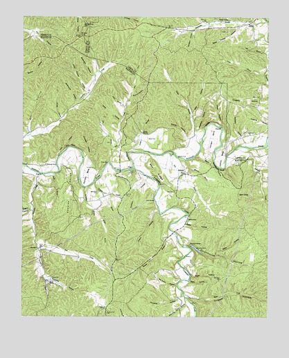
Topsy, TN USGS Topographic Map
Click on map above to begin viewing in our Map Viewer.

This topographic map contains these locations and features:
Feature Name Type Latitude Longitude GNIS ID View Map
AshlandPopulated PlaceN35.4362°W87.6675°1314607View Map
Ashland FordCrossingN35.4415°W87.6706°1314608View Map
Austin BranchStreamN35.4623°W87.6972°1275991View Map
Austin HollowValleyN35.4622°W87.6979°1302699View Map
Babe Thorpe HollowValleyN35.4961°W87.6401°1276041View Map
Bachelor BendBendN35.4340°W87.7167°1276045View Map
Bald KnobSummitN35.4254°W87.6392°1276208View Map
Bates School (historical)SchoolN35.4576°W87.6597°1302701View Map
Beatty CemeteryCemeteryN35.4942°W87.6447°1276693View Map
Beatty SpringSpringN35.4987°W87.6456°1276697View Map
Beech SpringSpringN35.3896°W87.7360°1276857View Map
Biffle HollowValleyN35.4135°W87.6671°1277220View Map
Bill Kutch HollowValleyN35.3886°W87.6711°1277460View Map
Bowstring BranchStreamN35.3751°W87.6753°1326582View Map
Bowstring HollowValleyN35.3811°W87.6674°1326626View Map
Buffalo River Volunteer Fire DepartmentBuildingN35.3896°W87.7023°2653720View Map
Burns CemeteryCemeteryN35.4462°W87.6725°1641767View Map
Carey FordCrossingN35.4406°W87.7192°1302711View Map
Carter BranchStreamN35.4437°W87.6961°1279775View Map
Cave HollowValleyN35.4417°W87.7319°1279927View Map
Cave SpringSpringN35.4233°W87.6828°1279946View Map
Chapel School (historical)SchoolN35.4084°W87.6714°1302715View Map
Choate CemeteryCemeteryN35.4370°W87.7131°1305909View Map
Churchwell Spring BranchStreamN35.4462°W87.6253°1309384View Map
Commissioner District 4CivilN35.4935°W87.6269°2464059View Map
Cothran BendBendN35.4415°W87.6484°1281347View Map
Courthouse HollowValleyN35.4047°W87.6655°1281392View Map
Courthouse Hollow CreekStreamN35.4037°W87.6642°1641870View Map
Courthouse SpringSpringN35.4042°W87.6639°1302726View Map
Dabbs CemeteryCemeteryN35.4517°W87.6314°1281948View Map
Davidson HollowValleyN35.4940°W87.6632°1282109View Map
Davis HollowValleyN35.3898°W87.6652°1282187View Map
Deer HollowValleyN35.4587°W87.6637°1306318View Map
Dry BranchStreamN35.4431°W87.6731°1282834View Map
Dugger HollowValleyN35.3842°W87.6671°1283102View Map
Dugger Hollow ProspectsMineN35.3779°W87.6511°1302740View Map
Durham CemeteryCemeteryN35.4365°W87.7278°1283225View Map
Durham HollowValleyN35.4323°W87.6873°1283231View Map
East Prong Moccasin CreekStreamN35.4023°W87.7411°1283396View Map
Edwards HollowValleyN35.4378°W87.7276°1283558View Map
Fall BranchStreamN35.4851°W87.6261°1284053View Map
Fortyeight CreekStreamN35.4370°W87.6942°1326592View Map
Graves HollowValleyN35.4495°W87.6655°1285963View Map
Grinder BluffCliffN35.4420°W87.6961°1286300View Map
Haley ChapelChurchN35.4979°W87.6328°1306532View Map
Higgins HollowValleyN35.4209°W87.7453°1287688View Map
Hollabaugh CemeteryCemeteryN35.4398°W87.7428°1641820View Map
Horselot HollowValleyN35.3834°W87.6703°1288420View Map
Horseshoe HillSummitN35.4965°W87.7197°1288444View Map
Hotel HollowValleyN35.4542°W87.6476°1288481View Map
John Thorpe HollowValleyN35.4693°W87.7180°1289500View Map
Johnson BendBendN35.4495°W87.6534°1289518View Map
Keazy BranchStreamN35.4342°W87.7389°1289927View Map
Kelly FordCrossingN35.4104°W87.6722°1302766View Map
Kellys Chapel ChurchChurchN35.4212°W87.6609°1646841View Map
Kutch HollowValleyN35.4201°W87.6820°1290411View Map
Kyles CreekStreamN35.3840°W87.6670°1290426View Map
Matheny CampLocaleN35.4920°W87.7203°1292919View Map
Mathis BranchStreamN35.4201°W87.7136°1292931View Map
Melton CemeteryCemeteryN35.4667°W87.6289°1293566View Map
Meredith FordCrossingN35.4342°W87.7097°1302776View Map
Meredith HollowValleyN35.3901°W87.7370°1293613View Map
Mill CreekStreamN35.4395°W87.7053°1293821View Map
Minnow BranchStreamN35.4406°W87.6670°1294059View Map
MoccasinPopulated PlaceN35.4034°W87.7406°1315527View Map
Moccasin CreekStreamN35.4345°W87.7406°1294138View Map
Morrow Valley School (historical)SchoolN35.3879°W87.6695°1646848View Map
Natural BridgeLocaleN35.4051°W87.6645°1295260View Map
Overflow HollowValleyN35.4535°W87.6593°1296544View Map
Owl BranchStreamN35.4509°W87.7461°1302781View Map
Owl HollowValleyN35.4519°W87.7462°1296599View Map
Pea RidgeRidgeN35.4351°W87.6811°1297028View Map
Phillips ChurchChurchN35.4031°W87.7422°1302782View Map
Pigpen HollowValleyN35.4356°W87.6284°1297458View Map
Pine BluffCliffN35.4462°W87.7259°1297504View Map
Prichett HollowValleyN35.4416°W87.7177°1298523View Map
Queens BranchStreamN35.4098°W87.6736°1298759View Map
Rainbow LakeLakeN35.4032°W87.6612°1298831View Map
Rand HollowValleyN35.4411°W87.6629°1298897View Map
Rasbury School (historical)SchoolN35.4342°W87.6622°1302789View Map
Repp HollowValleyN35.3922°W87.6643°1299223View Map
Robinette CreekStreamN35.4448°W87.6417°1299680View Map
Robinson HollowValleyN35.4756°W87.7136°1299712View Map
Salem CemeteryCemeteryN35.4356°W87.6928°1641898View Map
Salem ChurchChurchN35.4356°W87.6928°1300546View Map
Seiber Chapel (historical)ChurchN35.4629°W87.6442°1309476View Map
Shot BranchStreamN35.4567°W87.7003°1270224View Map
Skelton CemeteryCemeteryN35.3912°W87.7350°1303649View Map
Slickrock FordCrossingN35.4384°W87.7322°1314302View Map
Spout SpringSpringN35.4517°W87.6888°1271029View Map
Sprinkles BranchStreamN35.4287°W87.7178°1303779View Map
Squeeze Up BluffCliffN35.4367°W87.6495°1271178View Map
State HollowValleyN35.4028°W87.6508°1271270View Map
Steer HollowValleyN35.4566°W87.7002°1271318View Map
Stillhouse HollowValleyN35.4641°W87.7224°1271412View Map
Stitch HollowValleyN35.4205°W87.6820°1302802View Map
Stockard FordCrossingN35.4059°W87.6703°1302803View Map
Stowers HollowValleyN35.4476°W87.6366°1271562View Map
Sugartree HollowValleyN35.4258°W87.6266°1303912View Map
Swamp HollowValleyN35.4670°W87.6943°1271932View Map
SweetwaterPopulated PlaceN35.4973°W87.6320°1309490View Map
Sweetwater BranchStreamN35.4981°W87.6259°1271980View Map
Sweetwater School (historical)SchoolN35.4987°W87.6314°1309509View Map
The Court HouseArchN35.4042°W87.6639°1641777View Map
Topsey School (historical)SchoolN35.4245°W87.7111°1302807View Map
TopsyPopulated PlaceN35.4256°W87.7031°1272779View Map
Trace Creek CemeteryCemeteryN35.4976°W87.6320°1309493View Map
Tucker BranchStreamN35.4467°W87.6589°1272937View Map
Walker CemeteryCemeteryN35.4490°W87.6861°1273586View Map
Walker School (historical)SchoolN35.4467°W87.6972°1302810View Map
Water HollowValleyN35.4488°W87.6667°1302811View Map
Whitehead CemeteryCemeteryN35.4273°W87.7114°1274411View Map
Wisdom BranchStreamN35.4315°W87.7134°1274896View Map
Wright BranchStreamN35.4570°W87.7295°1275153View Map
Zion CemeteryCemeteryN35.4273°W87.6725°1275357View Map

Note: Coordinates in the location and feature list above are referenced to NAD83 datum.


Copyright (C) 2008-2024 Ryan Niemi / Sunset Dynamics ... All Rights Reserved