TopoQuest Logo
Do you find TopoQuest useful?
Help keep TopoQuest running and adding new maps/features by donating!
Bitcoin:  19c7KJd3qBynnjoSw5npx9KScwjBe4ifkT
Litecoin:  LXs6TkuXGGXo1vDsWCkWVdjQX94eUKd6ui
Home View Maps Find Maps Find Places Resources & Links


Suplee Butte, Oregon Topographic Map

USGS Map Title: Suplee Butte, OR
USGS Map MRC: 44119B5
DRG (GeoTIFF) Download: o44119b5.tif


Neighboring USGS Topographic Map Quads:


  Wolf Mountain, OR  
44119C6
 

  Aldrich Gulch, OR  
44119C5
 

  Aldrich Mountain South, OR  
44119C4
 

  Powell Mountain, OR  
44119B6
 

  Suplee Butte, OR  
44119B5
 

  Graylock Butte, OR  
44119B4
 

  Suplee, OR  
44119A6
 

  Funny Butte, OR  
44119A5
 

  Izee, OR  
44119A4


Map MRC Location:

N45°
W120°
N45°
W119°
H8 H7 H6 H5 H4 H3 H2 H1
G8 G7 G6 G5 G4 G3 G2 G1
F8 F7 F6 F5 F4 F3 F2 F1
E8 E7 E6 E5 E4 E3 E2 E1
D8 D7 D6 D5 D4 D3 D2 D1
C8 C7 C6 C5 C4 C3 C2 C1
B8 B7 B6 B5 B4 B3 B2 B1
A8 A7 A6 A5 A4 A3 A2 A1
N44°
W120°
N44°
W119°

Suplee Butte, OR USGS 1:24K Topographic Map Preview:
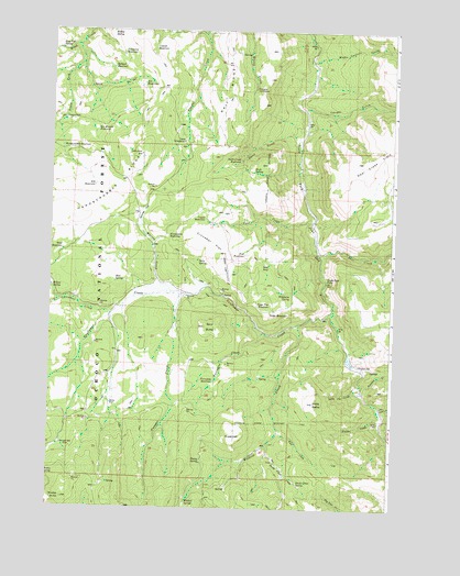
Suplee Butte, OR USGS Topographic Map
Click on map above to begin viewing in our Map Viewer.

This topographic map contains these locations and features:
Feature Name Type Latitude Longitude GNIS ID View Map
Art ReservoirReservoirN44.2360°W119.5920°1116691View Map
Basin CreekStreamN44.2346°W119.6094°1153830View Map
Bernard MillLocaleN44.1418°W119.6205°1116672View Map
Big Mowich ReservoirReservoirN44.2236°W119.6090°1116697View Map
Blue Pot SpringSpringN44.2449°W119.6225°1116687View Map
Blue SpringSpringN44.1839°W119.6015°1116661View Map
Buck SpringSpringN44.2131°W119.5522°1116701View Map
Cayuse ReservoirReservoirN44.2454°W119.5884°1116690View Map
Cinnabar FlatFlatN44.1954°W119.5664°1116705View Map
Cougar CreekStreamN44.1813°W119.5761°1116682View Map
Cougar GulchValleyN44.2293°W119.5350°1140230View Map
Coyote ReservoirReservoirN44.2009°W119.5691°1116703View Map
Davis CreekStreamN44.2215°W119.5350°1116694View Map
Davis Creek ReservoirReservoirN44.2157°W119.5567°1116695View Map
Deer CreekStreamN44.1918°W119.5283°1140842View Map
Delore PlaceLocaleN44.1524°W119.6025°1116670View Map
Dual ReservoirReservoirN44.1921°W119.6219°1116708View Map
Elk ReservoirReservoirN44.2094°W119.6093°1116700View Map
Ellingson MillLocaleN44.1626°W119.5127°1116681View Map
Fort CreekStreamN44.2004°W119.5300°1116702View Map
Fort ReservoirReservoirN44.1910°W119.5546°1116704View Map
Frazier CreekStreamN44.1482°W119.5044°1116676View Map
Frazier Recreation SiteLocaleN44.2210°W119.5772°1116696View Map
Greenwater ReservoirReservoirN44.1963°W119.5822°1116706View Map
Hard Scrabble ReservoirReservoirN44.2190°W119.6215°1116698View Map
Hobble SpringSpringN44.2496°W119.6036°1116688View Map
Hobnail ReservoirReservoirN44.2401°W119.6034°1116689View Map
Holding PastureFlatN44.2457°W119.6108°1153829View Map
Junction CreekStreamN44.1590°W119.5136°1144431View Map
Little BaldySummitN44.1535°W119.5308°1145078View Map
Little Fir CreekStreamN44.1563°W119.5139°1116677View Map
Little Frazier CreekStreamN44.1510°W119.5050°1116674View Map
Magic Lantern CreekStreamN44.2432°W119.5319°1155341View Map
Murray FlatFlatN44.2026°W119.5914°1116707View Map
Negro CabinLocaleN44.2271°W119.6208°1116699View Map
Porcupine CreekStreamN44.1713°W119.5472°1116669View Map
Porcupine ReservoirReservoirN44.1581°W119.5652°1116668View Map
Robinson HomesteadLocaleN44.2349°W119.5516°1116692View Map
Santa Claus SpringSpringN44.1315°W119.5340°1116679View Map
Santa Claus StreamStreamN44.1418°W119.5452°1116683View Map
Sedge ReservoirReservoirN44.1762°W119.5452°1116665View Map
Sedge Two ReservoirReservoirN44.1782°W119.5452°1116666View Map
Skid SeepSpringN44.1887°W119.5458°1116663View Map
South Fork FallsFallsN44.1847°W119.5246°1116667View Map
South Fork Wind CreekStreamN44.2457°W119.6164°1154325View Map
Spur ButteSummitN44.1735°W119.5655°1150215View Map
Strip SpringSpringN44.1899°W119.5715°1116662View Map
Stump SpringSpringN44.1369°W119.5693°1116675View Map
SugarloafSummitN44.1438°W119.5577°1155353View Map
Sugarloaf MountainSummitN44.1360°W119.5197°1150557View Map
Sunflower CreekStreamN44.1754°W119.5227°1150661View Map
Suplee ButteSummitN44.1276°W119.6197°1116671View Map
Trail CreekStreamN44.1451°W119.5416°1116678View Map
Viewpoint ReservoirReservoirN44.2433°W119.5996°1116686View Map
Wildcat CreekStreamN44.1735°W119.5347°1152337View Map
Wildcat SpringSpringN44.1266°W119.5746°1116680View Map
Wildhorse Falls ReservoirReservoirN44.1790°W119.5219°1153266View Map
Wildhorse ReservoirReservoirN44.1818°W119.5427°1153828View Map
Wildhorse SpringSpringN44.1812°W119.5377°1116664View Map
Willow SpringSpringN44.1825°W119.6246°1116709View Map

Note: Coordinates in the location and feature list above are referenced to NAD83 datum.


Copyright (C) 2008-2025 Ryan Niemi / Sunset Dynamics ... All Rights Reserved