TopoQuest Logo
Do you find TopoQuest useful?
Help keep TopoQuest running and adding new maps/features by donating!
Bitcoin:  19c7KJd3qBynnjoSw5npx9KScwjBe4ifkT
Litecoin:  LXs6TkuXGGXo1vDsWCkWVdjQX94eUKd6ui
Home View Maps Find Maps Find Places Resources & Links


Greasy, Oklahoma Topographic Map

USGS Map Title: Greasy, OK
USGS Map MRC: 35094F6
DRG (GeoTIFF) Download: o35094f6.tif


Neighboring USGS Topographic Map Quads:


  Tailholt, OK  
35094G7
 

  Stilwell West, OK  
35094G6
 

  Stilwell East, OK  
35094G5
 

  Bunch, OK  
35094F7
 

  Greasy, OK  
35094F6
 

  Big Round Mountain, OK  
35094F5
 

  Marble City, OK  
35094E7
 

  Brushy, OK  
35094E6
 

  Nicut, OK  
35094E5


Map MRC Location:

N36°
W95°
N36°
W94°
H8 H7 H6 H5 H4 H3 H2 H1
G8 G7 G6 G5 G4 G3 G2 G1
F8 F7 F6 F5 F4 F3 F2 F1
E8 E7 E6 E5 E4 E3 E2 E1
D8 D7 D6 D5 D4 D3 D2 D1
C8 C7 C6 C5 C4 C3 C2 C1
B8 B7 B6 B5 B4 B3 B2 B1
A8 A7 A6 A5 A4 A3 A2 A1
N35°
W95°
N35°
W94°

Greasy, OK USGS 1:24K Topographic Map Preview:
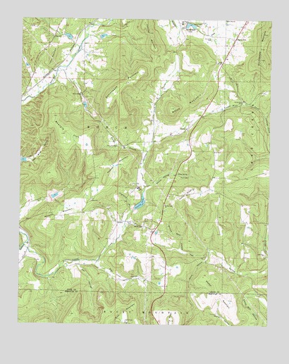
Greasy, OK USGS Topographic Map
Click on map above to begin viewing in our Map Viewer.

This topographic map contains these locations and features:
Feature Name Type Latitude Longitude GNIS ID View Map
Akins HollowValleyN35.6554°W94.6544°1089559View Map
Beaver BranchStreamN35.6956°W94.6861°1089925View Map
Beaver CemeteryCemeteryN35.6651°W94.6880°1089926View Map
Beaver CemeteryCemeteryN35.7192°W94.7202°1089927View Map
Beaver ChurchChurchN35.6756°W94.7141°1089929View Map
Beevale FlatFlatN35.7029°W94.7263°1089973View Map
Candy Mink CreekStreamN35.7104°W94.6277°1090900View Map
Candy Mink ParkParkN35.7165°W94.6386°1090901View Map
Cherry TreeCivilN35.7433°W94.6514°2631087View Map
Cherry TreePopulated PlaceN35.7415°W94.6433°1100288View Map
Cherry Tree Census Designated PlaceCensusN35.7454°W94.6428°2408018View Map
Chuculate CemeteryCemeteryN35.6982°W94.7014°1091353View Map
Chuculate ChurchChurchN35.7051°W94.6661°1091354View Map
Chulio CemeteryCemeteryN35.7422°W94.6554°1091356View Map
Copeland BranchStreamN35.6709°W94.6936°1091680View Map
Dahlonegah LakeReservoirN35.7480°W94.6669°1091914View Map
Dahlonegah MountainSummitN35.7229°W94.7002°1091915View Map
Dahlonegah ParkParkN35.7479°W94.6613°1091916View Map
Dahlonegah Public SchoolSchoolN35.7481°W94.6702°1091917View Map
Denny RidgeRidgeN35.6787°W94.6666°1092045View Map
Fletcher MountainSummitN35.7481°W94.6874°1092898View Map
Gan HollowValleyN35.6492°W94.7199°1093096View Map
GreasyCivilN35.6764°W94.6918°2631112View Map
GreasyPopulated PlaceN35.6673°W94.7008°1100461View Map
Greasy Census Designated PlaceCensusN35.6821°W94.7178°2408326View Map
Greasy CreekStreamN35.6570°W94.7486°1093357View Map
Greasy Fire DepartmentBuildingN35.6671°W94.6963°2657289View Map
Greasy LakeReservoirN35.6748°W94.6897°1093361View Map
Greasy Public SchoolSchoolN35.6811°W94.6908°1093362View Map
Guiding Light ChurchChurchN35.6743°W94.6772°1093433View Map
Hudson MountainSummitN35.6879°W94.7061°1093997View Map
Keeler ParkParkN35.6668°W94.6941°1094307View Map
Killer CemeteryCemeteryN35.6960°W94.6535°1094376View Map
Kingdom ChurchChurchN35.7429°W94.7344°1094389View Map
Lyons MountainSummitN35.7337°W94.7352°1095068View Map
Maxwell MountainSummitN35.6687°W94.7347°1095183View Map
Pine HollowValleyN35.6256°W94.6315°1096660View Map
Rock Fence CemeteryCemeteryN35.6519°W94.6264°2724208View Map
Rock Fence ChurchChurchN35.6543°W94.6272°1097346View Map
Sallisaw Creek Site 20 DamDamN35.7484°W94.6669°1757933View Map
Sallisaw Creek Site 21 DamDamN35.7434°W94.7102°1757935View Map
Sallisaw Creek Site 21 ReservoirReservoirN35.7434°W94.7102°1757936View Map
Sallisaw Creek Site 25 DamDamN35.6651°W94.7369°1751818View Map
Sallisaw Creek Site 25 ReservoirReservoirN35.6651°W94.7369°1751819View Map
Sallisaw Creek Site 26 DamDamN35.6718°W94.6919°1757943View Map
Sallisaw Creek Site 26 ReservoirReservoirN35.6718°W94.6919°1757944View Map
Star Killer HollowValleyN35.6504°W94.7110°1098493View Map
Walker MountainSummitN35.6387°W94.6505°1099306View Map
Welch MountainsSummitN35.7137°W94.6727°1099474View Map
William Ross HollowValleyN35.6554°W94.6684°1099837View Map
Yellow SpringSpringN35.6870°W94.6715°1100049View Map
Yellow Spring HollowValleyN35.6820°W94.6852°1100050View Map

Note: Coordinates in the location and feature list above are referenced to NAD83 datum.


Copyright (C) 2008-2024 Ryan Niemi / Sunset Dynamics ... All Rights Reserved