TopoQuest Logo
Do you find TopoQuest useful?
Help keep TopoQuest running and adding new maps/features by donating!
Bitcoin:  19c7KJd3qBynnjoSw5npx9KScwjBe4ifkT
Litecoin:  LXs6TkuXGGXo1vDsWCkWVdjQX94eUKd6ui
Home View Maps Find Maps Find Places Resources & Links


Peoria, Mississippi Topographic Map

USGS Map Title: Peoria, MS
USGS Map MRC: 31090B6
DRG (GeoTIFF) Download: o31090b6.tif


Neighboring USGS Topographic Map Quads:


  Busy Corner, MS  
31090C7
 

  Smithdale, MS  
31090C6
 

  Auburn, MS  
31090C5
 

  Liberty, MS  
31090B7
 

  Peoria, MS  
31090B6
 

  Lake Tangipahoa, MS  
31090B5
 

  Street, MS  
31090A7
 

  Gillsburg, MS  
31090A6
 

  Terrys Creek, MS  
31090A5


Map MRC Location:

N32°
W91°
N32°
W90°
H8 H7 H6 H5 H4 H3 H2 H1
G8 G7 G6 G5 G4 G3 G2 G1
F8 F7 F6 F5 F4 F3 F2 F1
E8 E7 E6 E5 E4 E3 E2 E1
D8 D7 D6 D5 D4 D3 D2 D1
C8 C7 C6 C5 C4 C3 C2 C1
B8 B7 B6 B5 B4 B3 B2 B1
A8 A7 A6 A5 A4 A3 A2 A1
N31°
W91°
N31°
W90°

Peoria, MS USGS 1:24K Topographic Map Preview:
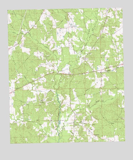
Peoria, MS USGS Topographic Map
Click on map above to begin viewing in our Map Viewer.

This topographic map contains these locations and features:
Feature Name Type Latitude Longitude GNIS ID View Map
Bates Mill Bridge (historical)BridgeN31.1624°W90.6951°685203View Map
Bates-Felder CemeteryCemeteryN31.1618°W90.7343°666567View Map
Bostic CemeteryCemeteryN31.1368°W90.6623°667456View Map
Brown Chapel CemeteryCemeteryN31.2213°W90.6498°685216View Map
Browns ChapelChurchN31.2230°W90.6501°667644View Map
Brumfield-Whittington CemeteryCemeteryN31.1757°W90.7423°685217View Map
Burris CemeteryCemeteryN31.1871°W90.6304°685219View Map
Butler CemeteryCemeteryN31.1946°W90.6307°667855View Map
Chandler CemeteryCemeteryN31.1868°W90.6979°685233View Map
Cochran ChapelChurchN31.1432°W90.6720°668637View Map
Cockerham CemeteryCemeteryN31.1435°W90.6726°685237View Map
Dickey Water Mill (historical)LocaleN31.1741°W90.6318°685245View Map
East Central Volunteer Fire DepartmentBuildingN31.2012°W90.6698°2667926View Map
East ForkPopulated PlaceN31.2032°W90.6684°669572View Map
East Fork Baptist ChurchChurchN31.2041°W90.6687°707320View Map
East Fork CemeteryCemeteryN31.2082°W90.6626°669575View Map
Fairview School (historical)SchoolN31.2360°W90.7204°685259View Map
Felder (historical)LocaleN31.1474°W90.7354°685261View Map
Felder CemeteryCemeteryN31.1699°W90.6301°685260View Map
Freshley BranchStreamN31.1388°W90.6915°670203View Map
Gardner CreekStreamN31.1721°W90.6990°670319View Map
Gardner-McKnight CemeteryCemeteryN31.2124°W90.6934°685272View Map
Gardner-O'Brien CemeteryCemeteryN31.1871°W90.7357°685269View Map
Garner CemeteryCemeteryN31.1593°W90.6379°685271View Map
GladingPopulated PlaceN31.1427°W90.6404°691889View Map
Glading Baptist ChurchChurchN31.1432°W90.6409°685276View Map
Glading CemeteryCemeteryN31.1432°W90.6415°685277View Map
Gordon CreekStreamN31.2024°W90.6759°670535View Map
Hamilton CemeteryCemeteryN31.1713°W90.7482°685284View Map
HebronPopulated PlaceN31.2335°W90.6779°685290View Map
Hebron Baptist ChurchChurchN31.2343°W90.6776°671066View Map
Hebron CemeteryCemeteryN31.2343°W90.6770°685291View Map
Hominy CreekStreamN31.1288°W90.6959°671380View Map
Honea CemeteryCemeteryN31.1260°W90.6395°685296View Map
Horse CreekStreamN31.2202°W90.6632°671464View Map
Hughey CemeteryCemeteryN31.2066°W90.7107°685299View Map
Johns CemeteryCemeteryN31.1879°W90.6979°685308View Map
Keith CemeteryCemeteryN31.2335°W90.6795°672078View Map
Little CemeteryCemeteryN31.1838°W90.7073°685318View Map
Lowden BranchStreamN31.2274°W90.7282°672908View Map
Marshalton (historical)LocaleN31.1460°W90.7057°685324View Map
Moses Robinson CemeteryCemeteryN31.1749°W90.7057°685341View Map
Mount Sinai Baptist ChurchChurchN31.1643°W90.7157°674267View Map
Mount Sinai CemeteryCemeteryN31.1641°W90.7151°685345View Map
Nunnery CemeteryCemeteryN31.2343°W90.7234°685356View Map
Nunnery Store (historical)LocaleN31.2321°W90.7243°685357View Map
PeoriaPopulated PlaceN31.1416°W90.6809°692137View Map
Quin CemeteryCemeteryN31.1716°W90.6401°685371View Map
Robinson Baptist ChurchChurchN31.1405°W90.6809°685380View Map
Robinson CemeteryCemeteryN31.1399°W90.6798°685381View Map
Robinson CreekStreamN31.1907°W90.6965°694585View Map
Robinson-McElvin CemeteryCemeteryN31.1691°W90.6604°685382View Map
Spurlocks (historical)LocaleN31.2280°W90.6473°685399View Map
Summers ChapelChurchN31.1907°W90.6420°678401View Map
Supervisor District 4CivilN31.2443°W90.6442°711772View Map
Webb ChapelChurchN31.1316°W90.6573°679414View Map
Webb Chapel CemeteryCemeteryN31.1316°W90.6576°685429View Map
Young-Garner CemeteryCemeteryN31.1882°W90.6307°685439View Map

Note: Coordinates in the location and feature list above are referenced to NAD83 datum.


Copyright (C) 2008-2025 Ryan Niemi / Sunset Dynamics ... All Rights Reserved