TopoQuest Logo
Do you find TopoQuest useful?
Help keep TopoQuest running and adding new maps/features by donating!
Bitcoin:  19c7KJd3qBynnjoSw5npx9KScwjBe4ifkT
Litecoin:  LXs6TkuXGGXo1vDsWCkWVdjQX94eUKd6ui
Home View Maps Find Maps Find Places Resources & Links


Sector, West Virginia Topographic Map

USGS Map Title: Sector, WV
USGS Map MRC: 39078B7
DRG (GeoTIFF) Download: o39078b7.tif


Neighboring USGS Topographic Map Quads:


  Burlington, WV  
39078C8
 

  Romney, WV  
39078C7
 

  Augusta, WV  
39078C6
 

  Old Fields, WV  
39078B8
 

  Sector, WV  
39078B7
 

  Rio, WV  
39078B6
 

  Moorefield, WV  
39078A8
 

  Needmore, WV  
39078A7
 

  Baker, WV  
39078A6


Map MRC Location:

N40°
W79°
N40°
W78°
H8 H7 H6 H5 H4 H3 H2 H1
G8 G7 G6 G5 G4 G3 G2 G1
F8 F7 F6 F5 F4 F3 F2 F1
E8 E7 E6 E5 E4 E3 E2 E1
D8 D7 D6 D5 D4 D3 D2 D1
C8 C7 C6 C5 C4 C3 C2 C1
B8 B7 B6 B5 B4 B3 B2 B1
A8 A7 A6 A5 A4 A3 A2 A1
N39°
W79°
N39°
W78°

Sector, WV USGS 1:24K Topographic Map Preview:
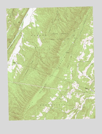
Sector, WV USGS Topographic Map
Click on map above to begin viewing in our Map Viewer.

This topographic map contains these locations and features:
Feature Name Type Latitude Longitude GNIS ID View Map
Bonner School (historical)SchoolN39.1262°W78.7578°1556824View Map
Brushy RunStreamN39.2112°W78.8547°1536524View Map
Devil Hole RunStreamN39.2207°W78.8531°1538153View Map
Glebe (historical)Populated PlaceN39.2001°W78.8592°1556766View Map
Green KnobSummitN39.2343°W78.8589°1554602View Map
Horn Camp RunStreamN39.1551°W78.7539°1540461View Map
Horn Camp School (historical)SchoolN39.1784°W78.7720°1556774View Map
InkermanPopulated PlaceN39.1382°W78.7686°1554774View Map
Island RidgeRidgeN39.2495°W78.8461°1540740View Map
Little Devil Hole RunStreamN39.2023°W78.8314°1542086View Map
Little MountainSummitN39.2315°W78.8089°1542177View Map
Lockinger RidgeRidgeN39.1843°W78.8425°1542287View Map
Long KnobSummitN39.2262°W78.8656°1542386View Map
Markwood School (historical)SchoolN39.1468°W78.7978°1556851View Map
Mount Olive ChurchChurchN39.1529°W78.7845°1543715View Map
Nathaniel MountainSummitN39.2093°W78.7947°1555190View Map
Nathaniel Mountain Lookout TowerTowerN39.1993°W78.7909°1557870View Map
Nathaniel Mountain Wildlife Management AreaParkN39.2226°W78.7911°1549515View Map
Piney MountainSummitN39.2148°W78.7709°1555362View Map
Saint Luke Presbyterian Church CemeteryCemeteryN39.2184°W78.8531°2726697View Map
Saint Lukes ChurchChurchN39.2193°W78.8528°1546255View Map
Sawmill RunStreamN39.2243°W78.8547°1546464View Map
SectorPopulated PlaceN39.2282°W78.8559°1560601View Map
Skaggs RunStreamN39.1376°W78.7686°1552907View Map
South Branch MountainRidgeN39.1943°W78.7959°1552967View Map
The TroughValleyN39.2237°W78.8575°1548012View Map
WickhamPopulated PlaceN39.2123°W78.8684°1555980View Map
Wood School (historical)SchoolN39.2107°W78.8545°1556819View Map

Note: Coordinates in the location and feature list above are referenced to NAD83 datum.


Copyright (C) 2008-2024 Ryan Niemi / Sunset Dynamics ... All Rights Reserved