TopoQuest Logo
Do you find TopoQuest useful?
Help keep TopoQuest running and adding new maps/features by donating!
Bitcoin:  19c7KJd3qBynnjoSw5npx9KScwjBe4ifkT
Litecoin:  LXs6TkuXGGXo1vDsWCkWVdjQX94eUKd6ui
Home View Maps Find Maps Find Places Resources & Links


Ross Canyon, Montana Topographic Map

USGS Map Title: Ross Canyon, MT
USGS Map MRC: 45109F8
DRG (GeoTIFF) Download: o45109f8.tif


Neighboring USGS Topographic Map Quads:


  Carney, MT  
45110G1
 

  Big Timber, MT  
45109G8
 

  Greycliff, MT  
45109G7
 

  McLeod, MT  
45110F1
 

  Ross Canyon, MT  
45109F8
 

  Packsaddle Butte, MT  
45109F7
 

  Enos Mountain, MT  
45110E1
 

  Sliderock Mountain, MT  
45109E8
 

  Wildcat Draw, MT  
45109E7


Map MRC Location:

N46°
W110°
N46°
W109°
H8 H7 H6 H5 H4 H3 H2 H1
G8 G7 G6 G5 G4 G3 G2 G1
F8 F7 F6 F5 F4 F3 F2 F1
E8 E7 E6 E5 E4 E3 E2 E1
D8 D7 D6 D5 D4 D3 D2 D1
C8 C7 C6 C5 C4 C3 C2 C1
B8 B7 B6 B5 B4 B3 B2 B1
A8 A7 A6 A5 A4 A3 A2 A1
N45°
W110°
N45°
W109°

Ross Canyon, MT USGS 1:24K Topographic Map Preview:
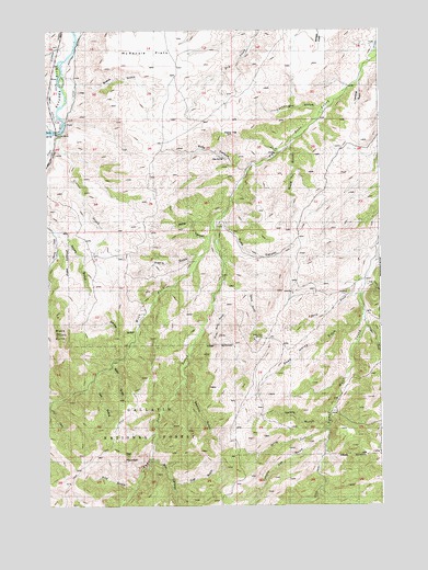
Ross Canyon, MT USGS Topographic Map
Click on map above to begin viewing in our Map Viewer.

This topographic map contains these locations and features:
Feature Name Type Latitude Longitude GNIS ID View Map
01S14E21AABB01 WellWellN45.7399°W109.9963°811568View Map
01S14E21AADD01 WellWellN45.7380°W109.9930°811556View Map
01S14E21ACAD01 WellWellN45.7363°W109.9977°811543View Map
01S14E28AAAD01 WellWellN45.7252°W109.9930°811439View Map
Asp GulchValleyN45.6294°W109.9688°779178View Map
Baker CanyonValleyN45.6958°W109.9396°779264View Map
Bear GulchValleyN45.6616°W109.9763°779524View Map
Black ButteSummitN45.6702°W109.9955°779972View Map
Box CanyonValleyN45.6374°W109.9616°780327View Map
Breck GulchValleyN45.7358°W109.9882°780379View Map
Calcie GulchValleyN45.6838°W109.9341°780774View Map
Cartwright GulchValleyN45.7288°W109.8980°780984View Map
Cedar CreekStreamN45.6719°W109.8805°781096View Map
Chimney Rock CreekStreamN45.6447°W109.8957°781231View Map
Clause CreekStreamN45.7202°W109.9966°781335View Map
Crest DitchCanalN45.7247°W109.9971°781888View Map
Davis CreekStreamN45.6808°W109.8830°782102View Map
Dead Horse GulchValleyN45.6738°W109.8821°782138View Map
Decker GulchValleyN45.6702°W109.9682°782185View Map
Eightmile BridgeBridgeN45.7233°W109.9966°783007View Map
Harris GulchValleyN45.6894°W109.9452°784569View Map
Lambing GulchValleyN45.7358°W109.8824°785938View Map
Lee GulchValleyN45.6591°W109.9824°786023View Map
Log Cabin CreekStreamN45.6830°W109.8802°786443View Map
McKenzie FlatsFlatN45.7483°W109.9574°787080View Map
Needle CreekStreamN45.6574°W109.9491°767991View Map
Nicely GulchValleyN45.6966°W109.9963°787984View Map
Piano HillSummitN45.7224°W109.9305°788826View Map
Red MountainSummitN45.6377°W109.9710°789464View Map
Ross CanyonValleyN45.7133°W109.9257°789782View Map
Ross SpringSpringN45.7165°W109.9339°789796View Map
Rudd CanyonValleyN45.7016°W109.9332°789843View Map
Sawmill GulchValleyN45.6572°W109.9494°790066View Map
Slide Rock GulchValleyN45.6799°W109.9374°790659View Map
Spotts GulchValleyN45.6469°W109.8949°791185View Map
Tomato Can GulchValleyN45.6419°W109.8963°792261View Map
Trail GulchValleyN45.6305°W109.9527°792321View Map
West Fork Upper Deer CreekStreamN45.6994°W109.9374°793094View Map
Whistle CreekStreamN45.7449°W109.9960°793181View Map
Wood GulchValleyN45.7191°W109.9094°793482View Map

Note: Coordinates in the location and feature list above are referenced to NAD83 datum.


Copyright (C) 2008-2025 Ryan Niemi / Sunset Dynamics ... All Rights Reserved