TopoQuest Logo
Do you find TopoQuest useful?
Help keep TopoQuest running and adding new maps/features by donating!
Bitcoin:  19c7KJd3qBynnjoSw5npx9KScwjBe4ifkT
Litecoin:  LXs6TkuXGGXo1vDsWCkWVdjQX94eUKd6ui
Home View Maps Find Maps Find Places Resources & Links


Work Creek, Montana Topographic Map

USGS Map Title: Work Creek, MT
USGS Map MRC: 45109F6
DRG (GeoTIFF) Download: o45109f6.tif


Neighboring USGS Topographic Map Quads:


  Greycliff, MT  
45109G7
 

  Lone Indian Butte, MT  
45109G6
 

  Stephens Hill, MT  
45109G5
 

  Packsaddle Butte, MT  
45109F7
 

  Work Creek, MT  
45109F6
 

  Reed Point, MT  
45109F5
 

  Wildcat Draw, MT  
45109E7
 

  Cow Face Hill, MT  
45109E6
 

  Sandborn Creek, MT  
45109E5


Map MRC Location:

N46°
W110°
N46°
W109°
H8 H7 H6 H5 H4 H3 H2 H1
G8 G7 G6 G5 G4 G3 G2 G1
F8 F7 F6 F5 F4 F3 F2 F1
E8 E7 E6 E5 E4 E3 E2 E1
D8 D7 D6 D5 D4 D3 D2 D1
C8 C7 C6 C5 C4 C3 C2 C1
B8 B7 B6 B5 B4 B3 B2 B1
A8 A7 A6 A5 A4 A3 A2 A1
N45°
W110°
N45°
W109°

Work Creek, MT USGS 1:24K Topographic Map Preview:
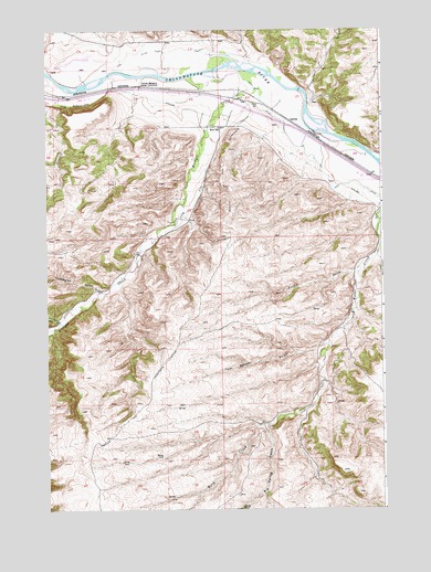
Work Creek, MT USGS Topographic Map
Click on map above to begin viewing in our Map Viewer.

This topographic map contains these locations and features:
Feature Name Type Latitude Longitude GNIS ID View Map
01S16E22CBBA01 WellWellN45.7313°W109.7449°811499View Map
01S16E22CBBC01 SpringSpringN45.7305°W109.7463°811492View Map
01S16E24AACC01 WellWellN45.7355°W109.6893°811532View Map
01S16E25____01 WellWellN45.7180°W109.6955°811379View Map
01S16E25AAAC01 WellWellN45.7233°W109.6877°811428View Map
01S16E36CBDA01 WellWellN45.7005°W109.7016°811247View Map
01S17E19BDCD01 WellWellN45.7330°W109.6793°811507View Map
01S17E20CBAA01 WellWellN45.7449°W109.6493°811606View Map
01S17E20CBAD01 WellWellN45.7449°W109.6485°811605View Map
01S17E20CBAD02 WellWellN45.7458°W109.6485°811623View Map
01S17E29BDDD01 WellWellN45.7183°W109.6549°811381View Map
01S17E33DACB01 WellWellN45.7008°W109.6282°811249View Map
02S16E10BACD01 WellWellN45.6780°W109.7405°811058View Map
02S16E12DCBA01 WellWellN45.6697°W109.6943°810988View Map
02S17E09BDAC01 SpringSpringN45.6769°W109.6366°811049View Map
Big Spring GulchValleyN45.6466°W109.6682°768830View Map
Bozeman TrailTrailN45.6583°W109.7118°769175View Map
Bratten Fishing Access SiteLocaleN45.7160°W109.6368°1744492View Map
Bridger CreekStreamN45.7355°W109.6702°780406View Map
Curtis GulchValleyN45.6880°W109.6330°770382View Map
Greycliff CreekStreamN45.7363°W109.7480°784330View Map
Interchange 384CrossingN45.7299°W109.6757°1743462View Map
Kent CemeteryCemeteryN45.7307°W109.6729°772995View Map
Kent DitchCanalN45.7122°W109.6471°785682View Map
Kent School (historical)SchoolN45.7244°W109.6860°772999View Map
Krone DitchCanalN45.7038°W109.6957°773141View Map
Line DitchCanalN45.7435°W109.7160°773377View Map
Norwegian GulchValleyN45.6822°W109.7305°788322View Map
Pateum (historical)LocaleN45.7347°W109.6985°1743394View Map
QuebecPopulated PlaceN45.7266°W109.6593°775511View Map
Shanks BasinValleyN45.7427°W109.6760°776402View Map
Silver CreekStreamN45.6735°W109.7449°790511View Map
The GreycliffsCliffN45.7305°W109.7402°777510View Map
Thomas Massacre Graves HistoricalCemeteryN45.7352°W109.7143°777570View Map
Tom Benson GulchValleyN45.6677°W109.6457°777692View Map

Note: Coordinates in the location and feature list above are referenced to NAD83 datum.


Copyright (C) 2008-2025 Ryan Niemi / Sunset Dynamics ... All Rights Reserved