TopoQuest Logo
Do you find TopoQuest useful?
Help keep TopoQuest running and adding new maps/features by donating!
Bitcoin:  19c7KJd3qBynnjoSw5npx9KScwjBe4ifkT
Litecoin:  LXs6TkuXGGXo1vDsWCkWVdjQX94eUKd6ui
Home View Maps Find Maps Find Places Resources & Links


Augusta East, Wisconsin Topographic Map

USGS Map Title: Augusta East, WI
USGS Map MRC: 44091F1
DRG (GeoTIFF) Download: o44091f1.tif


Neighboring USGS Topographic Map Quads:


  Lake Eau Claire West, WI  
44091G2
 

  Lake Eau Claire East, WI  
44091G1
 

  Simes Creek, WI  
44090G8
 

  Augusta West, WI  
44091F2
 

  Augusta East, WI  
44091F1
 

  Horse Creek, WI  
44090F8
 

  Osseo, WI  
44091E2
 

  Price, WI  
44091E1
 

  Fairchild, WI  
44090E8


Map MRC Location:

N45°
W92°
N45°
W91°
H8 H7 H6 H5 H4 H3 H2 H1
G8 G7 G6 G5 G4 G3 G2 G1
F8 F7 F6 F5 F4 F3 F2 F1
E8 E7 E6 E5 E4 E3 E2 E1
D8 D7 D6 D5 D4 D3 D2 D1
C8 C7 C6 C5 C4 C3 C2 C1
B8 B7 B6 B5 B4 B3 B2 B1
A8 A7 A6 A5 A4 A3 A2 A1
N44°
W92°
N44°
W91°

Augusta East, WI USGS 1:24K Topographic Map Preview:
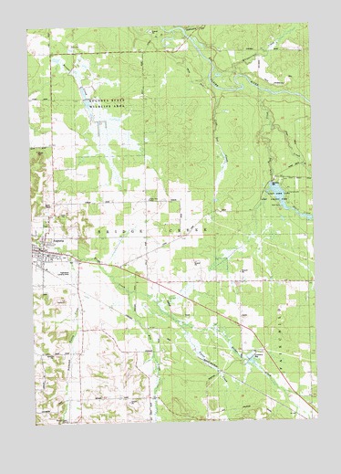
Augusta East, WI USGS Topographic Map
Click on map above to begin viewing in our Map Viewer.

This topographic map contains these locations and features:
Feature Name Type Latitude Longitude GNIS ID View Map
AugustaPopulated PlaceN44.6802°W91.1199°1561013View Map
Augusta City HallBuildingN44.6772°W91.1199°1846618View Map
Augusta Police DepartmentBuildingN44.6801°W91.1214°2759775View Map
Augusta Post OfficePost OfficeN44.6789°W91.1219°1846621View Map
Augusta Public LibraryBuildingN44.6797°W91.1200°2711406View Map
Augusta State Wildlife AreaParkN44.7261°W91.0902°1846622View Map
Black CreekStreamN44.6922°W91.0118°1561853View Map
Church of the Redeemer (historical)ChurchN44.6797°W91.1188°1846643View Map
City of AugustaCivilN44.6784°W91.1203°1582733View Map
Coon Creek 2WP1678 DamDamN44.7000°W91.0185°1791734View Map
Coon Fork Barrens State Natural AreaParkN44.7119°W91.0171°2057267View Map
Coon Fork CreekStreamN44.7294°W91.0227°1563363View Map
Coon Fork LakeReservoirN44.6953°W91.0138°1791735View Map
Coon Fork Lake County ParkParkN44.6950°W91.0107°1563365View Map
Coon Gut CreekStreamN44.7313°W91.0443°1563366View Map
Diamond Valley CreekStreamN44.6783°W91.1068°1563969View Map
Diamond Valley SchoolSchoolN44.6258°W91.1110°1846650View Map
East Lawn CemeteryCemeteryN44.6775°W91.1107°1846652View Map
First Baptist ChurchChurchN44.6797°W91.1229°1846668View Map
First Methodist Episcopal ChurchChurchN44.6794°W91.1218°1846672View Map
Forest View SchoolSchoolN44.6952°W91.0729°1846675View Map
German Methodist Episcopal Church (historical)ChurchN44.6783°W91.1224°1846676View Map
Graves Mill School (historical)SchoolN44.6688°W91.0027°1846681View Map
Hathaway CreekStreamN44.7480°W91.0557°1566131View Map
Hay CreekStreamN44.6663°W91.0827°1566178View Map
Kirkman Valley School (historical)SchoolN44.6786°W91.0746°1846700View Map
Oakridge SchoolSchoolN44.6471°W91.1114°2715743View Map
Papenfuss Landing Strip (historical)AirportN44.6725°W91.1082°1846725View Map
Pea CreekStreamN44.7191°W91.0177°1571105View Map
Pettisville School (historical)SchoolN44.6344°W91.0124°1846729View Map
Saint Paul Lutheran ChurchChurchN44.6805°W91.1240°1846760View Map
Town of Bridge CreekCivilN44.6974°W91.0609°1582855View Map
Travis CreekStreamN44.6563°W91.0610°1575580View Map
Troubled Waters School (historical)SchoolN44.7422°W91.0743°1846781View Map
Whippoorwill CreekStreamN44.7363°W91.0427°1576610View Map

Note: Coordinates in the location and feature list above are referenced to NAD83 datum.


Copyright (C) 2008-2025 Ryan Niemi / Sunset Dynamics ... All Rights Reserved