TopoQuest Logo
Do you find TopoQuest useful?
Help keep TopoQuest running and adding new maps/features by donating!
Bitcoin:  19c7KJd3qBynnjoSw5npx9KScwjBe4ifkT
Litecoin:  LXs6TkuXGGXo1vDsWCkWVdjQX94eUKd6ui
Home View Maps Find Maps Find Places Resources & Links


Griggsville, Illinois Topographic Map

USGS Map Title: Griggsville, IL
USGS Map MRC: 39090F6
DRG (GeoTIFF) Download: o39090f6.tif


Neighboring USGS Topographic Map Quads:


  Perry West, IL  
39090G7
 

  Perry East, IL  
39090G6
 

  Meredosia, IL  
39090G5
 

  New Salem, IL  
39090F7
 

  Griggsville, IL  
39090F6
 

  Florence, IL  
39090F5
 

  Pittsfield, IL  
39090E7
 

  Milton, IL  
39090E6
 

  Bedford, IL  
39090E5


Map MRC Location:

N40°
W91°
N40°
W90°
H8 H7 H6 H5 H4 H3 H2 H1
G8 G7 G6 G5 G4 G3 G2 G1
F8 F7 F6 F5 F4 F3 F2 F1
E8 E7 E6 E5 E4 E3 E2 E1
D8 D7 D6 D5 D4 D3 D2 D1
C8 C7 C6 C5 C4 C3 C2 C1
B8 B7 B6 B5 B4 B3 B2 B1
A8 A7 A6 A5 A4 A3 A2 A1
N39°
W91°
N39°
W90°

Griggsville, IL USGS 1:24K Topographic Map Preview:
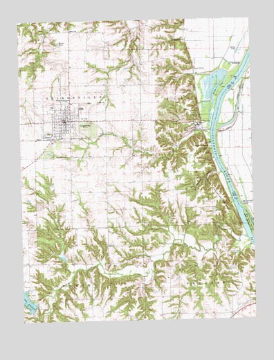
Griggsville, IL USGS Topographic Map
Click on map above to begin viewing in our Map Viewer.

This topographic map contains these locations and features:
Feature Name Type Latitude Longitude GNIS ID View Map
Anderson CemeteryCemeteryN39.7484°W90.6607°1725355View Map
Anderson SpringSpringN39.7413°W90.6606°1725356View Map
Bethel CemeteryCemeteryN39.6564°W90.7043°1852460View Map
Bethel ChurchChurchN39.6562°W90.7040°404305View Map
Bethel School (historical)SchoolN39.6495°W90.7023°404324View Map
Big Blue IslandIslandN39.6642°W90.6273°1725362View Map
Blue CreekStreamN39.6600°W90.6293°404583View Map
Boss Wilson Pond (historical)LakeN39.7242°W90.6901°404708View Map
Brush College School (historical)SchoolN39.6831°W90.7037°405016View Map
Burr Lake (historical)LakeN39.6837°W90.6321°1821146View Map
Church HollowValleyN39.6964°W90.6487°1725375View Map
City of GriggsvilleCivilN39.7079°W90.7273°2394251View Map
Curry AirportAirportN39.6603°W90.7012°427346View Map
Elledge CemeteryCemeteryN39.7156°W90.7079°1725381View Map
Flint CreekStreamN39.7028°W90.6476°408462View Map
Goldman School (historical)SchoolN39.6414°W90.6707°409126View Map
Greenfield School (historical)SchoolN39.6489°W90.7473°409487View Map
GriggsvillePopulated PlaceN39.7089°W90.7246°409508View Map
Griggsville CemeteryCemeteryN39.7139°W90.7326°1852478View Map
Griggsville Fire DepartmentBuildingN39.7087°W90.7282°2640662View Map
Griggsville High SchoolSchoolN39.7103°W90.7243°1822214View Map
Griggsville Historic DistrictParkN39.7084°W90.7251°1822215View Map
Griggsville LandingLocaleN39.6970°W90.6476°1725388View Map
Griggsville Post OfficePost OfficeN39.7087°W90.7255°2788685View Map
Hatch HollowValleyN39.7498°W90.7434°409920View Map
Holy Family ChurchChurchN39.7087°W90.7148°1725396View Map
Mauvaise Terre CreekStreamN39.7259°W90.6301°413137View Map
McCoe LakeLakeN39.7200°W90.6443°413213View Map
Napolean HollowValleyN39.6862°W90.6444°1725418View Map
New Pittsfield Lake Number 1ReservoirN39.6300°W90.7435°1691893View Map
New Pittsfield Lake Number 1 DamDamN39.6300°W90.7435°1691892View Map
New Pittsfield Lake Number 2ReservoirN39.6513°W90.7280°1691897View Map
New Pittsfield Lake Number 2 DamDamN39.6517°W90.7268°1691896View Map
North Flint School (historical)SchoolN39.7364°W90.6790°414590View Map
Phillips Ferry (historical)CrossingN39.7034°W90.6462°1821149View Map
Pike County Conservation AreaParkN39.6784°W90.6454°1822219View Map
Scott County Pumping StationLocaleN39.6742°W90.6304°425469View Map
Shelly LakeLakeN39.7418°W90.6274°418342View Map
Shelly LakeLakeN39.7363°W90.6329°1725446View Map
Shelly School (historical)SchoolN39.7459°W90.7132°418343View Map
Sleight PondLakeN39.7403°W90.7262°418602View Map
South Flint School (historical)SchoolN39.6787°W90.6626°418750View Map
Tollgate School (historical)SchoolN39.6281°W90.6373°419765View Map
Township of FlintCivilN39.7102°W90.6588°429006View Map
Township of GriggsvilleCivilN39.7083°W90.7423°429085View Map
Valley CityPopulated PlaceN39.7070°W90.6526°423271View Map
Valley City CemeteryCemeteryN39.7092°W90.6535°1852498View Map
Valley City Pumping StationLocaleN39.7317°W90.6315°425593View Map
Valley City QuarryMineN39.7037°W90.6593°1985433View Map
Village of Valley CityCivilN39.7071°W90.6514°2400038View Map
Wilson School (historical)SchoolN39.7231°W90.6929°421299View Map
Winegar SpringSpringN39.7295°W90.6562°1725472View Map

Note: Coordinates in the location and feature list above are referenced to NAD83 datum.


Copyright (C) 2008-2025 Ryan Niemi / Sunset Dynamics ... All Rights Reserved