TopoQuest Logo
Do you find TopoQuest useful?
Help keep TopoQuest running and adding new maps/features by donating!
Bitcoin:  19c7KJd3qBynnjoSw5npx9KScwjBe4ifkT
Litecoin:  LXs6TkuXGGXo1vDsWCkWVdjQX94eUKd6ui
Home View Maps Find Maps Find Places Resources & Links


Milton, Illinois Topographic Map

USGS Map Title: Milton, IL
USGS Map MRC: 39090E6
DRG (GeoTIFF) Download: o39090e6.tif


Neighboring USGS Topographic Map Quads:


  New Salem, IL  
39090F7
 

  Griggsville, IL  
39090F6
 

  Florence, IL  
39090F5
 

  Pittsfield, IL  
39090E7
 

  Milton, IL  
39090E6
 

  Bedford, IL  
39090E5
 

  Pleasant Hill East, IL  
39090D7
 

  Pearl West, IL  
39090D6
 

  Pearl East, IL  
39090D5


Map MRC Location:

N40°
W91°
N40°
W90°
H8 H7 H6 H5 H4 H3 H2 H1
G8 G7 G6 G5 G4 G3 G2 G1
F8 F7 F6 F5 F4 F3 F2 F1
E8 E7 E6 E5 E4 E3 E2 E1
D8 D7 D6 D5 D4 D3 D2 D1
C8 C7 C6 C5 C4 C3 C2 C1
B8 B7 B6 B5 B4 B3 B2 B1
A8 A7 A6 A5 A4 A3 A2 A1
N39°
W91°
N39°
W90°

Milton, IL USGS 1:24K Topographic Map Preview:
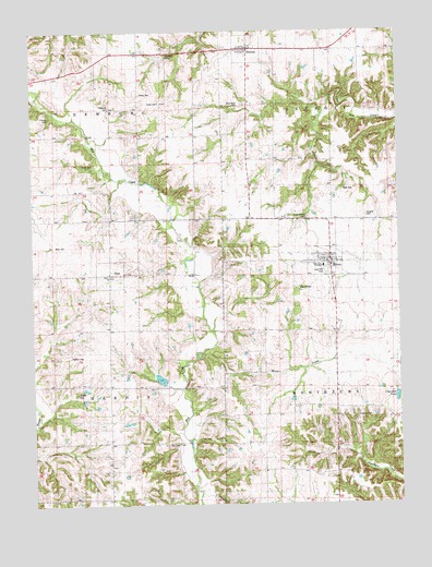
Milton, IL USGS Topographic Map
Click on map above to begin viewing in our Map Viewer.

This topographic map contains these locations and features:
Feature Name Type Latitude Longitude GNIS ID View Map
Blue River CemeteryCemeteryN39.6059°W90.6779°1725365View Map
Calvert HillSummitN39.6078°W90.7079°405410View Map
Center School (historical)SchoolN39.6145°W90.7404°405809View Map
Chandler PondLakeN39.5282°W90.6261°405947View Map
Clover School (historical)SchoolN39.5017°W90.7246°406268View Map
Columbia Farm PondReservoirN39.5332°W90.7068°1692515View Map
Columbia Farm Pond DamDamN39.5334°W90.7051°1692514View Map
Cox CemeteryCemeteryN39.5162°W90.7012°1725374View Map
Crossroads School (historical)SchoolN39.5462°W90.6473°406836View Map
DetroitPopulated PlaceN39.6206°W90.6768°407150View Map
Douglas CemeteryCemeteryN39.5759°W90.6360°1725377View Map
East Pike Fire Protection DistrictBuildingN39.5655°W90.6496°2640663View Map
East Pike High SchoolSchoolN39.5628°W90.6507°1725379View Map
East Pike ParkParkN39.5612°W90.6498°1725380View Map
Forman CemeteryCemeteryN39.6020°W90.7440°1852475View Map
French CemeteryCemeteryN39.5570°W90.6601°1725383View Map
Holford CemeteryCemeteryN39.5392°W90.7373°1725395View Map
Howland CemeteryCemeteryN39.6042°W90.7232°1725397View Map
Liberty School (historical)SchoolN39.5973°W90.7043°412023View Map
MiltonPopulated PlaceN39.5645°W90.6504°413632View Map
Milton Post OfficePost OfficeN39.5638°W90.6497°2788531View Map
Milton-Smith CemeteryCemeteryN39.5759°W90.6560°1725451View Map
Moore CreekStreamN39.5417°W90.6896°413784View Map
Newburg School (historical)SchoolN39.6195°W90.7126°414483View Map
Pettis CemeteryCemeteryN39.6087°W90.7129°1725426View Map
Pleasant Hill School (historical)SchoolN39.5917°W90.6726°415846View Map
Thurman CemeteryCemeteryN39.5231°W90.6351°1725460View Map
TimePopulated PlaceN39.5614°W90.7243°419728View Map
Time CemeteryCemeteryN39.5612°W90.7179°1852497View Map
Township of DetroitCivilN39.6159°W90.6430°428893View Map
Township of HardinCivilN39.5311°W90.7428°429107View Map
Township of MontezumaCivilN39.5311°W90.6330°429387View Map
Township of NewburgCivilN39.6195°W90.7426°429432View Map
Tripp CemeteryCemeteryN39.5900°W90.7329°1725463View Map
Union School (historical)SchoolN39.5314°W90.7251°420104View Map
Village of DetroitCivilN39.6201°W90.6760°2398717View Map
Village of MiltonCivilN39.5645°W90.6501°2399366View Map
Village of TimeCivilN39.5611°W90.7234°2399985View Map
Watt CemeteryCemeteryN39.5828°W90.6437°1725469View Map
West Grove School (historical)SchoolN39.5200°W90.6726°420851View Map
Willard CemeteryCemeteryN39.5295°W90.7351°1725470View Map
Wills CemeteryCemeteryN39.5684°W90.7423°1725471View Map

Note: Coordinates in the location and feature list above are referenced to NAD83 datum.


Copyright (C) 2008-2024 Ryan Niemi / Sunset Dynamics ... All Rights Reserved