TopoQuest Logo
Do you find TopoQuest useful?
Help keep TopoQuest running and adding new maps/features by donating!
Bitcoin:  19c7KJd3qBynnjoSw5npx9KScwjBe4ifkT
Litecoin:  LXs6TkuXGGXo1vDsWCkWVdjQX94eUKd6ui
Home View Maps Find Maps Find Places Resources & Links


Gross, Florida Topographic Map

USGS Map Title: Gross, FL
USGS Map MRC: 30081F6
DRG (GeoTIFF) Download: o30081f6.tif


Neighboring USGS Topographic Map Quads:


  Kings Ferry, FL  
30081G7
 

  Kingsland, GA  
30081G6
 

  Harrietts Bluff, GA  
30081G5
 

  Hilliard NE, FL  
30081F7
 

  Gross, FL  
30081F6
 

  Saint Marys, GA  
30081F5
 

  Callahan, FL  
30081E7
 

  Italia, FL  
30081E6
 

  Hedges, FL  
30081E5


Map MRC Location:

N31°
W82°
N31°
W81°
H8 H7 H6 H5 H4 H3 H2 H1
G8 G7 G6 G5 G4 G3 G2 G1
F8 F7 F6 F5 F4 F3 F2 F1
E8 E7 E6 E5 E4 E3 E2 E1
D8 D7 D6 D5 D4 D3 D2 D1
C8 C7 C6 C5 C4 C3 C2 C1
B8 B7 B6 B5 B4 B3 B2 B1
A8 A7 A6 A5 A4 A3 A2 A1
N30°
W82°
N30°
W81°

Gross, FL USGS 1:24K Topographic Map Preview:
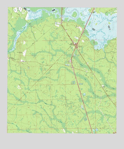
Gross, FL USGS Topographic Map
Click on map above to begin viewing in our Map Viewer.

This topographic map contains these locations and features:
Feature Name Type Latitude Longitude GNIS ID View Map
BeckerPopulated PlaceN30.6713°W81.6412°278369View Map
Casey CreekGutN30.7397°W81.6379°312403View Map
GrossPopulated PlaceN30.7161°W81.6754°294793View Map
Little Saint Marys RiverStreamN30.7472°W81.7112°285804View Map
Lower Sister CreekStreamN30.7280°W81.6440°286176View Map
McQueen SwampSwampN30.6759°W81.6259°286654View Map
Owens CemeteryCemeteryN30.7033°W81.7323°1796364View Map
Plummer SwampSwampN30.6490°W81.7079°289091View Map
Saint James ChurchChurchN30.6980°W81.7443°290195View Map
Saint Marys Scrubby Bluff Wastewater Treatment PlantBuildingN30.7493°W81.6491°2502464View Map
Sarah Bowden GrantCivilN30.6422°W81.6276°301033View Map
Scrubby BluffCliffN30.7458°W81.6540°322667View Map
Tom Mann SwampSwampN30.6271°W81.7308°292336View Map
Upper Sister CreekStreamN30.7280°W81.6440°292711View Map
White Oak SwampSwampN30.7279°W81.7351°293218View Map
Wildes CemeteryCemeteryN30.7144°W81.6948°1796365View Map
WildlightPopulated PlaceN30.6287°W81.6412°2787998View Map
Wilds Ferry (historical)CrossingN30.7422°W81.6904°1671433View Map

Note: Coordinates in the location and feature list above are referenced to NAD83 datum.


Copyright (C) 2008-2024 Ryan Niemi / Sunset Dynamics ... All Rights Reserved