TopoQuest Logo
Do you find TopoQuest useful?
Help keep TopoQuest running and adding new maps/features by donating!
Bitcoin:  19c7KJd3qBynnjoSw5npx9KScwjBe4ifkT
Litecoin:  LXs6TkuXGGXo1vDsWCkWVdjQX94eUKd6ui
Home View Maps Find Maps Find Places Resources & Links


Hamburg, Minnesota Topographic Map

USGS Map Title: Hamburg, MN
USGS Map MRC: 44093F8
DRG (GeoTIFF) Download: o44093f8.tif


Neighboring USGS Topographic Map Quads:


  Plato, MN  
44094G1
 

  Norwood, MN  
44093G8
 

  Waconia, MN  
44093G7
 

  Green Isle, MN  
44094F1
 

  Hamburg, MN  
44093F8
 

  Belle Plaine North, MN  
44093F7
 

  Arlington, MN  
44094E1
 

  Henderson, MN  
44093E8
 

  Belle Plaine South, MN  
44093E7


Map MRC Location:

N45°
W94°
N45°
W93°
H8 H7 H6 H5 H4 H3 H2 H1
G8 G7 G6 G5 G4 G3 G2 G1
F8 F7 F6 F5 F4 F3 F2 F1
E8 E7 E6 E5 E4 E3 E2 E1
D8 D7 D6 D5 D4 D3 D2 D1
C8 C7 C6 C5 C4 C3 C2 C1
B8 B7 B6 B5 B4 B3 B2 B1
A8 A7 A6 A5 A4 A3 A2 A1
N44°
W94°
N44°
W93°

Hamburg, MN USGS 1:24K Topographic Map Preview:
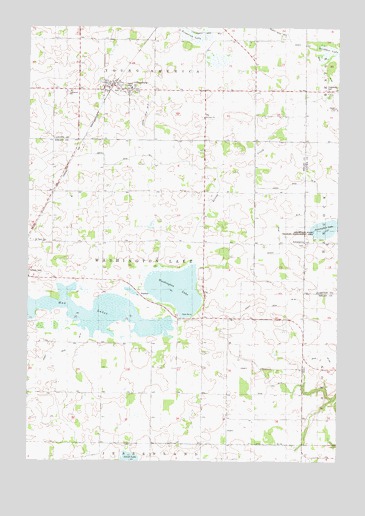
Hamburg, MN USGS Topographic Map
Click on map above to begin viewing in our Map Viewer.

This topographic map contains these locations and features:
Feature Name Type Latitude Longitude GNIS ID View Map
AssumptionPopulated PlaceN44.6880°W93.8889°639488View Map
Assumption CemeteryCemeteryN44.6878°W93.8889°2065080View Map
Assumption LakeLakeN44.6921°W93.8803°639492View Map
Assumption Post Office (historical)Post OfficeN44.6867°W93.8881°2094293View Map
Assumption State Wildlife Management AreaParkN44.6916°W93.8808°1817724View Map
Bovy Family CemeteryCemeteryN44.7083°W93.8778°2094261View Map
Carver County Waterfowl Production AreaParkN44.7219°W93.9419°2765231View Map
City of HamburgCivilN44.7328°W93.9644°2394274View Map
County Ditch Number FiftysevenCanalN44.6936°W93.8989°1817721View Map
County Ditch Number FortysevenCanalN44.6472°W93.8997°1817719View Map
County Ditch Number Four ACanalN44.7475°W93.8952°1815267View Map
County Ditch Number ThirtynineCanalN44.6497°W93.9994°1817726View Map
County Ditch Number ThirtytwoCanalN44.6680°W93.8758°1817716View Map
County Ditch Number Twelve ACanalN44.6300°W93.9008°1817717View Map
County Ditch Number Twentyfive ACanalN44.6555°W93.8830°1817718View Map
Emanuel Lutheran ChurchChurchN44.7317°W93.9847°2093475View Map
Emanuel Lutheran Church CemeteryCemeteryN44.7313°W93.9853°2094318View Map
Emanuel Lutheran SchoolSchoolN44.7313°W93.9834°643366View Map
Erin LakeLakeN44.6674°W93.9721°648354View Map
Evangelical Reformed ChurchChurchN44.7333°W93.9669°2093419View Map
Frederick LakeSwampN44.7472°W93.9336°643903View Map
HamburgPopulated PlaceN44.7333°W93.9672°644598View Map
HamburgLocaleN44.7331°W93.9664°2093416View Map
Hamburg Bicentennial ParkParkN44.7319°W93.9661°2094338View Map
Hamburg City HallBuildingN44.7333°W93.9669°2093418View Map
Hamburg Fire DepartmentBuildingN44.7322°W93.9712°2666242View Map
Hamburg Post OfficePost OfficeN44.7328°W93.9691°2093417View Map
Hawks ParkParkN44.7353°W93.9644°2094339View Map
Hoeffken LakeLakeN44.7424°W93.8786°645049View Map
Judicial Ditch Number ThreeCanalN44.7158°W93.9586°1817723View Map
Judicial Ditch Number Three ACanalN44.7236°W93.9536°1817722View Map
Ridgeview Ambulance Service HamburgBuildingN44.7322°W93.9711°2721357View Map
Saint Paul's Evangelical Reformed Church CemeteryCemeteryN44.7239°W93.9302°2094265View Map
Saint Pauls CemeteryCemeteryN44.6886°W93.9986°650981View Map
Saint Pauls ChurchChurchN44.7239°W93.9294°1817725View Map
Saint Pauls SchoolSchoolN44.7241°W93.9289°651002View Map
School Number 25SchoolN44.7027°W93.9164°651594View Map
Sibley County Waterfowl Production AreaParkN44.6651°W93.9855°2765504View Map
Snapsburg CemeteryCemeteryN44.7321°W93.8794°652202View Map
Township of Washington LakeCivilN44.6735°W93.9487°665924View Map
Washington LakeLakeN44.6742°W93.9403°653801View Map

Note: Coordinates in the location and feature list above are referenced to NAD83 datum.


Copyright (C) 2008-2025 Ryan Niemi / Sunset Dynamics ... All Rights Reserved