TopoQuest Logo
Do you find TopoQuest useful?
Help keep TopoQuest running and adding new maps/features by donating!
Bitcoin:  19c7KJd3qBynnjoSw5npx9KScwjBe4ifkT
Litecoin:  LXs6TkuXGGXo1vDsWCkWVdjQX94eUKd6ui
Home View Maps Find Maps Find Places Resources & Links


Green Isle, Minnesota Topographic Map

USGS Map Title: Green Isle, MN
USGS Map MRC: 44094F1
DRG (GeoTIFF) Download: o44094f1.tif


Neighboring USGS Topographic Map Quads:


  Glencoe, MN  
44094G2
 

  Plato, MN  
44094G1
 

  Norwood, MN  
44093G8
 

  New Auburn, MN  
44094F2
 

  Green Isle, MN  
44094F1
 

  Hamburg, MN  
44093F8
 

  Gaylord, MN  
44094E2
 

  Arlington, MN  
44094E1
 

  Henderson, MN  
44093E8


Map MRC Location:

N45°
W95°
N45°
W94°
H8 H7 H6 H5 H4 H3 H2 H1
G8 G7 G6 G5 G4 G3 G2 G1
F8 F7 F6 F5 F4 F3 F2 F1
E8 E7 E6 E5 E4 E3 E2 E1
D8 D7 D6 D5 D4 D3 D2 D1
C8 C7 C6 C5 C4 C3 C2 C1
B8 B7 B6 B5 B4 B3 B2 B1
A8 A7 A6 A5 A4 A3 A2 A1
N44°
W95°
N44°
W94°

Green Isle, MN USGS 1:24K Topographic Map Preview:
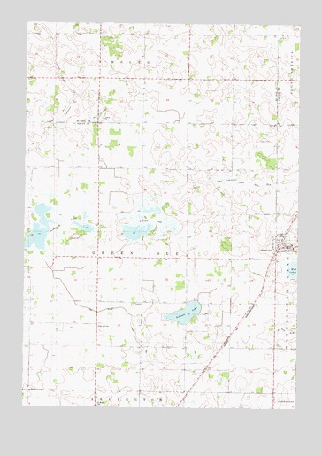
Green Isle, MN USGS Topographic Map
Click on map above to begin viewing in our Map Viewer.

This topographic map contains these locations and features:
Feature Name Type Latitude Longitude GNIS ID View Map
Bear LakebedSwampN44.7208°W94.0905°1817730View Map
Brian LakebedFlatN44.7222°W94.1058°1817732View Map
City of Green IsleCivilN44.6804°W94.0052°2394976View Map
County Ditch Number TwentynineCanalN44.6944°W94.0108°1817728View Map
Curran LakeLakeN44.6857°W94.0695°642552View Map
Fahey LakebedSwampN44.6994°W94.0336°1817729View Map
Green IslePopulated PlaceN44.6791°W94.0083°644409View Map
Green IsleLocaleN44.6800°W94.0069°2065136View Map
Green Isle CemeteryCemeteryN44.6514°W94.0914°644410View Map
Green Isle City HallBuildingN44.6792°W94.0081°2065140View Map
Green Isle Fire DepartmentBuildingN44.6785°W94.0059°2666429View Map
Green Isle Police DepartmentBuildingN44.6786°W94.0072°2758794View Map
Green Isle Post OfficePost OfficeN44.6778°W94.0058°2065137View Map
High Island Ditch Number TwoCanalN44.6477°W94.0741°1817727View Map
Saint Brendan ChurchChurchN44.6792°W94.0081°2065139View Map
Saint Johns ChurchChurchN44.7314°W94.0816°1817731View Map
Saint Johns SchoolSchoolN44.7305°W94.0830°650729View Map
Saint Marys CemeteryCemeteryN44.6261°W94.0916°650836View Map
Saint Paul's Lutheran ChurchChurchN44.6792°W94.0081°2065138View Map
Schauer LakeLakeN44.6558°W94.0510°651923View Map
Severance LakeLakeN44.6818°W94.1208°651872View Map
Township of Green IsleCivilN44.6737°W94.0719°664341View Map
Zion CemeteryCemeteryN44.6372°W94.0410°654441View Map
Zion School CemeteryCemeteryN44.6556°W94.0404°654495View Map

Note: Coordinates in the location and feature list above are referenced to NAD83 datum.


Copyright (C) 2008-2025 Ryan Niemi / Sunset Dynamics ... All Rights Reserved