TopoQuest Logo
Do you find TopoQuest useful?
Help keep TopoQuest running and adding new maps/features by donating!
Bitcoin:  19c7KJd3qBynnjoSw5npx9KScwjBe4ifkT
Litecoin:  LXs6TkuXGGXo1vDsWCkWVdjQX94eUKd6ui
Home View Maps Find Maps Find Places Resources & Links


Hampton, Pennsylvania Topographic Map

USGS Map Title: Hampton, PA
USGS Map MRC: 39077H1
DRG (GeoTIFF) Download: o39077h1.tif


Neighboring USGS Topographic Map Quads:


  Mount Holly Springs, PA  
40077A2
 

  Dillsburg, PA  
40077A1
 

  Wellsville, PA  
40076A8
 

  Biglerville, PA  
39077H2
 

  Hampton, PA  
39077H1
 

  Abbottstown, PA  
39076H8
 

  Gettysburg, PA  
39077G2
 

  McSherrystown, PA  
39077G1
 

  Hanover, PA  
39076G8


Map MRC Location:

N40°
W78°
N40°
W77°
H8 H7 H6 H5 H4 H3 H2 H1
G8 G7 G6 G5 G4 G3 G2 G1
F8 F7 F6 F5 F4 F3 F2 F1
E8 E7 E6 E5 E4 E3 E2 E1
D8 D7 D6 D5 D4 D3 D2 D1
C8 C7 C6 C5 C4 C3 C2 C1
B8 B7 B6 B5 B4 B3 B2 B1
A8 A7 A6 A5 A4 A3 A2 A1
N39°
W78°
N39°
W77°

Hampton, PA USGS 1:24K Topographic Map Preview:
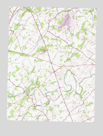
Hampton, PA USGS Topographic Map
Click on map above to begin viewing in our Map Viewer.

This topographic map contains these locations and features:
Feature Name Type Latitude Longitude GNIS ID View Map
AmatusPopulated PlaceN39.9643°W77.0439°1211076View Map
Baker SchoolSchoolN39.9737°W77.0214°1168609View Map
Beaverdam CreekStreamN39.9012°W77.1164°1169059View Map
BowlderPopulated PlaceN39.9476°W77.0989°1211072View Map
Browns DamDamN39.9284°W77.0325°1211077View Map
Fickes SchoolSchoolN39.9643°W77.0930°1174729View Map
Five PointsPopulated PlaceN39.9484°W77.1016°1203577View Map
Gardner RunStreamN39.9956°W77.0997°1175442View Map
Green Ridge SchoolSchoolN39.9001°W77.0433°1176109View Map
Hafers Mill (historical)LocaleN39.9293°W77.0325°1211075View Map
HamptonPopulated PlaceN39.9295°W77.0583°1176443View Map
Hampton Census Designated PlaceCensusN39.9290°W77.0583°2389895View Map
Hampton Fire Company Station 10BuildingN39.9291°W77.0566°2100005View Map
Hampton Meeting House CemeteryCemeteryN39.9400°W77.0631°2774889View Map
Hampton Union CemeteryCemeteryN39.9300°W77.0597°2774888View Map
Hoover SchoolSchoolN39.9437°W77.0366°1177368View Map
Huntington Quaker Meeting House CemeteryCemeteryN39.9951°W77.0818°2774893View Map
Independence SchoolSchoolN39.9223°W77.0233°1177727View Map
Lake MeadeReservoirN39.9850°W77.0424°1194471View Map
Lake MeadePopulated PlaceN39.9851°W77.0372°1852861View Map
Lake Meade Census Designated PlaceCensusN39.9836°W77.0421°2390019View Map
Lake Meade DamDamN39.9926°W77.0426°1194472View Map
Lake Meade Fire and Rescue Station 26BuildingN39.9739°W77.0367°2652932View Map
Lamberson AirportAirportN39.8828°W77.0833°2442851View Map
Lower Bermudian Lutheran Church CemeteryCemeteryN39.9956°W77.0438°2774902View Map
Markel RunStreamN39.9265°W77.0050°1180416View Map
Market Garden AirportAirportN39.9617°W77.1008°2442811View Map
Meadowlark FarmLocaleN39.9058°W77.0042°2650599View Map
Mount Olivet United Church of Christ CemeteryCemeteryN39.9965°W77.0434°2774903View Map
NewchesterPopulated PlaceN39.9034°W77.0955°1182390View Map
North Branch Mud RunStreamN39.9779°W77.0689°1202457View Map
Oakgrove SchoolSchoolN39.9126°W77.1116°1182819View Map
Oakwood SchoolSchoolN39.9173°W77.0722°1182854View Map
Pine ChurchChurchN39.8940°W77.1139°1211073View Map
Pine RunStreamN39.9054°W77.0214°1183889View Map
Pine Run SchoolSchoolN39.8987°W77.0150°1183904View Map
Round HillLocaleN39.9529°W77.0691°1212662View Map
Round HillSummitN39.9526°W77.0733°1185517View Map
Round Hill Post OfficePost OfficeN39.9523°W77.0694°1214268View Map
Round Hill Presbyterian ChurchyardCemeteryN39.9489°W77.0801°2774928View Map
Round Hill SchoolSchoolN39.9532°W77.0694°1185523View Map
Saint John's United Church of Christ CemeteryCemeteryN39.9040°W77.0932°2774933View Map
Saint Paul Lutheran Church CemeteryCemeteryN39.8946°W77.1146°2774925View Map
Schulteis FieldAirportN39.9196°W77.0459°2442878View Map
Seven Hundred SchoolSchoolN39.8923°W77.0550°1187260View Map
South Branch Conewago CreekStreamN39.8923°W77.0761°1193398View Map
Stauffers SchoolSchoolN39.9387°W77.0028°1188571View Map
Swift RunStreamN39.8923°W77.0825°1189182View Map
The PinesPopulated PlaceN39.8940°W77.1153°1189442View Map
Township of HamiltonCivilN39.9005°W77.0210°1215783View Map
Township of ReadingCivilN39.9482°W77.0381°1215793View Map
Two Churches SchoolSchoolN39.9965°W77.0444°1190020View Map
Victory SchoolSchoolN39.9676°W77.0544°1190408View Map
WaldheimPopulated PlaceN39.9076°W77.0603°1211074View Map
Whitcomb View SchoolSchoolN39.9770°W77.1222°1191245View Map
Wilts SchoolSchoolN39.9845°W77.0989°1211071View Map
Wolferd SchoolSchoolN39.9937°W77.0855°1191698View Map
York Sulphur SpringsSpringN39.9956°W77.0939°1191907View Map

Note: Coordinates in the location and feature list above are referenced to NAD83 datum.


Copyright (C) 2008-2024 Ryan Niemi / Sunset Dynamics ... All Rights Reserved