TopoQuest Logo
Do you find TopoQuest useful?
Help keep TopoQuest running and adding new maps/features by donating!
Bitcoin:  19c7KJd3qBynnjoSw5npx9KScwjBe4ifkT
Litecoin:  LXs6TkuXGGXo1vDsWCkWVdjQX94eUKd6ui
Home View Maps Find Maps Find Places Resources & Links


Harlansburg, Pennsylvania Topographic Map

USGS Map Title: Harlansburg, PA
USGS Map MRC: 41080A2
DRG (GeoTIFF) Download: o41080a2.tif


Neighboring USGS Topographic Map Quads:


  Greenfield, PA  
41080B3
 

  Mercer, PA  
41080B2
 

  Grove City, PA  
41080B1
 

  New Castle North, PA  
41080A3
 

  Harlansburg, PA  
41080A2
 

  Slippery Rock, PA  
41080A1
 

  New Castle South, PA  
40080H3
 

  Portersville, PA  
40080H2
 

  Prospect, PA  
40080H1


Map MRC Location:

N42°
W81°
N42°
W80°
H8 H7 H6 H5 H4 H3 H2 H1
G8 G7 G6 G5 G4 G3 G2 G1
F8 F7 F6 F5 F4 F3 F2 F1
E8 E7 E6 E5 E4 E3 E2 E1
D8 D7 D6 D5 D4 D3 D2 D1
C8 C7 C6 C5 C4 C3 C2 C1
B8 B7 B6 B5 B4 B3 B2 B1
A8 A7 A6 A5 A4 A3 A2 A1
N41°
W81°
N41°
W80°

Harlansburg, PA USGS 1:24K Topographic Map Preview:
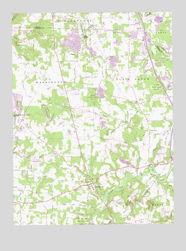
Harlansburg, PA USGS Topographic Map
Click on map above to begin viewing in our Map Viewer.

This topographic map contains these locations and features:
Feature Name Type Latitude Longitude GNIS ID View Map
Black RunStreamN41.0248°W80.1320°1169734View Map
Braden SchoolSchoolN41.0328°W80.1670°1196908View Map
BrentPopulated PlaceN41.1137°W80.1670°1170200View Map
Burns SchoolSchoolN41.1039°W80.1789°1196904View Map
Camp RentzLocaleN41.0290°W80.1495°1171069View Map
Carr SchoolSchoolN41.0620°W80.2423°1196899View Map
Center SchoolSchoolN41.0676°W80.1503°1196906View Map
Chambers ReservoirReservoirN41.0934°W80.2431°1195258View Map
Cooper SchoolSchoolN41.0398°W80.2053°1196901View Map
Deep Valley CampLocaleN41.0290°W80.1378°1173076View Map
DrakePopulated PlaceN41.1170°W80.1878°1173442View Map
East Lawrence Elementary SchoolSchoolN41.0723°W80.1534°1211459View Map
East Lawrence SchoolSchoolN41.0723°W80.1528°1173834View Map
Eight Square SchoolSchoolN41.0209°W80.1326°1196909View Map
Elliotts MillsPopulated PlaceN41.0351°W80.1434°1174151View Map
Green Meadows Golf CourseLocaleN41.0809°W80.2042°1205585View Map
HarlansburgPopulated PlaceN41.0242°W80.1887°1176531View Map
Jackson SchoolSchoolN41.0967°W80.2109°1196897View Map
Jamison RunStreamN41.0328°W80.1406°1177985View Map
Jordan SchoolSchoolN41.0692°W80.2053°1196898View Map
McFarland SchoolSchoolN41.0159°W80.2192°1196902View Map
Meadowlark Farm Airport (historical)AirportN41.0153°W80.1276°1194157View Map
Mount Pleasant SchoolSchoolN41.0992°W80.1476°1196905View Map
Oak Grove SchoolSchoolN41.0617°W80.1667°1196907View Map
Plain GrovePopulated PlaceN41.0542°W80.1428°1204414View Map
Potter Run SchoolSchoolN41.1098°W80.2481°1196896View Map
Ridge SchoolSchoolN41.0126°W80.1581°1196910View Map
RockvillePopulated PlaceN41.0028°W80.1734°1204532View Map
Scott Township Volunteer Fire Department Station 1500BuildingN41.0224°W80.1970°2644921View Map
Shaw Landing Area (historical)AirportN41.1209°W80.2206°1194174View Map
Spring SchoolSchoolN41.0151°W80.2442°1196903View Map
State Game Lands Number 151ParkN41.0734°W80.1864°1188453View Map
State Game Lands Number 216ParkN41.0031°W80.1970°1188492View Map
State Game Lands Number 284ParkN41.1167°W80.1664°1208390View Map
Stevenson CemeteryCemeteryN41.1167°W80.1923°1208592View Map
Taylor RunStreamN41.0290°W80.1578°1189312View Map
Township of Plain GroveCivilN41.0762°W80.1498°1216660View Map
Township of ScottCivilN41.0260°W80.2040°1216662View Map
Township of WashingtonCivilN41.0832°W80.2237°1217314View Map
Young SchoolSchoolN41.0409°W80.2370°1196900View Map

Note: Coordinates in the location and feature list above are referenced to NAD83 datum.


Copyright (C) 2008-2025 Ryan Niemi / Sunset Dynamics ... All Rights Reserved