TopoQuest Logo
Do you find TopoQuest useful?
Help keep TopoQuest running and adding new maps/features by donating!
Bitcoin:  19c7KJd3qBynnjoSw5npx9KScwjBe4ifkT
Litecoin:  LXs6TkuXGGXo1vDsWCkWVdjQX94eUKd6ui
Home View Maps Find Maps Find Places Resources & Links


Grove City, Pennsylvania Topographic Map

USGS Map Title: Grove City, PA
USGS Map MRC: 41080B1
DRG (GeoTIFF) Download: o41080b1.tif


Neighboring USGS Topographic Map Quads:


  Jackson Center, PA  
41080C2
 

  Sandy Lake, PA  
41080C1
 

  Polk, PA  
41079C8
 

  Mercer, PA  
41080B2
 

  Grove City, PA  
41080B1
 

  Barkeyville, PA  
41079B8
 

  Harlansburg, PA  
41080A2
 

  Slippery Rock, PA  
41080A1
 

  West Sunbury, PA  
41079A8


Map MRC Location:

N42°
W81°
N42°
W80°
H8 H7 H6 H5 H4 H3 H2 H1
G8 G7 G6 G5 G4 G3 G2 G1
F8 F7 F6 F5 F4 F3 F2 F1
E8 E7 E6 E5 E4 E3 E2 E1
D8 D7 D6 D5 D4 D3 D2 D1
C8 C7 C6 C5 C4 C3 C2 C1
B8 B7 B6 B5 B4 B3 B2 B1
A8 A7 A6 A5 A4 A3 A2 A1
N41°
W81°
N41°
W80°

Grove City, PA USGS 1:24K Topographic Map Preview:
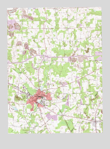
Grove City, PA USGS Topographic Map
Click on map above to begin viewing in our Map Viewer.

This topographic map contains these locations and features:
Feature Name Type Latitude Longitude GNIS ID View Map
Allison Airport (historical)AirportN41.1734°W80.0517°1194186View Map
August-Menzies-Monroe Airport (historical)AirportN41.1362°W80.0678°1194177View Map
Barmore LakeReservoirN41.1499°W80.1152°1168726View Map
Barmore Lake DamDamN41.1401°W80.1131°1195298View Map
Barmore RunStreamN41.1409°W80.0948°1168727View Map
Beloved Disciple CemeteryCemeteryN41.1728°W80.0706°1169208View Map
Black RunStreamN41.1906°W80.0689°1169732View Map
Black RunStreamN41.1262°W80.0937°1169735View Map
Borough of Grove CityCivilN41.1572°W80.0892°1215440View Map
Borough of HarrisvilleCivilN41.1366°W80.0105°1214995View Map
Bowie SchoolSchoolN41.2489°W80.1073°1196883View Map
Broad AcresPopulated PlaceN41.1770°W80.0837°1170281View Map
CentertownPopulated PlaceN41.2287°W80.0445°1203241View Map
Central SchoolSchoolN41.1578°W80.0892°1171501View Map
Chestnut Ridge SchoolSchoolN41.1839°W80.1242°1196874View Map
Cranberry SchoolSchoolN41.1859°W80.1059°1196879View Map
Cranberry SchoolSchoolN41.1856°W80.1051°1172631View Map
East Branch Wolf CreekStreamN41.2031°W80.0581°1173780View Map
Ebenezer ChurchChurchN41.2289°W80.0720°1173956View Map
EnterprisePopulated PlaceN41.1642°W80.0389°1203523View Map
Flying M Ranch AirportAirportN41.2160°W80.0930°1194196View Map
Gordon SchoolSchoolN41.2176°W80.1003°1196884View Map
Grove CityPopulated PlaceN41.1578°W80.0887°1176273View Map
Grove City Area High SchoolSchoolN41.1617°W80.0992°1211453View Map
Grove City Area Junior High SchoolSchoolN41.1559°W80.0864°1211454View Map
Grove City CollegeSchoolN41.1556°W80.0792°1176274View Map
Grove City Country ClubLocaleN41.1476°W80.1120°1213222View Map
Grove City Landing Area (historical)AirportN41.1351°W80.0676°1196885View Map
Grove City Medical CenterHospitalN41.1710°W80.0851°2718064View Map
Grove City Police DepartmentBuildingN41.1590°W80.0786°2780559View Map
Grove City Post OfficePost OfficeN41.1598°W80.0854°2779569View Map
Grove City Volunteer Fire Department Station 1 HeadquartersBuildingN41.1626°W80.0848°2645801View Map
Grove City Volunteer Fire Department Station 95BuildingN41.1590°W80.0783°2645351View Map
Hall of Arts and LectureBuildingN41.1547°W80.0778°2103549View Map
Har-Mer Elementary SchoolSchoolN41.1356°W80.0109°1211451View Map
Harbison ChapelChurchN41.1567°W80.0811°2103550View Map
Harmony CemeteryCemeteryN41.1359°W80.0252°1176547View Map
HarrisvillePopulated PlaceN41.1367°W80.0092°1176592View Map
Harrisville Post OfficePost OfficeN41.1363°W80.0090°2779805View Map
Harrisville Volunteer Fire Company Station 34BuildingN41.1372°W80.0068°2645633View Map
Helen Harker HallBuildingN41.1558°W80.0792°2103551View Map
Hemlock SchoolSchoolN41.1951°W80.0484°1196880View Map
Henry Buhl LibraryBuildingN41.1542°W80.0797°2103552View Map
Highland Elementary SchoolSchoolN41.1606°W80.0992°1211456View Map
Highland SchoolSchoolN41.1606°W80.0995°1177050View Map
Hillview Elementary SchoolSchoolN41.1542°W80.0803°1211455View Map
Hopeman HallBuildingN41.1539°W80.0806°2103554View Map
Hoyt Hall of EngineeringBuildingN41.1547°W80.0792°2103555View Map
IrishtownPopulated PlaceN41.2134°W80.1248°1192671View Map
Issac C Ketier DormitoryBuildingN41.1553°W80.0808°2103556View Map
J Howard Pew Fine Arts CenterBuildingN41.1528°W80.0775°2103557View Map
Kerr SchoolSchoolN41.1714°W80.0537°1196878View Map
Kerrs CornersPopulated PlaceN41.1717°W80.0523°1178409View Map
Klondike SchoolSchoolN41.1823°W80.0187°1197572View Map
Lincoln SchoolSchoolN41.1634°W80.0853°1179398View Map
Mary Anderson Pew DormitoryBuildingN41.1564°W80.0800°2103559View Map
Mary Ethel Pew DormitoryBuildingN41.1567°W80.0786°2103560View Map
McCoy SchoolSchoolN41.1478°W80.0628°1196875View Map
McCoys CornersPopulated PlaceN41.1270°W80.0964°1180664View Map
McCoytownPopulated PlaceN41.1426°W80.0526°1214119View Map
McDowell CornersLocaleN41.1748°W80.1237°1180698View Map
Memorial ParkParkN41.1598°W80.1062°1180915View Map
MillbrookPopulated PlaceN41.2487°W80.0609°1181204View Map
Montgomery SchoolSchoolN41.2178°W80.0573°1196882View Map
Nutts CornersLocaleN41.1878°W80.0048°1182718View Map
Park Elementary SchoolSchoolN41.1617°W80.0992°1211452View Map
Patterson SchoolSchoolN41.2203°W80.0178°1196881View Map
Perrys CornersPopulated PlaceN41.1978°W80.0787°1183607View Map
Phillips Field HouseBuildingN41.1575°W80.0842°2103563View Map
Physical Learning CenterBuildingN41.1558°W80.0783°2103564View Map
Pinchalong SchoolSchoolN41.1559°W80.0631°1196876View Map
Pine Grove Public Golf CourseLocaleN41.1814°W80.0595°1205590View Map
Pine Township Engine Company Station 85BuildingN41.1548°W80.1051°2645877View Map
Pine Township Engine Company Station 85BuildingN41.1680°W80.0772°2645805View Map
Pinetop SchoolSchoolN41.1570°W80.1159°1196877View Map
President's Residence - Grove City CollegeBuildingN41.1547°W80.0825°2103565View Map
Rockwell Hall of ScienceBuildingN41.1553°W80.0797°2103566View Map
Sagulla Airport (historical)AirportN41.2426°W80.1145°1194203View Map
School for BoysSchoolN41.1703°W80.1134°1187098View Map
Schoolfield ChurchChurchN41.2487°W80.0609°1187107View Map
Scott Hill ChurchChurchN41.1901°W80.0273°1187164View Map
Spring Field CornersLocaleN41.2262°W80.1239°1188225View Map
Superior Ambulance ServiceBuildingN41.1405°W80.0400°2719454View Map
Swamproot (historical)Populated PlaceN41.1426°W80.0526°1204780View Map
Township of MercerCivilN41.1269°W80.0110°1216061View Map
Township of PineCivilN41.1681°W80.0657°1216813View Map
Township of Wolf CreekCivilN41.2177°W80.0607°1215453View Map
Union Home CemeteryCemeteryN41.2289°W80.0684°1190160View Map
Washington Kindergarden CenterSchoolN41.1628°W80.0764°1211684View Map
Washington SchoolSchoolN41.1628°W80.0762°1190647View Map
WEDA-FM (Grove City)TowerN41.1723°W80.0628°1200284View Map
Weir C Ketler Technology Learning CenterBuildingN41.1539°W80.0792°2103568View Map
Woodland CemeteryCemeteryN41.1701°W80.0814°1191738View Map
WSAJ-FM (Grove City)TowerN41.1592°W80.0803°1200283View Map
Zerbe Health CenterBuildingN41.1542°W80.0814°2103570View Map

Note: Coordinates in the location and feature list above are referenced to NAD83 datum.


Copyright (C) 2008-2025 Ryan Niemi / Sunset Dynamics ... All Rights Reserved