TopoQuest Logo
Do you find TopoQuest useful?
Help keep TopoQuest running and adding new maps/features by donating!
Bitcoin:  19c7KJd3qBynnjoSw5npx9KScwjBe4ifkT
Litecoin:  LXs6TkuXGGXo1vDsWCkWVdjQX94eUKd6ui
Home View Maps Find Maps Find Places Resources & Links


Mercer, Pennsylvania Topographic Map

USGS Map Title: Mercer, PA
USGS Map MRC: 41080B2
DRG (GeoTIFF) Download: o41080b2.tif


Neighboring USGS Topographic Map Quads:


  Fredonia, PA  
41080C3
 

  Jackson Center, PA  
41080C2
 

  Sandy Lake, PA  
41080C1
 

  Greenfield, PA  
41080B3
 

  Mercer, PA  
41080B2
 

  Grove City, PA  
41080B1
 

  New Castle North, PA  
41080A3
 

  Harlansburg, PA  
41080A2
 

  Slippery Rock, PA  
41080A1


Map MRC Location:

N42°
W81°
N42°
W80°
H8 H7 H6 H5 H4 H3 H2 H1
G8 G7 G6 G5 G4 G3 G2 G1
F8 F7 F6 F5 F4 F3 F2 F1
E8 E7 E6 E5 E4 E3 E2 E1
D8 D7 D6 D5 D4 D3 D2 D1
C8 C7 C6 C5 C4 C3 C2 C1
B8 B7 B6 B5 B4 B3 B2 B1
A8 A7 A6 A5 A4 A3 A2 A1
N41°
W81°
N41°
W80°

Mercer, PA USGS 1:24K Topographic Map Preview:
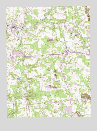
Mercer, PA USGS Topographic Map
Click on map above to begin viewing in our Map Viewer.

This topographic map contains these locations and features:
Feature Name Type Latitude Longitude GNIS ID View Map
AmsterdamPopulated PlaceN41.1339°W80.1337°1168274View Map
Beaver RunStreamN41.2012°W80.2320°1169042View Map
BlacktownPopulated PlaceN41.1667°W80.1734°1169777View Map
Borough of MercerCivilN41.2265°W80.2359°1215444View Map
Boston SchoolSchoolN41.1956°W80.2059°1196894View Map
Bottle Hill SchoolSchoolN41.1689°W80.1398°1196891View Map
Brandy Springs ParkParkN41.2217°W80.2431°1170166View Map
Carpenders CemeteryCemeteryN41.1814°W80.2403°1171239View Map
Center CemeteryCemeteryN41.1520°W80.1270°1171426View Map
Cool Spring CreekStreamN41.2239°W80.2262°1198207View Map
Courtney CemeteryCemeteryN41.1937°W80.2017°1172517View Map
Cribbs SchoolSchoolN41.1889°W80.1881°1196893View Map
Findley CemeteryCemeteryN41.2159°W80.2139°1174756View Map
Five PointsPopulated PlaceN41.2170°W80.1662°1203588View Map
Grove City AirportAirportN41.1448°W80.1676°1194182View Map
Grove City Postal Retail StorePost OfficeN41.1398°W80.1568°2779866View Map
Hope MillsPopulated PlaceN41.1903°W80.2273°1203834View Map
Houston JunctionLocaleN41.2295°W80.2192°1196888View Map
Hunters RunStreamN41.1517°W80.2298°1202649View Map
Indian RunStreamN41.1437°W80.2398°1177783View Map
Johnston Tavern Historical SiteParkN41.1487°W80.2220°1196886View Map
LeesburgPopulated PlaceN41.1345°W80.2201°1179129View Map
Leesburg StationPopulated PlaceN41.1431°W80.2412°1179130View Map
LondonPopulated PlaceN41.1437°W80.1487°1179833View Map
MercerPopulated PlaceN41.2270°W80.2398°1180934View Map
Mercer Area Elementary SchoolSchoolN41.2259°W80.2362°1211458View Map
Mercer Area Junior High SchoolSchoolN41.2242°W80.2484°1211457View Map
Mercer Borough Police DepartmentBuildingN41.2287°W80.2388°2780583View Map
Mercer County Sheriffs AgencyBuildingN41.2252°W80.2394°2780584View Map
Mercer East End Volunteer Fire Department Station 87BuildingN41.2252°W80.2291°2645182View Map
Mercer Post OfficePost OfficeN41.2287°W80.2382°2779723View Map
Mill CreekStreamN41.2339°W80.1923°1181145View Map
Mill RunStreamN41.1648°W80.2245°1181181View Map
MillburnPopulated PlaceN41.1687°W80.2303°1181205View Map
Millburn SchoolSchoolN41.1695°W80.2040°1196892View Map
Mount Nebo SchoolSchoolN41.2048°W80.1431°1196890View Map
Munnell RunStreamN41.2264°W80.2248°1182095View Map
Nazareth ChurchChurchN41.1301°W80.1795°1182190View Map
Nelson's Run AirportAirportN41.2157°W80.1970°1194200View Map
Number Five MineMineN41.1417°W80.1778°1213090View Map
OaklandPopulated PlaceN41.2364°W80.2187°1182824View Map
Otter CreekStreamN41.2239°W80.2262°1199928View Map
PardoePopulated PlaceN41.2181°W80.1448°1183291View Map
Pine RunStreamN41.1781°W80.2251°1183881View Map
SchollardPopulated PlaceN41.1395°W80.2142°1187097View Map
Springfield FallsPopulated PlaceN41.1439°W80.2215°1188295View Map
Springfield FallsFallsN41.1423°W80.2178°1201445View Map
Springfield Township Volunteer Fire Department Station 77BuildingN41.1428°W80.1781°2645790View Map
State Correctional Institution MercerBuildingN41.2028°W80.2250°2757219View Map
Township of FindleyCivilN41.2080°W80.1736°1216801View Map
Township of SpringfieldCivilN41.1482°W80.1984°1216820View Map
TurnerPopulated PlaceN41.2406°W80.1865°1204838View Map
Watts LakeLakeN41.1284°W80.1672°1190704View Map
Wayside ChurchChurchN41.1864°W80.1462°1190730View Map
Whiteoak SchoolSchoolN41.2267°W80.1323°1196889View Map
WSAJ-AM (Grove City)TowerN41.1592°W80.1923°1200483View Map
Yellow CreekStreamN41.2467°W80.1809°1191875View Map

Note: Coordinates in the location and feature list above are referenced to NAD83 datum.


Copyright (C) 2008-2025 Ryan Niemi / Sunset Dynamics ... All Rights Reserved