TopoQuest Logo
Do you find TopoQuest useful?
Help keep TopoQuest running and adding new maps/features by donating!
Bitcoin:  19c7KJd3qBynnjoSw5npx9KScwjBe4ifkT
Litecoin:  LXs6TkuXGGXo1vDsWCkWVdjQX94eUKd6ui
Home View Maps Find Maps Find Places Resources & Links


Avella, Pennsylvania Topographic Map

USGS Map Title: Avella, PA
USGS Map MRC: 40080C4
DRG (GeoTIFF) Download: o40080c4.tif


Neighboring USGS Topographic Map Quads:


  Weirton, WV  
40080D5
 

  Burgettstown, PA  
40080D4
 

  Clinton, PA  
40080D3
 

  Steubenville East, OH  
40080C5
 

  Avella, PA  
40080C4
 

  Midway, PA  
40080C3
 

  Bethany, WV  
40080B5
 

  West Middletown, PA  
40080B4
 

  Washington West, PA  
40080B3


Map MRC Location:

N41°
W81°
N41°
W80°
H8 H7 H6 H5 H4 H3 H2 H1
G8 G7 G6 G5 G4 G3 G2 G1
F8 F7 F6 F5 F4 F3 F2 F1
E8 E7 E6 E5 E4 E3 E2 E1
D8 D7 D6 D5 D4 D3 D2 D1
C8 C7 C6 C5 C4 C3 C2 C1
B8 B7 B6 B5 B4 B3 B2 B1
A8 A7 A6 A5 A4 A3 A2 A1
N40°
W81°
N40°
W80°

Avella, PA USGS 1:24K Topographic Map Preview:
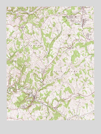
Avella, PA USGS Topographic Map
Click on map above to begin viewing in our Map Viewer.

This topographic map contains these locations and features:
Feature Name Type Latitude Longitude GNIS ID View Map
AtlasburgPopulated PlaceN40.3412°W80.3828°1168492View Map
Atlasburg Census Designated PlaceCensusN40.3435°W80.3803°2631246View Map
Atlasburg Elementary SchoolSchoolN40.3409°W80.3831°1211550View Map
Atlasburg Post OfficePost OfficeN40.3403°W80.3848°2431838View Map
AvellaPopulated PlaceN40.2751°W80.4606°1168518View Map
Avella Area Junior Senior High SchoolSchoolN40.2717°W80.4648°1208370View Map
Avella Census Designated PlaceCensusN40.2737°W80.4672°2584436View Map
Avella HighlandsPopulated PlaceN40.2734°W80.4648°1201497View Map
Avella Post OfficePost OfficeN40.2752°W80.4602°2779803View Map
Avella Volunteer Fire Department Station 35BuildingN40.2745°W80.4588°2644819View Map
Bethel ChurchChurchN40.3153°W80.4890°1169382View Map
Bixton TunnelTunnelN40.2823°W80.4923°1169684View Map
BrowntownPopulated PlaceN40.2790°W80.4648°1170418View Map
Cedar Grove SchoolSchoolN40.3073°W80.4448°1171374View Map
Craighead TunnelTunnelN40.2842°W80.4845°1172606View Map
Cross CreekPopulated PlaceN40.3290°W80.4092°1172738View Map
Cross Creek Census Designated PlaceCensusN40.3264°W80.4091°2584449View Map
Cross Creek County ParkParkN40.2567°W80.4026°1205175View Map
EldersvillePopulated PlaceN40.3520°W80.4784°1174081View Map
Eldersville Elementary SchoolSchoolN40.3490°W80.4765°1211551View Map
Fairview CemeteryCemeteryN40.3674°W80.3893°1174481View Map
Flood Dam 485DamN40.3717°W80.4998°1194761View Map
Grand View Dairy FarmLocaleN40.2550°W80.4606°2708344View Map
Hanlin StationPopulated PlaceN40.3676°W80.4670°1198228View Map
Haynan CreekStreamN40.2676°W80.4417°1192594View Map
Hill StadiumParkN40.3701°W80.3901°1213231View Map
Independence CemeteryCemeteryN40.2531°W80.4915°1177721View Map
Independence Township SchoolSchoolN40.2715°W80.4648°1177728View Map
JeffersonPopulated PlaceN40.2859°W80.4987°1178008View Map
Jefferson Township Volunteer Fire Department Station 49BuildingN40.3508°W80.4755°2645407View Map
LangelothPopulated PlaceN40.3651°W80.4140°1178867View Map
Langeloth Census Designated PlaceCensusN40.3631°W80.4137°2631281View Map
Langeloth Elementary SchoolSchoolN40.3651°W80.4090°1211552View Map
Langeloth Post OfficePost OfficeN40.3646°W80.4077°2431900View Map
Meadowcroft (historical)LocaleN40.2942°W80.4915°1205174View Map
Meadowcroft Rock ShelterLocaleN40.2862°W80.4906°1205106View Map
Middle Fork Cross CreekStreamN40.2870°W80.4498°1181032View Map
Mount Calvary ChurchChurchN40.2640°W80.4756°1181652View Map
North Fork Cross CreekStreamN40.2767°W80.4615°1182581View Map
P and W PatchPopulated PlaceN40.2640°W80.4773°1183172View Map
PA-479 DamDamN40.3667°W80.4848°1194755View Map
Pa-480 DamDamN40.3651°W80.4598°1194752View Map
Pa-484 DamDamN40.3734°W80.4915°1194762View Map
Pa-485 DamDamN40.3701°W80.4998°1194759View Map
Pattersons MillPopulated PlaceN40.2923°W80.4484°1204367View Map
Quakers KnobSummitN40.3431°W80.4106°1184529View Map
ReaPopulated PlaceN40.2773°W80.3973°1204467View Map
Rea Block FieldLocaleN40.2740°W80.3981°1205105View Map
Saint Johns ChurchChurchN40.2778°W80.4592°1186104View Map
SlovanPopulated PlaceN40.3592°W80.3898°1187838View Map
Slovan Census Designated PlaceCensusN40.3595°W80.3850°2631304View Map
Slovan Post OfficePost OfficeN40.3594°W80.3904°2431939View Map
Slovan Volunteer Fire DepartmentBuildingN40.3600°W80.3900°2644888View Map
Smith Township Police DepartmentBuildingN40.3545°W80.3908°2780212View Map
South Fork Cross CreekStreamN40.2637°W80.4348°1188063View Map
State Game Lands Number 303ParkN40.2917°W80.4831°1208371View Map
StudaPopulated PlaceN40.3037°W80.4467°1188897View Map
Township of Cross CreekCivilN40.2960°W80.4116°1217188View Map
Township of JeffersonCivilN40.3348°W80.4785°1217196View Map
Ward RunStreamN40.3692°W80.4673°1193607View Map
Washington County Mennonite SchoolSchoolN40.3502°W80.4769°2431613View Map
West End CemeteryCemeteryN40.2884°W80.4453°1191012View Map
West Middletown (historical)Populated PlaceN40.2623°W80.4287°1201496View Map
Zinc DamDamN40.3567°W80.3981°1194746View Map
Zinc Dam ReservoirReservoirN40.3570°W80.4002°1194747View Map

Note: Coordinates in the location and feature list above are referenced to NAD83 datum.


Copyright (C) 2008-2025 Ryan Niemi / Sunset Dynamics ... All Rights Reserved