TopoQuest Logo
Do you find TopoQuest useful?
Help keep TopoQuest running and adding new maps/features by donating!
Bitcoin:  19c7KJd3qBynnjoSw5npx9KScwjBe4ifkT
Litecoin:  LXs6TkuXGGXo1vDsWCkWVdjQX94eUKd6ui
Home View Maps Find Maps Find Places Resources & Links


Harris, Iowa Topographic Map

USGS Map Title: Harris, IA
USGS Map MRC: 43095D4
DRG (GeoTIFF) Download: o43095d4.tif


Neighboring USGS Topographic Map Quads:


  Worthington South, MN  
43095E5
 

  Round Lake, MN  
43095E4
 

  Sioux Valley, MN  
43095E3
 

  Ocheyedan, IA  
43095D5
 

  Harris, IA  
43095D4
 

  Lake Park, IA  
43095D3
 

  Melvin, IA  
43095C5
 

  May City, IA  
43095C4
 

  Lake Park SE, IA  
43095C3


Map MRC Location:

N44°
W96°
N44°
W95°
H8 H7 H6 H5 H4 H3 H2 H1
G8 G7 G6 G5 G4 G3 G2 G1
F8 F7 F6 F5 F4 F3 F2 F1
E8 E7 E6 E5 E4 E3 E2 E1
D8 D7 D6 D5 D4 D3 D2 D1
C8 C7 C6 C5 C4 C3 C2 C1
B8 B7 B6 B5 B4 B3 B2 B1
A8 A7 A6 A5 A4 A3 A2 A1
N43°
W96°
N43°
W95°

Harris, IA USGS 1:24K Topographic Map Preview:
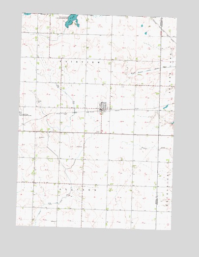
Harris, IA USGS Topographic Map
Click on map above to begin viewing in our Map Viewer.

This topographic map contains these locations and features:
Feature Name Type Latitude Longitude GNIS ID View Map
Breuker FarmsLocaleN43.4603°W95.4014°2723225View Map
City of HarrisCivilN43.4435°W95.4371°2394303View Map
Fairview CemeteryCemeteryN43.4483°W95.4864°456502View Map
Fairview Prairie Wildlife Management AreaParkN43.4527°W95.4267°1907295View Map
HarrisPopulated PlaceN43.4452°W95.4342°457280View Map
HarrisLocaleN43.4439°W95.4336°1907382View Map
Harris Fire StationBuildingN43.4447°W95.4336°1907381View Map
Harris Post OfficePost OfficeN43.4444°W95.4336°1907380View Map
Harris-Lake Park SchoolSchoolN43.4486°W95.4336°1907383View Map
Hibma FarmsLocaleN43.4158°W95.4486°2723228View Map
Iowa Lake ParkParkN43.4944°W95.4586°1907296View Map
Iowa Lake State Game Management AreaParkN43.4969°W95.4589°457832View Map
Judicial Ditch Number 64CanalN43.4186°W95.4717°465852View Map
Loeschen FarmLocaleN43.4458°W95.4611°2723226View Map
Snyder Wildlife Management AreaParkN43.4444°W95.4461°1907294View Map
Timmons Wildlife RefugeParkN43.3875°W95.4664°1907293View Map
Township of AllisonCivilN43.3865°W95.4463°467390View Map
Township of FairviewCivilN43.4654°W95.4462°467819View Map
Union CemeteryCemeteryN43.4316°W95.4347°462437View Map

Note: Coordinates in the location and feature list above are referenced to NAD83 datum.


Copyright (C) 2008-2024 Ryan Niemi / Sunset Dynamics ... All Rights Reserved