TopoQuest Logo
Do you find TopoQuest useful?
Help keep TopoQuest running and adding new maps/features by donating!
Bitcoin:  19c7KJd3qBynnjoSw5npx9KScwjBe4ifkT
Litecoin:  LXs6TkuXGGXo1vDsWCkWVdjQX94eUKd6ui
Home View Maps Find Maps Find Places Resources & Links


Hartwell, Arkansas Topographic Map

USGS Map Title: Hartwell, AR
USGS Map MRC: 36093A7
DRG (GeoTIFF) Download: o36093a7.tif


Neighboring USGS Topographic Map Quads:


  Spring Valley, AR  
36093B8
 

  Hindsville, AR  
36093B7
 

  Forum, AR  
36093B6
 

  Goshen, AR  
36093A8
 

  Hartwell, AR  
36093A7
 

  Huntsville, AR  
36093A6
 

  Durham, AR  
35093H8
 

  Japton, AR  
35093H7
 

  Witter, AR  
35093H6


Map MRC Location:

N37°
W94°
N37°
W93°
H8 H7 H6 H5 H4 H3 H2 H1
G8 G7 G6 G5 G4 G3 G2 G1
F8 F7 F6 F5 F4 F3 F2 F1
E8 E7 E6 E5 E4 E3 E2 E1
D8 D7 D6 D5 D4 D3 D2 D1
C8 C7 C6 C5 C4 C3 C2 C1
B8 B7 B6 B5 B4 B3 B2 B1
A8 A7 A6 A5 A4 A3 A2 A1
N36°
W94°
N36°
W93°

Hartwell, AR USGS 1:24K Topographic Map Preview:
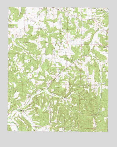
Hartwell, AR USGS Topographic Map
Click on map above to begin viewing in our Map Viewer.

This topographic map contains these locations and features:
Feature Name Type Latitude Longitude GNIS ID View Map
Bohannan Community ChurchChurchN36.0854°W93.8121°46810View Map
Bohannan Mount Volunteer Fire DepartmentBuildingN36.0736°W93.8304°2116169View Map
Bohannan MountainSummitN36.0987°W93.8063°57404View Map
Bohannan Mountain ChurchChurchN36.0734°W93.8257°46811View Map
Boyd MountainSummitN36.0731°W93.8685°57422View Map
Cobb Creek ChurchChurchN36.0340°W93.8052°47874View Map
Drakes CreekPopulated PlaceN36.0206°W93.8599°57677View Map
Drakes Creek ChurchChurchN36.0012°W93.8405°48599View Map
Farmer CemeteryCemeteryN36.1106°W93.8460°49007View Map
HartwellPopulated PlaceN36.1204°W93.8019°57895View Map
Hock CreekStreamN36.0220°W93.8619°50161View Map
Huntsville Municipal AirportAirportN36.0784°W93.7538°83734View Map
Keefer MountainSummitN36.1165°W93.8621°58007View Map
Lower Smyrna ChurchChurchN36.1231°W93.7505°51504View Map
Mante (historical)Populated PlaceN36.0842°W93.8113°66405View Map
Mantie HollowValleyN36.0709°W93.7941°51651View Map
Oak Grove MissionChurchN36.0829°W93.7705°52920View Map
RoxtonPopulated PlaceN36.0370°W93.7982°58552View Map
Sharon ChurchChurchN36.1137°W93.7691°54733View Map
Township of Bohannan (historical)CivilN36.0857°W93.8212°68840View Map
Township of RichlandCivilN36.0315°W93.8253°68854View Map
Upper Smyrna ChurchChurchN36.1242°W93.7660°55856View Map
Worley CemeteryCemeteryN36.0781°W93.8505°56547View Map

Note: Coordinates in the location and feature list above are referenced to NAD83 datum.


Copyright (C) 2008-2024 Ryan Niemi / Sunset Dynamics ... All Rights Reserved