TopoQuest Logo
Do you find TopoQuest useful?
Help keep TopoQuest running and adding new maps/features by donating!
Bitcoin:  19c7KJd3qBynnjoSw5npx9KScwjBe4ifkT
Litecoin:  LXs6TkuXGGXo1vDsWCkWVdjQX94eUKd6ui
Home View Maps Find Maps Find Places Resources & Links


Hayden, Indiana Topographic Map

USGS Map Title: Hayden, IN
USGS Map MRC: 38085H6
DRG (GeoTIFF) Download: o38085h6.tif


Neighboring USGS Topographic Map Quads:


  Azalia, IN  
39085A7
 

  North Vernon, IN  
39085A6
 

  Butlerville, IN  
39085A5
 

  Chestnut Ridge, IN  
38085H7
 

  Hayden, IN  
38085H6
 

  Vernon, IN  
38085H5
 

  Crothersville, IN  
38085G7
 

  Deputy, IN  
38085G6
 

  Volga, IN  
38085G5


Map MRC Location:

N39°
W86°
N39°
W85°
H8 H7 H6 H5 H4 H3 H2 H1
G8 G7 G6 G5 G4 G3 G2 G1
F8 F7 F6 F5 F4 F3 F2 F1
E8 E7 E6 E5 E4 E3 E2 E1
D8 D7 D6 D5 D4 D3 D2 D1
C8 C7 C6 C5 C4 C3 C2 C1
B8 B7 B6 B5 B4 B3 B2 B1
A8 A7 A6 A5 A4 A3 A2 A1
N38°
W86°
N38°
W85°

Hayden, IN USGS 1:24K Topographic Map Preview:
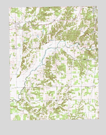
Hayden, IN USGS Topographic Map
Click on map above to begin viewing in our Map Viewer.

This topographic map contains these locations and features:
Feature Name Type Latitude Longitude GNIS ID View Map
Aerobatic Practice AirportAirportN38.9958°W85.7493°2676930View Map
Brushy ForkStreamN38.8845°W85.7052°431688View Map
Centerville Community ChurchChurchN38.9406°W85.6408°432347View Map
Duck BranchStreamN38.9553°W85.6819°433741View Map
Four CornersPopulated PlaceN38.9542°W85.7402°434719View Map
German CemeteryCemeteryN38.8967°W85.6843°435038View Map
Green CemeteryCemeteryN38.9379°W85.6635°435389View Map
HaydenPopulated PlaceN38.9831°W85.7405°435914View Map
Hayden Census Designated PlaceCensusN38.9714°W85.7389°2587019View Map
Hayden Elementary SchoolSchoolN38.9817°W85.7402°447489View Map
Hayden QuarryMineN38.9858°W85.7244°2567525View Map
Indian CreekStreamN38.9539°W85.6955°436741View Map
Jennings CountyCivilN38.9969°W85.6281°450364View Map
LovettPopulated PlaceN38.9114°W85.6330°438350View Map
Lovett Township Volunteer Fire DepartmentBuildingN38.9112°W85.6335°2626299View Map
Marsh CemeteryCemeteryN38.9363°W85.7018°438649View Map
Meek CemeteryCemeteryN38.9327°W85.7054°438963View Map
Muscatatuck County ParkParkN38.9848°W85.6255°439898View Map
Polly BranchStreamN38.9187°W85.7261°441415View Map
Powder CreekStreamN38.9542°W85.6891°441515View Map
Saint Catherines CemeteryCemeteryN38.9625°W85.6903°442512View Map
Saint James CemeteryCemeteryN38.9551°W85.7396°442549View Map
Saint Josephs ChurchChurchN38.9562°W85.7419°442640View Map
Sixmile CemeteryCemeteryN38.9829°W85.7223°443560View Map
Spencer Township Volunteer Fire Department Station 1BuildingN38.9824°W85.7364°2626221View Map
Spencer Township Volunteer Fire Department Station 2BuildingN38.9821°W85.7370°2626301View Map
Stewart CemeteryCemeteryN38.9567°W85.6705°444149View Map
Sullivan CemeteryCemeteryN38.9527°W85.6844°444367View Map
Tanglewood LakeReservoirN38.9865°W85.6788°448548View Map
Tea CreekStreamN38.8978°W85.7427°444609View Map
Tea Creek ChurchChurchN38.9048°W85.6683°444611View Map
Township of LovettCivilN38.9078°W85.6406°453583View Map
Township of SpencerCivilN38.9705°W85.7439°453861View Map
Van Voorhies Lake DamDamN38.9867°W85.6794°448550View Map
Weston CemeteryCemeteryN38.9037°W85.7223°445848View Map
Weston ChurchChurchN38.9089°W85.7225°445851View Map
Whitcomb CemeteryCemeteryN38.9831°W85.7245°445917View Map
WOCH-AM (North Vernon)TowerN38.9962°W85.6505°448465View Map
WOCH-FM (North Vernon)TowerN38.9962°W85.6505°448950View Map
Zion ChurchChurchN38.9551°W85.6808°446454View Map

Note: Coordinates in the location and feature list above are referenced to NAD83 datum.


Copyright (C) 2008-2024 Ryan Niemi / Sunset Dynamics ... All Rights Reserved