TopoQuest Logo
Do you find TopoQuest useful?
Help keep TopoQuest running and adding new maps/features by donating!
Bitcoin:  19c7KJd3qBynnjoSw5npx9KScwjBe4ifkT
Litecoin:  LXs6TkuXGGXo1vDsWCkWVdjQX94eUKd6ui
Home View Maps Find Maps Find Places Resources & Links


Hempstead, Texas Topographic Map

USGS Map Title: Hempstead, TX
USGS Map MRC: 30096A1
DRG (GeoTIFF) Download: o30096a1.tif


Neighboring USGS Topographic Map Quads:


  Daniels, TX  
30096B2
 

  Howth, TX  
30096B1
 

  Waller NW, TX  
30095B8
 

  Buckhorn, TX  
30096A2
 

  Hempstead, TX  
30096A1
 

  Waller, TX  
30095A8
 

  Burleigh, TX  
29096H2
 

  Sunny Side, TX  
29096H1
 

  Hockley Mound, TX  
29095H8


Map MRC Location:

N31°
W97°
N31°
W96°
H8 H7 H6 H5 H4 H3 H2 H1
G8 G7 G6 G5 G4 G3 G2 G1
F8 F7 F6 F5 F4 F3 F2 F1
E8 E7 E6 E5 E4 E3 E2 E1
D8 D7 D6 D5 D4 D3 D2 D1
C8 C7 C6 C5 C4 C3 C2 C1
B8 B7 B6 B5 B4 B3 B2 B1
A8 A7 A6 A5 A4 A3 A2 A1
N30°
W97°
N30°
W96°

Hempstead, TX USGS 1:24K Topographic Map Preview:
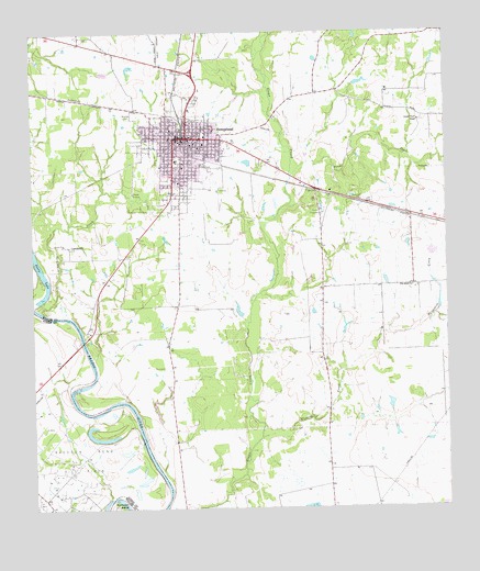
Hempstead, TX USGS Topographic Map
Click on map above to begin viewing in our Map Viewer.

This topographic map contains these locations and features:
Feature Name Type Latitude Longitude GNIS ID View Map
Brenham CemeteryCemeteryN30.1027°W96.0961°1331224View Map
City of HempsteadCivilN30.0995°W96.0782°2410740View Map
Frontier Emergency Medical ServiceBuildingN30.0867°W96.0830°2655837View Map
Greater Wyatt ChapelChurchN30.1016°W96.0080°1336901View Map
HempsteadPopulated PlaceN30.0974°W96.0783°1337592View Map
Hempstead City HallBuildingN30.0971°W96.0806°2753176View Map
Hempstead DivisionCivilN30.0934°W96.0722°1938835View Map
Hempstead GliderportAirportN30.1216°W96.0866°1386804View Map
Hempstead High SchoolSchoolN30.0847°W96.0783°2009582View Map
Hempstead Police DepartmentBuildingN30.0951°W96.0803°2375990View Map
Hempstead Post OfficePost OfficeN30.0965°W96.0806°2731513View Map
Hempstead Volunteer Fire DepartmentBuildingN30.0915°W96.0796°2552257View Map
LewisvillePopulated PlaceN30.0688°W96.1141°1378581View Map
Lewisville CreekStreamN30.0511°W96.1197°1339861View Map
Pine IslandPopulated PlaceN30.0580°W96.0375°1388558View Map
Pine Island ChurchChurchN30.0580°W96.0108°1344061View Map
Ponds CreekStreamN30.0872°W96.0466°1344346View Map
Prairie View Volunteer Fire DepartmentBuildingN30.0759°W96.0026°2552151View Map
Prairie View-Waller DivisionCivilN30.0746°W96.0008°1939295View Map
Primecare Medical ServicesBuildingN30.0963°W96.0813°2656171View Map
Raccoon BendBendN30.0013°W96.0997°1344691View Map
Raccoon Bend Oil FieldOilfieldN30.0122°W96.1116°1372197View Map
Saint Bartholomews Episcopal ChurchChurchN30.0975°W96.0835°2471103View Map
Texas Department of Public Safety Troopers OfficeBuildingN30.0959°W96.0657°2375837View Map
Threemile CreekStreamN30.0183°W96.0569°1348532View Map
Town of Pine IslandCivilN30.0554°W96.0253°2413133View Map
Waller County Constable's Office Precinct 1BuildingN30.1023°W96.0754°2739407View Map
Waller County Constable's Office Precinct 3BuildingN30.0724°W96.0770°2739409View Map
Waller County CourthouseBuildingN30.0977°W96.0780°2030534View Map
Waller County Emergency Management ServicesBuildingN30.0962°W96.0700°2552175View Map
Waller County JailBuildingN30.1024°W96.0754°2738744View Map
Waller County Sheriff's OfficeBuildingN30.1024°W96.0754°2375973View Map
Waller County Volunteer Emergency Medical ServiceBuildingN30.0960°W96.0717°2656055View Map

Note: Coordinates in the location and feature list above are referenced to NAD83 datum.


Copyright (C) 2008-2025 Ryan Niemi / Sunset Dynamics ... All Rights Reserved