TopoQuest Logo
Do you find TopoQuest useful?
Help keep TopoQuest running and adding new maps/features by donating!
Bitcoin:  19c7KJd3qBynnjoSw5npx9KScwjBe4ifkT
Litecoin:  LXs6TkuXGGXo1vDsWCkWVdjQX94eUKd6ui
Home View Maps Find Maps Find Places Resources & Links


Burleigh, Texas Topographic Map

USGS Map Title: Burleigh, TX
USGS Map MRC: 29096H2
DRG (GeoTIFF) Download: o29096h2.tif


Neighboring USGS Topographic Map Quads:


  Kenney, TX  
30096A3
 

  Buckhorn, TX  
30096A2
 

  Hempstead, TX  
30096A1
 

  Bellville, TX  
29096H3
 

  Burleigh, TX  
29096H2
 

  Sunny Side, TX  
29096H1
 

  Cat Spring, TX  
29096G3
 

  Sealy, TX  
29096G2
 

  San Felipe, TX  
29096G1


Map MRC Location:

N30°
W97°
N30°
W96°
H8 H7 H6 H5 H4 H3 H2 H1
G8 G7 G6 G5 G4 G3 G2 G1
F8 F7 F6 F5 F4 F3 F2 F1
E8 E7 E6 E5 E4 E3 E2 E1
D8 D7 D6 D5 D4 D3 D2 D1
C8 C7 C6 C5 C4 C3 C2 C1
B8 B7 B6 B5 B4 B3 B2 B1
A8 A7 A6 A5 A4 A3 A2 A1
N29°
W97°
N29°
W96°

Burleigh, TX USGS 1:24K Topographic Map Preview:
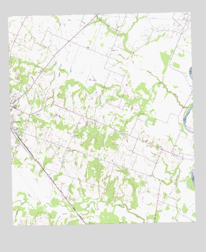
Burleigh, TX USGS Topographic Map
Click on map above to begin viewing in our Map Viewer.

This topographic map contains these locations and features:
Feature Name Type Latitude Longitude GNIS ID View Map
Abel CemeteryCemeteryN29.8958°W96.2111°1350848View Map
Bellville City ParkParkN29.9486°W96.2461°2028838View Map
Bellville DivisionCivilN29.9919°W96.2383°1938525View Map
Bellville YardsLocaleN29.9291°W96.2458°1351854View Map
Boggy CreekStreamN29.8877°W96.2189°1352578View Map
BurleighPopulated PlaceN29.9197°W96.1502°1379480View Map
City ParkParkN29.9488°W96.2464°2028606View Map
Clear CreekStreamN29.8825°W96.2102°1373128View Map
Clear CreekStreamN29.9705°W96.2189°1373129View Map
Constance CreekStreamN29.8891°W96.2308°1329124View Map
Coshatte Agricultural Society HallLocaleN29.9191°W96.2114°1355038View Map
Coshatte CemeteryCemeteryN29.9274°W96.2066°1355039View Map
Deadman CreekStreamN29.8752°W96.1719°1373361View Map
Dethloff CemeteryCemeteryN29.8999°W96.2158°1355943View Map
Dry CreekStreamN29.9488°W96.1516°1356296View Map
Grant SchoolSchoolN29.9241°W96.1586°1358280View Map
Grants ChapelChurchN29.9799°W96.1950°1358283View Map
Grawunder FieldAirportN29.9433°W96.2460°1386238View Map
Holtz CemeteryCemeteryN29.8972°W96.1591°1359466View Map
Ives CreekStreamN29.9586°W96.1469°1372164View Map
Ivys Creek CemeteryCemeteryN29.9794°W96.1791°1360056View Map
Menke CemeteryCemeteryN29.9355°W96.2039°1362621View Map
Muddy BranchStreamN29.9966°W96.1875°1372186View Map
Oak Knoll CemeteryCemeteryN29.9441°W96.2497°1364294View Map
Pilgrims Rest CemeteryCemeteryN29.9366°W96.1925°1365232View Map
Pilgrims Rest CemeteryCemeteryN29.9511°W96.2283°1365233View Map
Piney CreekStreamN29.9427°W96.1280°1375470View Map
Piney SchoolSchoolN29.9288°W96.1736°1365325View Map
Pleasant Grove ChurchChurchN29.9783°W96.1797°1365405View Map
Racoon Bend Oil FieldOilfieldN29.9916°W96.1311°1375609View Map
Saint Paul ChurchChurchN29.9155°W96.1388°1367292View Map
Truvine ChurchChurchN29.9224°W96.1555°1370173View Map

Note: Coordinates in the location and feature list above are referenced to NAD83 datum.


Copyright (C) 2008-2024 Ryan Niemi / Sunset Dynamics ... All Rights Reserved