TopoQuest Logo
Do you find TopoQuest useful?
Help keep TopoQuest running and adding new maps/features by donating!
Bitcoin:  19c7KJd3qBynnjoSw5npx9KScwjBe4ifkT
Litecoin:  LXs6TkuXGGXo1vDsWCkWVdjQX94eUKd6ui
Home View Maps Find Maps Find Places Resources & Links


Henson Springs, Alabama Topographic Map

USGS Map Title: Henson Springs, AL
USGS Map MRC: 34088A1
DRG (GeoTIFF) Download: o34088a1.tif


Neighboring USGS Topographic Map Quads:


  Bexar, AL  
34088B2
 

  Weston, AL  
34088B1
 

  Hamilton, AL  
34087B8
 

  Detroit, AL  
34088A2
 

  Henson Springs, AL  
34088A1
 

  Hamilton SW, AL  
34087A8
 

  Sulligent, AL  
33088H2
 

  Beaverton, AL  
33088H1
 

  Guin, AL  
33087H8


Map MRC Location:

N35°
W89°
N35°
W88°
H8 H7 H6 H5 H4 H3 H2 H1
G8 G7 G6 G5 G4 G3 G2 G1
F8 F7 F6 F5 F4 F3 F2 F1
E8 E7 E6 E5 E4 E3 E2 E1
D8 D7 D6 D5 D4 D3 D2 D1
C8 C7 C6 C5 C4 C3 C2 C1
B8 B7 B6 B5 B4 B3 B2 B1
A8 A7 A6 A5 A4 A3 A2 A1
N34°
W89°
N34°
W88°

Henson Springs, AL USGS 1:24K Topographic Map Preview:
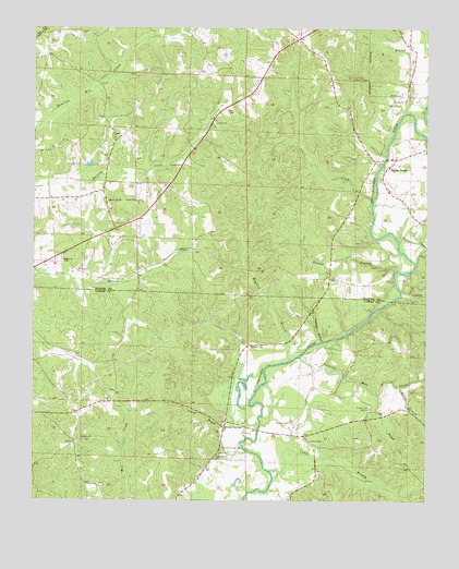
Henson Springs, AL USGS Topographic Map
Click on map above to begin viewing in our Map Viewer.

This topographic map contains these locations and features:
Feature Name Type Latitude Longitude GNIS ID View Map
Ballard CemeteryCemeteryN34.0632°W88.1156°137926View Map
Ballard Freewill Baptist ChurchChurchN34.0637°W88.1159°113423View Map
Bishop CemeteryCemeteryN34.1245°W88.0100°137937View Map
Camp BranchStreamN34.0079°W88.0492°115447View Map
Cantrell BranchStreamN34.0420°W88.0331°115596View Map
Cantrell CemeteryCemeteryN34.0254°W88.0172°158804View Map
Cantrell Family CemeteryCemeteryN34.0562°W88.0320°154516View Map
Cantrell Mill CreekStreamN34.0384°W88.0403°115598View Map
Carter CemeteryCemeteryN34.1032°W88.0628°115664View Map
Carter Methodist ChurchChurchN34.1032°W88.0611°137947View Map
Cedar Grove ChurchChurchN34.0112°W88.0664°115791View Map
Clark CreekStreamN34.0801°W88.0173°116178View Map
Cobtown ChurchChurchN34.0409°W88.0561°116333View Map
Cooper CemeteryCemeteryN34.0934°W88.1009°137958View Map
Cooper Freewill Baptist ChurchChurchN34.0957°W88.0998°116581View Map
Crump BranchStreamN34.0145°W88.0581°116932View Map
Crump CemeteryCemeteryN34.0129°W88.0647°159033View Map
Dugan CreekStreamN34.0684°W88.0089°154451View Map
Duncan BranchStreamN34.0615°W88.0095°117658View Map
East Detroit Oil and Gas FieldOilfieldN34.0334°W88.1098°154856View Map
Eli BranchStreamN34.0284°W88.0150°117918View Map
Estill BranchStreamN34.0304°W88.0078°118041View Map
Evins Ferry (historical)CrossingN34.0187°W88.0536°132773View Map
Fulton BridgePopulated PlaceN34.0884°W88.0123°118755View Map
Fulton Bridge CemeteryCemeteryN34.0876°W88.0120°137975View Map
Fulton Bridge Missionary Baptist ChurchChurchN34.0882°W88.0120°137976View Map
Henson CemeteryCemeteryN34.0207°W88.0431°158841View Map
Henson SpringSpringN34.0190°W88.0648°149429View Map
Henson SpringsPopulated PlaceN34.0193°W88.0642°158842View Map
Henson Springs CemeteryCemeteryN34.0143°W88.0650°119989View Map
Henson Springs Fire DepartmentBuildingN34.0125°W88.0660°2683316View Map
Henson Springs Oil FieldOilfieldN34.0176°W88.0484°154852View Map
Liberty CemeteryCemeteryN34.0162°W88.1089°158449View Map
Liberty ChurchChurchN34.0168°W88.1092°121557View Map
Mayfield BranchStreamN34.0370°W88.0436°122421View Map
Metcalf Ferry (historical)CrossingN34.0384°W88.0398°132788View Map
Mount Joy ChurchChurchN34.0793°W88.1017°123235View Map
Sell BranchStreamN34.1026°W88.0070°126533View Map
Town Hill Lookout TowerTowerN34.1123°W88.0248°164428View Map
Union ChapelChurchN34.0159°W88.0364°128273View Map
Webb ChurchChurchN34.0243°W88.0173°128682View Map

Note: Coordinates in the location and feature list above are referenced to NAD83 datum.


Copyright (C) 2008-2025 Ryan Niemi / Sunset Dynamics ... All Rights Reserved