TopoQuest Logo
Do you find TopoQuest useful?
Help keep TopoQuest running and adding new maps/features by donating!
Bitcoin:  19c7KJd3qBynnjoSw5npx9KScwjBe4ifkT
Litecoin:  LXs6TkuXGGXo1vDsWCkWVdjQX94eUKd6ui
Home View Maps Find Maps Find Places Resources & Links


Detroit, Alabama Topographic Map

USGS Map Title: Detroit, AL
USGS Map MRC: 34088A2
DRG (GeoTIFF) Download: o34088a2.tif


Neighboring USGS Topographic Map Quads:


  Tremont, MS  
34088B3
 

  Bexar, AL  
34088B2
 

  Weston, AL  
34088B1
 

  Turon, MS  
34088A3
 

  Detroit, AL  
34088A2
 

  Henson Springs, AL  
34088A1
 

  Greenwood Springs, MS  
33088H3
 

  Sulligent, AL  
33088H2
 

  Beaverton, AL  
33088H1


Map MRC Location:

N35°
W89°
N35°
W88°
H8 H7 H6 H5 H4 H3 H2 H1
G8 G7 G6 G5 G4 G3 G2 G1
F8 F7 F6 F5 F4 F3 F2 F1
E8 E7 E6 E5 E4 E3 E2 E1
D8 D7 D6 D5 D4 D3 D2 D1
C8 C7 C6 C5 C4 C3 C2 C1
B8 B7 B6 B5 B4 B3 B2 B1
A8 A7 A6 A5 A4 A3 A2 A1
N34°
W89°
N34°
W88°

Detroit, AL USGS 1:24K Topographic Map Preview:
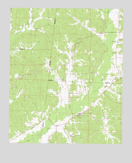
Detroit, AL USGS Topographic Map
Click on map above to begin viewing in our Map Viewer.

This topographic map contains these locations and features:
Feature Name Type Latitude Longitude GNIS ID View Map
Allman ChapelChurchN34.0065°W88.1814°113038View Map
Aston BranchStreamN34.0643°W88.1456°113265View Map
Barnesville CreekStreamN34.1218°W88.1414°113499View Map
Bluegut CreekStreamN34.0915°W88.1425°114599View Map
ByrdPopulated PlaceN34.0798°W88.1323°163214View Map
Byrd Junior High SchoolSchoolN34.0948°W88.1309°165370View Map
Carter CemeteryCemeteryN34.0237°W88.1814°115663View Map
DetroitPopulated PlaceN34.0282°W88.1700°117242View Map
Detroit ChurchChurchN34.0601°W88.1336°117243View Map
Detroit Elementary SchoolSchoolN34.0295°W88.1675°132770View Map
Detroit Fire and RescueBuildingN34.0278°W88.1734°2682667View Map
Detroit Post OfficePost OfficeN34.0315°W88.1628°166645View Map
Dry CreekStreamN34.0262°W88.1967°117542View Map
Dry CreekStreamN34.1204°W88.1428°117583View Map
Factory CreekStreamN34.0782°W88.1395°118101View Map
Friendship North Baptist ChurchChurchN34.0593°W88.1906°118717View Map
Friendship North CemeteryCemeteryN34.0587°W88.1889°137974View Map
Hamilton Mill CreekStreamN34.0929°W88.1398°119641View Map
Holligan and Moore CemeteryCemeteryN34.1023°W88.1289°137994View Map
Kingsville ChurchChurchN34.0532°W88.1417°121240View Map
Liberty Grove ChurchChurchN34.1101°W88.2317°672461View Map
Little Dry CreekStreamN34.0407°W88.1917°121781View Map
New Macedonia ChurchChurchN34.0082°W88.1756°123865View Map
Northington BranchStreamN34.0151°W88.2048°124024View Map
Old Thompson-Centrell CemeteryCemeteryN34.0879°W88.1500°138041View Map
Pleasant Site CemeteryCemeteryN34.0976°W88.1695°138051View Map
Pleasant Site Freewill Baptist ChurchChurchN34.0973°W88.1714°153011View Map
Reedy BranchStreamN34.0307°W88.1764°125527View Map
Riggans CemeteryCemeteryN34.0668°W88.2075°676663View Map
Rocky BranchStreamN34.0457°W88.1642°125805View Map
Rudicell CemeteryCemeteryN34.1176°W88.1275°138061View Map
Shelton CemeteryCemeteryN34.0840°W88.1845°138063View Map
Thompson CemeteryCemeteryN34.0698°W88.1303°138075View Map
Thompson CemeteryCemeteryN34.0157°W88.2231°678697View Map
Town of DetroitCivilN34.0274°W88.1678°2406377View Map
West Detroit Gas FieldOilfieldN34.0232°W88.1778°154850View Map

Note: Coordinates in the location and feature list above are referenced to NAD83 datum.


Copyright (C) 2008-2025 Ryan Niemi / Sunset Dynamics ... All Rights Reserved