TopoQuest Logo
Do you find TopoQuest useful?
Help keep TopoQuest running and adding new maps/features by donating!
Bitcoin:  19c7KJd3qBynnjoSw5npx9KScwjBe4ifkT
Litecoin:  LXs6TkuXGGXo1vDsWCkWVdjQX94eUKd6ui
Home View Maps Find Maps Find Places Resources & Links


La Prele Reservoir, Wyoming Topographic Map

USGS Map Title: La Prele Reservoir, WY
USGS Map MRC: 42105F5
DRG (GeoTIFF) Download: o42105f5.tif


Neighboring USGS Topographic Map Quads:


  Careyhurst, WY  
42105G6
 

  Orpha, WY  
42105G5
 

  Douglas, WY  
42105G4
 

  Hermit Rock, WY  
42105F6
 

  La Prele Reservoir, WY  
42105F5
 

  Chalk Buttes, WY  
42105F4
 

  Blue Nose Creek, WY  
42105E6
 

  Maneater Creek, WY  
42105E5
 

  Poison Lake, WY  
42105E4


Map MRC Location:

N43°
W106°
N43°
W105°
H8 H7 H6 H5 H4 H3 H2 H1
G8 G7 G6 G5 G4 G3 G2 G1
F8 F7 F6 F5 F4 F3 F2 F1
E8 E7 E6 E5 E4 E3 E2 E1
D8 D7 D6 D5 D4 D3 D2 D1
C8 C7 C6 C5 C4 C3 C2 C1
B8 B7 B6 B5 B4 B3 B2 B1
A8 A7 A6 A5 A4 A3 A2 A1
N42°
W106°
N42°
W105°

La Prele Reservoir, WY USGS 1:24K Topographic Map Preview:
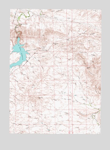
La Prele Reservoir, WY USGS Topographic Map
Click on map above to begin viewing in our Map Viewer.

This topographic map contains these locations and features:
Feature Name Type Latitude Longitude GNIS ID View Map
Ayres Natural BridgeArchN42.7343°W105.6123°1679050View Map
Buckshot CreekStreamN42.7052°W105.6233°1586036View Map
Bulls RunStreamN42.6911°W105.6117°1586125View Map
Center Realty Reservoir Number 1ReservoirN42.6283°W105.5689°1609021View Map
Center Realty Reservoir Number 1 DamDamN42.6283°W105.5689°1609020View Map
Curtis CreekStreamN42.6969°W105.6000°1587298View Map
Dull Knife CreekStreamN42.7041°W105.5980°1587910View Map
Harris CreekStreamN42.7086°W105.5983°1589332View Map
Hazenville PassGapN42.7152°W105.5655°1589448View Map
Johnson DrawValleyN42.6536°W105.5142°1590161View Map
Johnson Mailbox HillSummitN42.7089°W105.5733°1590180View Map
KATH-FM (Douglas)TowerN42.7283°W105.5300°1608917View Map
King CreekStreamN42.6405°W105.5089°1590353View Map
Krazier CreekStreamN42.6408°W105.5097°1590417View Map
La Prele DamDamN42.7166°W105.6139°1605899View Map
La Prele ReservoirReservoirN42.7035°W105.6053°1590448View Map
Loco DrawValleyN42.6450°W105.5411°1590914View Map
Middle Fork King CreekStreamN42.6333°W105.5947°1591531View Map
Nine Mile HillSummitN42.7252°W105.5142°1592044View Map
North Fork King CreekStreamN42.6364°W105.5828°1592186View Map
Rattlesnake HillSummitN42.6444°W105.5244°1593195View Map
Sand CreekStreamN42.7480°W105.5983°1593832View Map
Schofield PassGapN42.6916°W105.5208°1593998View Map
Sheep CreekStreamN42.6494°W105.5019°1594184View Map
South Fork King CreekStreamN42.6364°W105.5828°1603148View Map
Stinson HillSlopeN42.7052°W105.5861°1597510View Map
Tomahawk DrawValleyN42.6852°W105.6239°1595619View Map
Tomahawk PeakSummitN42.6608°W105.5861°1595621View Map
Whitaker DrawValleyN42.6680°W105.5250°1596295View Map
Willow SpringSpringN42.7194°W105.5444°1596477View Map
Wilson DrawValleyN42.6572°W105.5328°1596496View Map
Wilson Number 1 DamDamN42.6500°W105.5089°1608054View Map
Wilson Number 1 ReservoirReservoirN42.6500°W105.5089°1608055View Map

Note: Coordinates in the location and feature list above are referenced to NAD83 datum.


Copyright (C) 2008-2024 Ryan Niemi / Sunset Dynamics ... All Rights Reserved