TopoQuest Logo
Do you find TopoQuest useful?
Help keep TopoQuest running and adding new maps/features by donating!
Bitcoin:  19c7KJd3qBynnjoSw5npx9KScwjBe4ifkT
Litecoin:  LXs6TkuXGGXo1vDsWCkWVdjQX94eUKd6ui
Home View Maps Find Maps Find Places Resources & Links


Pierrepont, New York Topographic Map

USGS Map Title: Pierrepont, NY
USGS Map MRC: 44075E1
DRG (GeoTIFF) Download: o44075e1.tif


Neighboring USGS Topographic Map Quads:


  Morley, NY  
44075F2
 

  West Potsdam, NY  
44075F1
 

  Potsdam, NY  
44074F8
 

  Canton, NY  
44075E2
 

  Pierrepont, NY  
44075E1
 

  Colton, NY  
44074E8
 

  Hermon, NY  
44075D2
 

  West Pierrepont, NY  
44075D1
 

  Albert Marsh, NY  
44074D8


Map MRC Location:

N45°
W76°
N45°
W75°
H8 H7 H6 H5 H4 H3 H2 H1
G8 G7 G6 G5 G4 G3 G2 G1
F8 F7 F6 F5 F4 F3 F2 F1
E8 E7 E6 E5 E4 E3 E2 E1
D8 D7 D6 D5 D4 D3 D2 D1
C8 C7 C6 C5 C4 C3 C2 C1
B8 B7 B6 B5 B4 B3 B2 B1
A8 A7 A6 A5 A4 A3 A2 A1
N44°
W76°
N44°
W75°

Pierrepont, NY USGS 1:24K Topographic Map Preview:
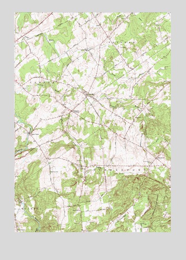
Pierrepont, NY USGS Topographic Map
Click on map above to begin viewing in our Map Viewer.

This topographic map contains these locations and features:
Feature Name Type Latitude Longitude GNIS ID View Map
Baldwin BranchStreamN44.5023°W75.1063°977209View Map
Beach Plains ChurchChurchN44.5126°W75.0724°975933View Map
Boyden BrookStreamN44.5759°W75.0866°976008View Map
Brick ChapelLocaleN44.5562°W75.1133°976022View Map
Brick Chapel ChurchChurchN44.5581°W75.1161°2599057View Map
Crary MillsPopulated PlaceN44.5776°W75.0669°976204View Map
Giffins Corners SchoolSchoolN44.6031°W75.0663°976345View Map
Langdon CornersLocaleN44.5692°W75.0791°976531View Map
Leet CemeteryCemeteryN44.6219°W75.0361°976538View Map
Leonard BrookStreamN44.5670°W75.0205°976541View Map
Maple Leaf FarmLocaleN44.5108°W75.0622°2559376View Map
North RussellPopulated PlaceN44.5026°W75.1227°976738View Map
Pierrepoint Volunteer Fire CompanyBuildingN44.5379°W75.0098°2718687View Map
PierrepontPopulated PlaceN44.5423°W75.0119°976811View Map
Pierrepont Hill CemeteryCemeteryN44.5401°W75.0166°976812View Map
Taylor CreekStreamN44.5048°W75.0246°977099View Map
Town of PierrepontCivilN44.5282°W75.0137°979365View Map
Waterman HillSummitN44.5345°W75.0966°977189View Map
White Church CemeteryCemeteryN44.5739°W75.0385°977268View Map
WSLU-FM (Canton)TowerN44.5337°W75.0969°977704View Map
WVNC-FM (Canton)TowerN44.5337°W75.0969°977703View Map

Note: Coordinates in the location and feature list above are referenced to NAD83 datum.


Copyright (C) 2008-2024 Ryan Niemi / Sunset Dynamics ... All Rights Reserved