TopoQuest Logo
Do you find TopoQuest useful?
Help keep TopoQuest running and adding new maps/features by donating!
Bitcoin:  19c7KJd3qBynnjoSw5npx9KScwjBe4ifkT
Litecoin:  LXs6TkuXGGXo1vDsWCkWVdjQX94eUKd6ui
Home View Maps Find Maps Find Places Resources & Links


High Market, New York Topographic Map

USGS Map Title: High Market, NY
USGS Map MRC: 43075E5
DRG (GeoTIFF) Download: o43075e5.tif


Neighboring USGS Topographic Map Quads:


  Sears Pond, NY  
43075F6
 

  Page, NY  
43075F5
 

  Glenfield, NY  
43075F4
 

  North Osceola, NY  
43075E6
 

  High Market, NY  
43075E5
 

  Constableville, NY  
43075E4
 

  Florence, NY  
43075D6
 

  Point Rock, NY  
43075D5
 

  West Leyden, NY  
43075D4


Map MRC Location:

N44°
W76°
N44°
W75°
H8 H7 H6 H5 H4 H3 H2 H1
G8 G7 G6 G5 G4 G3 G2 G1
F8 F7 F6 F5 F4 F3 F2 F1
E8 E7 E6 E5 E4 E3 E2 E1
D8 D7 D6 D5 D4 D3 D2 D1
C8 C7 C6 C5 C4 C3 C2 C1
B8 B7 B6 B5 B4 B3 B2 B1
A8 A7 A6 A5 A4 A3 A2 A1
N43°
W76°
N43°
W75°

High Market, NY USGS 1:24K Topographic Map Preview:
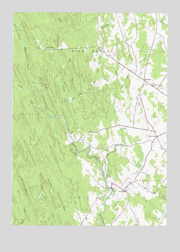
High Market, NY USGS Topographic Map
Click on map above to begin viewing in our Map Viewer.

This topographic map contains these locations and features:
Feature Name Type Latitude Longitude GNIS ID View Map
Alder CreekStreamN43.5276°W75.5502°942282View Map
Byron CornersLocaleN43.5526°W75.5082°945406View Map
Dirreen CreekStreamN43.5637°W75.5855°948472View Map
Fish CreekPopulated PlaceN43.5203°W75.5332°972472View Map
High MarketLocaleN43.5856°W75.5191°952743View Map
Kelly CreekStreamN43.5756°W75.5427°954474View Map
Little Alder CreekStreamN43.5570°W75.5380°955444View Map
Michigan MillsPopulated PlaceN43.6037°W75.5974°972796View Map
Moore Meadow StreamStreamN43.5740°W75.5774°957599View Map
Pringle CreekStreamN43.5534°W75.5785°961144View Map
Roaring BrookStreamN43.5684°W75.5991°962635View Map
School Number 5 (historical)SchoolN43.5525°W75.5078°2106091View Map
School Number 6 (historical)SchoolN43.5828°W75.5127°975511View Map
School Number 9 (historical)SchoolN43.5501°W75.5680°975661View Map
Sevenmile CreekStreamN43.6237°W75.6210°964865View Map
Sixmile CreekStreamN43.6140°W75.6188°965327View Map
Sucker BrookStreamN43.5573°W75.5330°969306View Map
Town of West TurinCivilN43.5941°W75.5099°979628View Map

Note: Coordinates in the location and feature list above are referenced to NAD83 datum.


Copyright (C) 2008-2025 Ryan Niemi / Sunset Dynamics ... All Rights Reserved