TopoQuest Logo
Do you find TopoQuest useful?
Help keep TopoQuest running and adding new maps/features by donating!
Bitcoin:  19c7KJd3qBynnjoSw5npx9KScwjBe4ifkT
Litecoin:  LXs6TkuXGGXo1vDsWCkWVdjQX94eUKd6ui
Home View Maps Find Maps Find Places Resources & Links


Hilgard Mountain, Utah Topographic Map

USGS Map Title: Hilgard Mountain, UT
USGS Map MRC: 38111F5
DRG (GeoTIFF) Download: o38111f5.tif


Neighboring USGS Topographic Map Quads:


  Gooseberry Creek, UT  
38111G6
 

  Yogo Creek, UT  
38111G5
 

  Old Woman Plateau, UT  
38111G4
 

  Mount Terrill, UT  
38111F6
 

  Hilgard Mountain, UT  
38111F5
 

  Johns Peak, UT  
38111F4
 

  Fish Lake, UT  
38111E6
 

  Forsyth Reservoir, UT  
38111E5
 

  Geyser Peak, UT  
38111E4


Map MRC Location:

N39°
W112°
N39°
W111°
H8 H7 H6 H5 H4 H3 H2 H1
G8 G7 G6 G5 G4 G3 G2 G1
F8 F7 F6 F5 F4 F3 F2 F1
E8 E7 E6 E5 E4 E3 E2 E1
D8 D7 D6 D5 D4 D3 D2 D1
C8 C7 C6 C5 C4 C3 C2 C1
B8 B7 B6 B5 B4 B3 B2 B1
A8 A7 A6 A5 A4 A3 A2 A1
N38°
W112°
N38°
W111°

Hilgard Mountain, UT USGS 1:24K Topographic Map Preview:
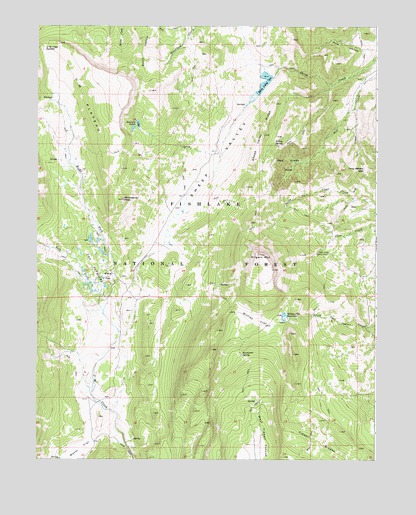
Hilgard Mountain, UT USGS Topographic Map
Click on map above to begin viewing in our Map Viewer.

This topographic map contains these locations and features:
Feature Name Type Latitude Longitude GNIS ID View Map
Black FlatFlatN38.6778°W111.5988°1425660View Map
Clear Creek Guard StationLocaleN38.6847°W111.5180°1426700View Map
Emerald LakesLakeN38.7205°W111.5900°1427815View Map
Great Western TrailTrailN38.6450°W111.5010°1454981View Map
Hilgard MountainSummitN38.6841°W111.5438°1428715View Map
Left Fork U M CreekStreamN38.6678°W111.6007°1442538View Map
Pole HollowValleyN38.7430°W111.5010°1431386View Map
Porcupine SpringSpringN38.6556°W111.5499°1431418View Map
Red Creek HoleBasinN38.7105°W111.5307°1431634View Map
Right Fork U M CreekStreamN38.6678°W111.6007°1431816View Map
Sheep ValleyValleyN38.7372°W111.5377°1432388View Map
Sheep Valley DamDamN38.7350°W111.5391°1434711View Map
Sheep Valley ReservoirReservoirN38.7331°W111.5420°1434710View Map
Sheep Valley RidgeRidgeN38.7186°W111.5419°1432389View Map
The PotholesLakeN38.6842°W111.6035°1433406View Map
U M PlateauPlainN38.7264°W111.6044°1451157View Map
U M Yogo SaddleGapN38.7444°W111.6224°1433768View Map
Water FlatFlatN38.6280°W111.6085°1447047View Map
Willies FlatFlatN38.6655°W111.5446°1434301View Map
Willies Flat ReservoirReservoirN38.6664°W111.5342°1434302View Map
Willow SpringSpringN38.7159°W111.5379°1434348View Map
Windstorm PeakSummitN38.7000°W111.5935°1434395View Map
Yens Peters GapGapN38.7089°W111.5052°1434511View Map

Note: Coordinates in the location and feature list above are referenced to NAD83 datum.


Copyright (C) 2008-2025 Ryan Niemi / Sunset Dynamics ... All Rights Reserved