TopoQuest Logo
Do you find TopoQuest useful?
Help keep TopoQuest running and adding new maps/features by donating!
Bitcoin:  19c7KJd3qBynnjoSw5npx9KScwjBe4ifkT
Litecoin:  LXs6TkuXGGXo1vDsWCkWVdjQX94eUKd6ui
Home View Maps Find Maps Find Places Resources & Links


Hiwassee, Virginia Topographic Map

USGS Map Title: Hiwassee, VA
USGS Map MRC: 36080H6
DRG (GeoTIFF) Download: o36080h6.tif


Neighboring USGS Topographic Map Quads:


  Pulaski, VA  
37080A7
 

  Dublin, VA  
37080A6
 

  Radford South, VA  
37080A5
 

  Fosters Falls, VA  
36080H7
 

  Hiwassee, VA  
36080H6
 

  Indian Valley, VA  
36080H5
 

  Sylvatus, VA  
36080G7
 

  Hillsville, VA  
36080G6
 

  Dugspur, VA  
36080G5


Map MRC Location:

N37°
W81°
N37°
W80°
H8 H7 H6 H5 H4 H3 H2 H1
G8 G7 G6 G5 G4 G3 G2 G1
F8 F7 F6 F5 F4 F3 F2 F1
E8 E7 E6 E5 E4 E3 E2 E1
D8 D7 D6 D5 D4 D3 D2 D1
C8 C7 C6 C5 C4 C3 C2 C1
B8 B7 B6 B5 B4 B3 B2 B1
A8 A7 A6 A5 A4 A3 A2 A1
N36°
W81°
N36°
W80°

Hiwassee, VA USGS 1:24K Topographic Map Preview:
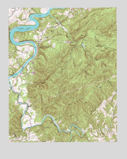
Hiwassee, VA USGS Topographic Map
Click on map above to begin viewing in our Map Viewer.

This topographic map contains these locations and features:
Feature Name Type Latitude Longitude GNIS ID View Map
AllisoniaPopulated PlaceN36.9393°W80.7362°1495189View Map
Allisonia Census Designated PlaceCensusN36.9342°W80.7255°2584796View Map
Allisonia Methodist ChurchChurchN36.9396°W80.7362°1690078View Map
Bark Camp BranchStreamN36.9521°W80.6540°1462783View Map
Bear KnobSummitN36.9121°W80.6631°1495243View Map
Bethel ChurchChurchN36.9673°W80.7148°1463166View Map
Big BranchStreamN36.8832°W80.6634°1463326View Map
Big Macks CreekStreamN36.9940°W80.7026°1463379View Map
Big Reed Island CreekStreamN36.9340°W80.7495°1463393View Map
Brannom BranchStreamN36.8948°W80.6976°1463769View Map
Brannom KnobSummitN36.9093°W80.6806°1495293View Map
Bullard KnobSummitN36.9260°W80.6462°1495331View Map
Chestnut KnobSummitN36.8996°W80.6795°1464827View Map
Chimney BranchStreamN36.9712°W80.6628°1464851View Map
Chimney MountainSummitN36.9821°W80.6587°1464852View Map
Chimney RockSummitN36.9754°W80.6659°1464855View Map
Cove BranchStreamN36.9429°W80.6620°1465323View Map
Dead Pine MountainSummitN36.9293°W80.6809°1495458View Map
Deepwater CreekStreamN36.8871°W80.6340°1465721View Map
Draper Slaughter ChapelChurchN36.9976°W80.7426°1465947View Map
Dry BranchStreamN36.9204°W80.7376°1465975View Map
Dry Pond CemeteryCemeteryN36.8757°W80.6973°1738667View Map
Dry Pond ChurchChurchN36.8754°W80.6967°1466004View Map
Fall BranchStreamN36.8918°W80.6745°1466440View Map
Farris Mines ChurchChurchN36.9087°W80.7273°1466502View Map
First MountainSummitN36.9912°W80.6590°1466590View Map
Greasy CreekStreamN36.8832°W80.6634°1467419View Map
High Knoll MountainSummitN36.9790°W80.6337°1468012View Map
HiwasseePopulated PlaceN36.9687°W80.7137°1495697View Map
Hiwassee Census Designated PlaceCensusN36.9683°W80.7045°2584857View Map
Hiwassee ChurchChurchN36.9721°W80.7070°1468077View Map
Hiwassee Post OfficePost OfficeN36.9702°W80.7127°2780321View Map
Hiwassee Volunteer Fire DepartmentBuildingN36.9693°W80.7140°2721203View Map
Hurst CemeteryCemeteryN36.9865°W80.7003°1468430View Map
Irish MountainSummitN36.9376°W80.7042°1468514View Map
Jersey RidgeRidgeN36.9623°W80.6640°1468695View Map
Jimmy Marshall CemeteryCemeteryN36.8757°W80.6337°1738748View Map
Lake PowhatanReservoirN36.9654°W80.6643°1490773View Map
Lake Powhatan DamDamN36.9651°W80.6648°1490772View Map
Little Irish MountainSummitN36.9735°W80.6959°1469571View Map
Little Macks CreekStreamN36.9676°W80.6765°1469587View Map
Little Reed Island CreekStreamN36.9318°W80.7495°1484962View Map
Locust Thicket MountainSummitN36.9585°W80.6409°1495860View Map
Mack Creek VillagePopulated PlaceN36.9854°W80.6901°1469992View Map
Macks MountainSummitN36.9260°W80.6462°1469994View Map
Maple BranchStreamN36.9768°W80.6809°1470063View Map
Marshall CemeteryCemeteryN36.8843°W80.6637°1738787View Map
Marshall CemeteryCemeteryN36.8790°W80.7270°1738792View Map
Matheny HollowValleyN36.9629°W80.6335°1474245View Map
New Bethel ChurchChurchN36.9968°W80.7431°1471393View Map
New River ChurchChurchN36.9993°W80.6570°1471492View Map
Ore KnobSummitN36.8932°W80.7026°1496050View Map
Panther CreekStreamN36.8851°W80.6440°1472043View Map
Phillips CemeteryCemeteryN36.8848°W80.6267°1738856View Map
Pilgrims Rest ChurchChurchN36.9587°W80.7295°1472314View Map
Powhatan CampLocaleN36.9640°W80.6620°1472753View Map
Puncheoncamp BranchStreamN36.9518°W80.6440°1472865View Map
Reed Island ChurchChurchN36.8965°W80.7248°1473090View Map
Regional EMS - Hiwassee BaseBuildingN36.9694°W80.7140°2721176View Map
Rich Hill School (historical)SchoolN36.9246°W80.7467°1501478View Map
Rigney SpringSpringN36.9646°W80.6462°1473228View Map
Rock CreekStreamN36.8990°W80.7078°1473360View Map
Rustin HollowValleyN36.8917°W80.7124°1473661View Map
Shelton Chapel (historical)ChurchN36.9015°W80.6292°1738892View Map
Simpkins CemeteryCemeteryN36.9096°W80.6434°1738900View Map
Sloan BranchStreamN36.9885°W80.7251°1487321View Map
Smith CemeteryCemeteryN36.8793°W80.6462°1738902View Map
Spencer BranchStreamN36.9640°W80.7184°1474936View Map
Stony MountainSummitN36.9785°W80.7015°1496269View Map
TinytownPopulated PlaceN36.9821°W80.6965°1475737View Map
White BranchStreamN36.8904°W80.6542°1476577View Map
White Oak Camp BranchStreamN36.9787°W80.6551°1476598View Map
White Oak FlatsFlatN36.9629°W80.6370°1476608View Map

Note: Coordinates in the location and feature list above are referenced to NAD83 datum.


Copyright (C) 2008-2024 Ryan Niemi / Sunset Dynamics ... All Rights Reserved