TopoQuest Logo
Do you find TopoQuest useful?
Help keep TopoQuest running and adding new maps/features by donating!
Bitcoin:  19c7KJd3qBynnjoSw5npx9KScwjBe4ifkT
Litecoin:  LXs6TkuXGGXo1vDsWCkWVdjQX94eUKd6ui
Home View Maps Find Maps Find Places Resources & Links


Hillsville, Virginia Topographic Map

USGS Map Title: Hillsville, VA
USGS Map MRC: 36080G6
DRG (GeoTIFF) Download: o36080g6.tif


Neighboring USGS Topographic Map Quads:


  Fosters Falls, VA  
36080H7
 

  Hiwassee, VA  
36080H6
 

  Indian Valley, VA  
36080H5
 

  Sylvatus, VA  
36080G7
 

  Hillsville, VA  
36080G6
 

  Dugspur, VA  
36080G5
 

  Woodlawn, VA  
36080F7
 

  Fancy Gap, VA  
36080F6
 

  Laurel Fork, VA  
36080F5


Map MRC Location:

N37°
W81°
N37°
W80°
H8 H7 H6 H5 H4 H3 H2 H1
G8 G7 G6 G5 G4 G3 G2 G1
F8 F7 F6 F5 F4 F3 F2 F1
E8 E7 E6 E5 E4 E3 E2 E1
D8 D7 D6 D5 D4 D3 D2 D1
C8 C7 C6 C5 C4 C3 C2 C1
B8 B7 B6 B5 B4 B3 B2 B1
A8 A7 A6 A5 A4 A3 A2 A1
N36°
W81°
N36°
W80°

Hillsville, VA USGS 1:24K Topographic Map Preview:
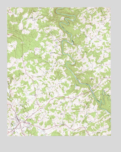
Hillsville, VA USGS Topographic Map
Click on map above to begin viewing in our Map Viewer.

This topographic map contains these locations and features:
Feature Name Type Latitude Longitude GNIS ID View Map
Alderman CemeteryCemeteryN36.7626°W80.6562°1462391View Map
Alfred Marshall CemeteryCemeteryN36.8543°W80.6565°1738584View Map
Allison ChapelChurchN36.8437°W80.6898°1462421View Map
Allison Chapel CemeteryCemeteryN36.8437°W80.6898°1738587View Map
Andrew Jennings CemeteryCemeteryN36.8143°W80.6992°1738588View Map
Beaverdam CreekStreamN36.7868°W80.7476°1462958View Map
Bethel ChurchChurchN36.8373°W80.6909°1463165View Map
Bobbitt CemeteryCemeteryN36.7973°W80.6759°1738604View Map
Bobbitt CreekStreamN36.7987°W80.6501°1463624View Map
Branscome CemeteryCemeteryN36.8185°W80.6426°1738614View Map
Buckhorn CreekStreamN36.8293°W80.6817°1464004View Map
Burks ForkStreamN36.7818°W80.6376°1464117View Map
Camp VirginianLocaleN36.7999°W80.6662°1464359View Map
Can Horton CemeteryCemeteryN36.7535°W80.6478°1738622View Map
Carroll County Fire and RescueBuildingN36.7692°W80.7237°2086373View Map
Carroll County High SchoolSchoolN36.7623°W80.7234°1738625View Map
Carroll County Intermediate SchoolSchoolN36.7687°W80.7391°1738725View Map
Carroll County Sheriff's OfficeBuildingN36.7682°W80.7350°2766958View Map
Carter-Wilkerson CemeteryCemeteryN36.7676°W80.7340°1738628View Map
Church Alderman CemeteryCemeteryN36.7604°W80.6751°1738631View Map
Collier School (historical)SchoolN36.7857°W80.6723°1738639View Map
Dalton CemeteryCemeteryN36.7985°W80.6973°1738653View Map
Dalton CemeteryCemeteryN36.8026°W80.6876°1738654View Map
Dalton-Horton CemeteryCemeteryN36.7782°W80.6278°1738656View Map
Davis CemeteryCemeteryN36.8404°W80.6542°1738659View Map
DeHaven CemeteryCemeteryN36.7585°W80.6901°1738660View Map
Dinwiddie CemeteryCemeteryN36.8629°W80.7167°1738664View Map
Dinwiddie ChurchChurchN36.8629°W80.7173°1465814View Map
Easrly Marshall CemeteryCemeteryN36.8521°W80.6426°1738669View Map
Fairview ChurchChurchN36.7551°W80.7051°1466409View Map
Freemont CemeteryCemeteryN36.7612°W80.6831°1738695View Map
Freemont ChurchChurchN36.7612°W80.6823°1466880View Map
Fugate Dalton CemeteryCemeteryN36.8648°W80.6565°1738696View Map
Gallimore-McPeak CemeteryCemeteryN36.8073°W80.6276°1738697View Map
Gardner CemeteryCemeteryN36.7662°W80.7206°1466986View Map
Gardner CemeteryCemeteryN36.7810°W80.7142°1466987View Map
Gardner CemeteryCemeteryN36.8040°W80.6303°1738698View Map
Gilmer ChapelChurchN36.7821°W80.6840°1467106View Map
Goad CemeteryCemeteryN36.7646°W80.6340°1738702View Map
Goad ChurchChurchN36.7632°W80.6506°1467169View Map
Goad School (historical)SchoolN36.7674°W80.6434°1738704View Map
Grassy CreekStreamN36.8065°W80.7476°1467364View Map
Grassy Creek Church (historical)ChurchN36.8260°W80.7320°1738707View Map
Green B Mabry CemeteryCemeteryN36.8293°W80.6337°1738711View Map
Harmony Grove ChurchChurchN36.7565°W80.7431°1467756View Map
HillsvillePopulated PlaceN36.7626°W80.7348°1498493View Map
Hillsville Elementary SchoolSchoolN36.7879°W80.6945°1738724View Map
Hillsville Police DepartmentBuildingN36.7632°W80.7353°2766977View Map
Hillsville Post OfficePost OfficeN36.7575°W80.7339°2766223View Map
Hillsville Volunteer Fire DepartmentBuildingN36.7622°W80.7286°2086377View Map
Horton CemeteryCemeteryN36.7587°W80.6373°1738727View Map
Huffman KnobSummitN36.7712°W80.6862°1495727View Map
Island CreekStreamN36.8185°W80.6790°1468530View Map
Island Creek ChurchChurchN36.7901°W80.7159°1468533View Map
Jennings CemeteryCemeteryN36.8104°W80.6792°1738744View Map
Jennings CemeteryCemeteryN36.7954°W80.7137°1468683View Map
John Patterson Webb CemeteryCemeteryN36.7548°W80.6651°1738753View Map
Largen CemeteryCemeteryN36.7896°W80.6520°1738765View Map
Liberty HillPopulated PlaceN36.8310°W80.6973°1477489View Map
Liberty Hill CemeteryCemeteryN36.8415°W80.6881°1469375View Map
Liberty Hill ChurchChurchN36.8307°W80.6981°1738773View Map
Lindsey-Old Bethesda CemeteryCemeteryN36.8398°W80.6476°1738775View Map
Little Snake CreekStreamN36.7896°W80.6462°1469654View Map
LongshoalLocaleN36.8746°W80.7120°1469849View Map
Longshoal Lookout TowerTowerN36.8712°W80.7192°1491187View Map
Mabry CemeteryCemeteryN36.7857°W80.7248°1738782View Map
Mabry CrossroadsPopulated PlaceN36.7893°W80.7153°1738783View Map
Martin CemeteryCemeteryN36.7882°W80.6712°1738796View Map
Martin Phillips CemeteryCemeteryN36.8726°W80.6659°1738799View Map
Mitchell CrossroadsPopulated PlaceN36.8623°W80.7178°1477545View Map
Montgomery CemeteryCemeteryN36.8690°W80.7434°1738814View Map
Montgomery-Smith CemeteryCemeteryN36.8704°W80.7434°1738816View Map
New Hope ChurchChurchN36.7937°W80.6476°1471433View Map
Newman CemeteryCemeteryN36.8582°W80.6342°1738835View Map
North CemeteryCemeteryN36.7721°W80.7384°1471587View Map
North Prong Buckhorn CreekStreamN36.8198°W80.6942°1471636View Map
OcalaPopulated PlaceN36.8601°W80.6384°1738844View Map
Old Gilmer Chapel CemeteryCemeteryN36.7823°W80.6845°1738845View Map
Panther Creek CemeteryCemeteryN36.8607°W80.6367°1738851View Map
Panther Creek ChurchChurchN36.8604°W80.6370°1472044View Map
Pine CreekStreamN36.8473°W80.6717°1472334View Map
Pine Creek DistrictCivilN36.8423°W80.6959°1927444View Map
Road CreekStreamN36.8385°W80.6709°1473283View Map
Shockley CemeteryCemeteryN36.8110°W80.7281°1474541View Map
South Prong Buckhorn CreekStreamN36.8198°W80.6942°1474884View Map
StarPopulated PlaceN36.8057°W80.7203°1738907View Map
Sutphin CemeteryCemeteryN36.8715°W80.6642°1738915View Map
Theophilus Quesenberry CemeteryCemeteryN36.8296°W80.6353°1738921View Map
Thomas Alderman CemeteryCemeteryN36.7671°W80.6992°1738922View Map
Thomas E Marshall CemeteryCemeteryN36.8618°W80.6570°1738926View Map
Thomas Jennings CemeteryCemeteryN36.8218°W80.6876°1738927View Map
Thompson CemeteryCemeteryN36.8621°W80.6348°1738929View Map
Town of HillsvilleCivilN36.7612°W80.7370°2390249View Map
Watson CemeteryCemeteryN36.7890°W80.7270°1738944View Map
Webb CemeteryCemeteryN36.7768°W80.6470°1476422View Map
Westside ChurchChurchN36.7526°W80.7442°1476534View Map
WHHV-AM (Hillsville)TowerN36.7501°W80.7220°1498940View Map
White CemeteryCemeteryN36.8365°W80.7459°1738950View Map
Wilkinson CemeteryCemeteryN36.7593°W80.7298°1738953View Map
William D Tomkins Memorial BridgeBridgeN36.7951°W80.6487°1738956View Map
Witcher KnobSummitN36.8054°W80.6492°1496429View Map
Worrell CemeteryCemeteryN36.7829°W80.6617°1738966View Map
Worrell CemeteryCemeteryN36.8693°W80.7390°1738967View Map

Note: Coordinates in the location and feature list above are referenced to NAD83 datum.


Copyright (C) 2008-2024 Ryan Niemi / Sunset Dynamics ... All Rights Reserved