TopoQuest Logo
Do you find TopoQuest useful?
Help keep TopoQuest running and adding new maps/features by donating!
Bitcoin:  19c7KJd3qBynnjoSw5npx9KScwjBe4ifkT
Litecoin:  LXs6TkuXGGXo1vDsWCkWVdjQX94eUKd6ui
Home View Maps Find Maps Find Places Resources & Links


Preble, Indiana Topographic Map

USGS Map Title: Preble, IN
USGS Map MRC: 40085G1
DRG (GeoTIFF) Download: o40085g1.tif


Neighboring USGS Topographic Map Quads:


  Ossian, IN  
40085H2
 

  Poe, IN  
40085H1
 

  Hoagland, IN  
40084H8
 

  Uniondale, IN  
40085G2
 

  Preble, IN  
40085G1
 

  Decatur, IN  
40084G8
 

  Bluffton, IN  
40085F2
 

  Linn Grove, IN  
40085F1
 

  Berne, IN  
40084F8


Map MRC Location:

N41°
W86°
N41°
W85°
H8 H7 H6 H5 H4 H3 H2 H1
G8 G7 G6 G5 G4 G3 G2 G1
F8 F7 F6 F5 F4 F3 F2 F1
E8 E7 E6 E5 E4 E3 E2 E1
D8 D7 D6 D5 D4 D3 D2 D1
C8 C7 C6 C5 C4 C3 C2 C1
B8 B7 B6 B5 B4 B3 B2 B1
A8 A7 A6 A5 A4 A3 A2 A1
N40°
W86°
N40°
W85°

Preble, IN USGS 1:24K Topographic Map Preview:
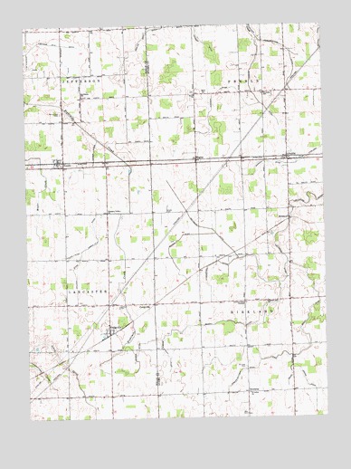
Preble, IN USGS Topographic Map
Click on map above to begin viewing in our Map Viewer.

This topographic map contains these locations and features:
Feature Name Type Latitude Longitude GNIS ID View Map
Adler DitchCanalN40.7653°W85.0152°430022View Map
Berry DitchCanalN40.7712°W85.0086°430852View Map
Bethlehem Lutheran SchoolSchoolN40.8528°W85.1011°430987View Map
Bracht DitchCanalN40.7809°W85.0411°431432View Map
Compro-Wittmer DitchCanalN40.7650°W85.0352°432839View Map
Conrad DitchCanalN40.8078°W85.0602°432899View Map
CraigvillePopulated PlaceN40.7784°W85.0908°433082View Map
CurryvillePopulated PlaceN40.7864°W85.0719°433257View Map
Eightmile Number Four DitchCanalN40.8617°W85.1230°434054View Map
Eightmile Number Three DitchCanalN40.8628°W85.1083°434053View Map
Eightmile Number Two DitchCanalN40.8681°W85.1216°434052View Map
Gallivan DitchCanalN40.7967°W85.1050°434929View Map
Gerber DitchCanalN40.7742°W85.0775°435034View Map
Gerber Joint DitchCanalN40.7703°W85.0666°435035View Map
Heller NurseryBuildingN40.8133°W85.0156°2628478View Map
Henschen DitchCanalN40.7992°W85.0436°436041View Map
HondurasPopulated PlaceN40.7581°W85.0330°436378View Map
Kirkland Bible InstituteSchoolN40.7867°W85.0333°437356View Map
Kutzman DitchCanalN40.8550°W85.0383°437480View Map
MagleyPopulated PlaceN40.8314°W85.0533°438474View Map
Maple CreekStreamN40.8514°W85.1247°438542View Map
Miller DitchCanalN40.8023°W85.1052°439210View Map
Norris DitchCanalN40.7609°W85.0083°440207View Map
Nuenschwander DitchCanalN40.7648°W85.1191°440364View Map
Oakland CemeteryCemeteryN40.7856°W85.0864°440465View Map
PetersonPopulated PlaceN40.8131°W85.0147°441058View Map
Pigeon Number Two DitchCanalN40.8109°W85.0966°441119View Map
Pleasant Dale ChurchChurchN40.7870°W85.0244°441241View Map
Pleasant Valley ChurchChurchN40.8156°W85.0908°441331View Map
Prairie View CemeteryCemeteryN40.8473°W85.1098°441561View Map
PreblePopulated PlaceN40.8323°W85.0147°441572View Map
Preble Volunteer Fire DepartmentBuildingN40.8346°W85.0155°2625677View Map
Saint Lukes CemeteryCemeteryN40.7661°W85.0338°442664View Map
Saint Lukes ChurchChurchN40.7578°W85.0322°442667View Map
Saint Pauls SchoolSchoolN40.8534°W85.0244°442791View Map
Salem CemeteryCemeteryN40.8534°W85.0493°442893View Map
Salem ChurchChurchN40.8531°W85.0536°442922View Map
Shady CemeteryCemeteryN40.8157°W85.0663°443245View Map
Shel-Mar FarmsLocaleN40.7586°W85.0778°2629007View Map
The Lazy K AirportAirportN40.8265°W85.0906°449363View Map
TocsinPopulated PlaceN40.8303°W85.1091°444793View Map
Township of KirklandCivilN40.7876°W85.0335°453526View Map
Township of PrebleCivilN40.8749°W85.0349°453776View Map
Werling Myers DitchCanalN40.8675°W85.0144°445682View Map
Yarger DitchCanalN40.8356°W85.0964°446368View Map
Zion CemeteryCemeteryN40.7512°W85.0333°446445View Map

Note: Coordinates in the location and feature list above are referenced to NAD83 datum.


Copyright (C) 2008-2025 Ryan Niemi / Sunset Dynamics ... All Rights Reserved