TopoQuest Logo
Do you find TopoQuest useful?
Help keep TopoQuest running and adding new maps/features by donating!
Bitcoin:  19c7KJd3qBynnjoSw5npx9KScwjBe4ifkT
Litecoin:  LXs6TkuXGGXo1vDsWCkWVdjQX94eUKd6ui
Home View Maps Find Maps Find Places Resources & Links


Pondville, Alabama Topographic Map

USGS Map Title: Pondville, AL
USGS Map MRC: 32087H3
DRG (GeoTIFF) Download: o32087h3.tif


Neighboring USGS Topographic Map Quads:


  Duncanville, AL  
33087A4
 

  Pearson, AL  
33087A3
 

  West Blocton West, AL  
33087A2
 

  Payne Lake, AL  
32087H4
 

  Pondville, AL  
32087H3
 

  Centreville West, AL  
32087H2
 

  Hogglesville, AL  
32087G4
 

  Heiberger, AL  
32087G3
 

  Harrisburg, AL  
32087G2


Map MRC Location:

N33°
W88°
N33°
W87°
H8 H7 H6 H5 H4 H3 H2 H1
G8 G7 G6 G5 G4 G3 G2 G1
F8 F7 F6 F5 F4 F3 F2 F1
E8 E7 E6 E5 E4 E3 E2 E1
D8 D7 D6 D5 D4 D3 D2 D1
C8 C7 C6 C5 C4 C3 C2 C1
B8 B7 B6 B5 B4 B3 B2 B1
A8 A7 A6 A5 A4 A3 A2 A1
N32°
W88°
N32°
W87°

Pondville, AL USGS 1:24K Topographic Map Preview:
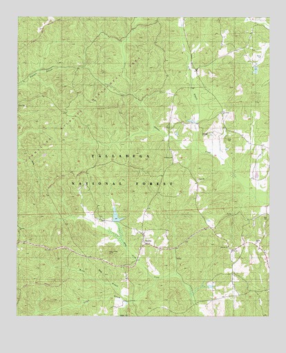
Pondville, AL USGS Topographic Map
Click on map above to begin viewing in our Map Viewer.

This topographic map contains these locations and features:
Feature Name Type Latitude Longitude GNIS ID View Map
Avery CemeteryCemeteryN32.9487°W87.2708°159096View Map
Caddis Lake DamDamN32.9168°W87.3250°161331View Map
Data (historical)Populated PlaceN32.9687°W87.3253°161897View Map
Elam CemeteryCemeteryN32.9162°W87.2505°159562View Map
Eoline Volunteer Fire Department Station 2BuildingN32.9842°W87.2607°2683116View Map
Friendship CemeteryCemeteryN32.9446°W87.2992°150989View Map
Friendship ChurchChurchN32.9412°W87.2983°159632View Map
Kornegay LakeReservoirN32.9685°W87.2550°161333View Map
Kornegay Lake DamDamN32.9685°W87.2550°161332View Map
Lake PonderosaReservoirN32.9170°W87.3258°161909View Map
Lick BranchStreamN32.9451°W87.2858°159942View Map
Mathis CemeteryCemeteryN32.9057°W87.2564°160055View Map
Miller BranchStreamN32.8812°W87.3183°160107View Map
Mulberry CemeteriesCemeteryN32.9071°W87.3694°160199View Map
Mulberry Missionary Baptist ChurchChurchN32.9121°W87.3736°160200View Map
PondvillePopulated PlaceN32.9051°W87.3111°160427View Map
Pondville Baptist ChurchChurchN32.9046°W87.3122°161910View Map
Pondville CemeteryCemeteryN32.9082°W87.3119°150991View Map
Pondville Lookout TowerTowerN32.9018°W87.3286°164517View Map
Pondville United Methodist ChurchChurchN32.9090°W87.3119°150990View Map
Ridgeville ChurchChurchN32.9043°W87.2703°160488View Map
Union Grove Baptist ChurchChurchN32.9601°W87.2739°160775View Map
Yeager BranchStreamN32.8907°W87.3053°160874View Map

Note: Coordinates in the location and feature list above are referenced to NAD83 datum.


Copyright (C) 2008-2025 Ryan Niemi / Sunset Dynamics ... All Rights Reserved